Milecastle 7

Last updated

Milecastle 7
Tyne and Wear, England, UK
West Road (A186) - geograph.org.uk - 4421551.jpg
Milecastle 7 probably lies near the A186 road
Denton Hall Turret on the Roman Wall - geograph.org.uk - 103160.jpg
Turret 7B and attached wall
Tyne and Wear UK location map.svg
Red pog.svg
Milecastle 7
Location in Tyne and Wear
Coordinates 54°58′48″N1°40′35″W / 54.980119°N 1.676469°W / 54.980119; -1.676469 Coordinates: 54°58′48″N1°40′35″W / 54.980119°N 1.676469°W / 54.980119; -1.676469
Grid reference NZ20806510

Milecastle 7 (Benwell Bank or Benwell Hill) was a milecastle of the Roman Hadrian's Wall. The milecastle itself has not been discovered by archaeologists and its presumed location lies beneath a modern housing development. Roman finds have been made in the area and the associated structure of Turret 7B is a significant surviving structure of the wall.

Contents

Construction

Milecastle 7 has not been located. English Heritage currently lists it at a presumed location midway between Turret 6B (which was located in 1751) and Turret 7A (which has visible remains). [1] This location is covered by modern housing development. [1]

Excavations and investigations

A site investigation in 1928 failed to discover any trace of the milecastle. [1] Three stones have been found in the area of Milecastle 7 bearing the markings of the Legio II Augusta. Their style dates them to the late 2nd century AD, suggesting that the wall here was repaired around that date. [2]

Associated turrets

Each milecastle on Hadrian's Wall had two associated turret structures. These turrets were positioned approximately one-third and two-thirds of a Roman mile to the west of the Milecastle, and would probably have been manned by part of the milecastle's garrison. The turrets associated with Milecastle 7 are known as Turret 7A and Turret 7B.

Turret 7A

Turret 7A is located in Denton Burn, in between Thorntree Drive and Brignall Gardens off the A186. [3] During the construction of a nearby house in 1923 a sestertius coin dating to the reign of Emperor Trajan was discovered. [3] Another coin was found in 1929. [3]

Location: 54°58′55″N1°40′57″W / 54.981843°N 1.682549°W / 54.981843; -1.682549 (Turret 7A)

Turret 7B

Turret 7B (Denton Hall Turret or Denton Turret) is located in West Denton opposite East Denton Hall (also known as Bishops House) on West Road. [4] The turret is up to six courses high and is made from sandstone. It is recessed by 5 feet (1.5 m) into a section of the broad part of Hadrian's Wall that measures 65m long. [4] Turret 7B is 13 feet (4.0 m) wide north to south and 14 feet (4.3 m) east to west with a 3 feet 8 inches (1.12 m) wide entrance in its south side. [4] The wall associated with Turret 7B is the furthest east of the known surviving sections. [5] Small sections of consolidated wall lie between Turret 7B and 7A at 54°58′58″N1°41′10″W / 54.98287°N 1.68616°W / 54.98287; -1.68616 and 54°58′58″N1°41′08″W / 54.98271°N 1.68546°W / 54.98271; -1.68546 . [6]

The interior of Turret 7B Denton Hall Turret interior.jpg
The interior of Turret 7B

The turret was first located in 1928 and excavated by the Office of Works in 1929. [4] The excavation discovered a heap of pottery in the centre of the east wall, which has been suggested as the location of a window. [7] Three different levels of floor were found suggesting three stages of occupation of 122–196, 205–295 and 300–367 AD. [4] [7] The original floor was constructed of clay and contained a hearth and a stone box, with a stone bowl on it, the floor had been partially repaired with flagstones. A spearhead and the binding from a shield were discovered within the repair. [7] A building had been constructed over the turret and 18th-century pottery remains associated with this were also found. [7] Another excavation was carried out in 1936. [4] It has been proposed that Turret 7B was one of the structures garrisoned by soldiers based at the Condercum fort to the east in Benwell. [8]

The turret was placed under English Heritage guardianship by 1971. [4] The turret and attached wall are maintained as a single property by English Heritage (known as "Denton Hall Turret"). The organisation operates the property as an open access site with no entrance fees. [9] [10] Turret 7B was the first site on Hadrian's Wall visited in Guy de la Bédoyère's BBC Radio 4 series The Romans in Britain. [11]

Location: 54°59′03″N1°41′28″W / 54.984139°N 1.691234°W / 54.984139; -1.691234 (Turret 7B)

Monument records

MonumentMonument Number English Heritage Archive Number
Milecastle 724841NZ 26 NW 1
Turret 7A24842NZ 26 NW 2
Turret 7B22648NZ 16 NE 1

Related Research Articles

Milecastle 4

Milecastle 4 was a milecastle of the Roman Hadrian's Wall. Its remains exist beneath the Newcastle Arts Centre at 67-75 Westgate Road. This position is some way away from its predicted position which is at these coordinates: 54.970440°N 1.608669°W The actual location is between the predicted positions of Turrets 4A and 4B, which has led to suggestions that the numbering and positioning of milecastles and turrets on this part of Hadrian's Wall should be reconsidered.

Milecastle 3

Milecastle 3 (Ouseburn) was a milecastle of the Roman Hadrian's Wall. No remains exist, but it was thought to have been located at the junction of the A187 Byker Bridge and Stephen Street.

Milecastle 1

Milecastle 1 was a milecastle of the Roman Hadrian's Wall. It was located near the valley of Stott's Pow. Its remains are covered over, and are located beneath the recreation ground at Miller's Dene. Early excavations and investigations of Turret 0B were mistakenly interpreted as Milecastle 1. The Milecastle sits within the parish of Wallsend.

Milecastle 2

Milecastle 2 (Walker) was a milecastle of the Roman Hadrian's Wall. No remains are currently visible, having been built over, but its probable location is at or near the junction of the A187 Fossway and Tunstall Avenue, in the parish of Wallsend.

Milecastle 5

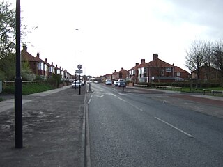
Milecastle 5 was the first milecastle west of Pons Aelius fort of the Roman Hadrian's Wall. No remains exist of the milecastle, though its supposed position is at the junction of the A186 Westgate road and the B1311 Corporation Street. No remains currently exist.

Milecastle 6

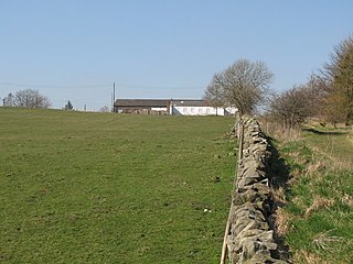
Milecastle 6 was a milecastle of the Roman Hadrian's Wall.

Milecastle 8

Milecastle 8 was a milecastle of the Roman Hadrian's Wall. Its remains are located in West Denton, Newcastle upon Tyne. The milecastle has two associated turret structures that are known as turret 8A and turret 8B. The turrets and milecastle were excavated in the 1920s, yielding some pottery and stone carvings, and have since been overlain by modern roads. The exact location of the structures is disputed, with the road hiding any surface traces. The Milecastle forms part of the Hadrian's Wall World Heritage Site.

Milecastle 9

Milecastle 9 was a milecastle of the Roman Hadrian's Wall. Its remains exist partially as a low platform, and are located in West Denton, 300 yards (270 m) from Chapel House Farm. However, the northern part of the remains are now mostly covered by the modern roads (A69/B6528). The milecastle marks a watershed between those with relatively well-defined positions and those whose position are less certain.

Milecastle 11 Milecastle of Hadrians Wall

Milecastle 11 was a milecastle of the Roman Hadrian's Wall. No remains exist, but the measured position is the middle of the old village of Throckley Bank Top, under the Working Men's Club.

Milecastle 12

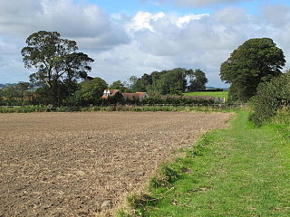
Milecastle 12 (Heddon) was a milecastle of the Roman Hadrian's Wall. Its remains lay under Town Farm, Heddon-on-the-Wall, with nothing visible on the surface.

Milecastle 13

Milecastle 13 was a milecastle of the Roman Hadrian's Wall. Its remains exist as a low platform south of the B6318 Military Road.

Milecastle 14

Milecastle 14 was a milecastle of the Roman Hadrian's Wall. Its remains exist as a low platform, south of the B6318 Military Road and about 1 kilometre (0.62 mi) to the west of the road junction at Rudchester Farm.

Milecastle 15

Milecastle 15 (Whitchester) was a milecastle of the Roman Hadrian's Wall. Its remains exist as a bold platform with robbed walls located on the southern side of the B6318 Military Road approximately 3 kilometres (1.9 mi) west of its crossing of the A69 road. It has not been excavated.

Milecastle 21

Milecastle 21 was a milecastle of the Roman Hadrian's Wall. The site was identified by measurement only, as the milecastle's remains have been totally removed. This is probably due to extensive quarrying at the site, which now lies under pasture.

Milecastle 22

Milecastle 22 (Portgate) was a milecastle of the Roman Hadrian's Wall. Its remains exist as a low, turf covered platform just east of the Portgate roundabout. The platform is 0.5 metres (1.6 ft) on the east side, reducing to only a parch mark on the west side.

Milecastle 23

Milecastle 23 (Stanley) was a milecastle of the Roman Hadrian's Wall. Its remains exist as a low, grass covered platform with traces of an external ditch. It is located to the south of the B6318 Military Road around 1.5 kilometres (0.93 mi) west of its junction with the A68.

Milecastle 27

Milecastle 27 was a milecastle of the Roman Hadrian's Wall. It was located on the line of Hadrian's Wall, approximately midway between the A6079 and the River North Tyne. Its remains survive as a slight squarish platform with a maximum height of 0.4 metres (1.3 ft), but it is poorly defined to the north and east.

Milecastle 25

Milecastle 25 (Codlawhill) was a milecastle of the Roman Hadrian's Wall. Its remains exist as a low platform, and are located to the south of the B6318 Military Road, nearly 5 kilometres (3.1 mi) to the west of its junction with the A68.

Milecastle 30

Milecastle 30 was a milecastle of the Roman Hadrian's Wall. Its remains exist as an outward-facing scarp with a maximum height of 0.8 metres (2.6 ft). Masonry from the east wall remains in situ. The remaining stretch is 3.1 metres (10 ft) in length by 2.25 metres (7.4 ft) thick, and survives to a height of 0.6 metres (2.0 ft). It is located at the western part of Limestone Corner, just off the B6318 Military Road.

Milecastle 31

Milecastle 31 (Carrawburgh) was a milecastle of the Roman Hadrian's Wall. Its remains exist as a turf covered platform beside the B6318 Military Road, just to the east of Carrawburgh fort.

References

  1. 1 2 3 "Milecastle 7". Pastscape. English Heritage. Archived from the original on 10 September 2010. Retrieved 14 May 2010.
  2. Breeze, David J (1934), Handbook to the Roman Wall (14th Revised edition – Nov 2006), Society of Antiquaries of Newcastle upon Tyne, p. 158, ISBN   0-901082-65-1
  3. 1 2 3 "Turret 7A". Pastscape. English Heritage. Archived from the original on 10 September 2010. Retrieved 14 May 2010.
  4. 1 2 3 4 5 6 7 "Turret 7B". Pastscape. English Heritage. Archived from the original on 23 December 2012. Retrieved 14 May 2010.
  5. "Hadrian's Wall, England". The Princeton encyclopedia of classical sites. Archived from the original on 9 July 2012. Retrieved 18 May 2010.
  6. Bishop, M. C. (2014). An Archaeological Guide to Walking Hadrian's Wall from Wallsend to Bowness-on-Solway (East to West). The Armatura Press. pp. 38–39. ISBN   978-1-910238-00-4.
  7. 1 2 3 4 Breeze, David J (1934), Handbook to the Roman Wall (14th Revised edition – Nov 2006), Society of Antiquaries of Newcastle upon Tyne, p. 160, ISBN   0-901082-65-1
  8. Lindsay, Allason-Jones. "Material culture and identity" (PDF). Archaeology Data Service. Retrieved 18 May 2010.
  9. "Denton Hall Turret". English Heritage. Retrieved 18 May 2010.
  10. "Denton Hall Turret (Hadrian's Wall)". Britain Express. Retrieved 18 May 2010.
  11. "Hadrian's Wall". BBC. Retrieved 18 May 2010.