Milecastle 41

Last updated

Milecastle 41
(The site of) Milecastle 41 - geograph.org.uk - 610141.jpg
The site of Milecastle 41
Northumberland UK location map.svg
Red pog.svg
Location within Northumberland
Type Milecastle
Location
Coordinates 54°59′50″N2°25′23″W / 54.997335°N 2.423185°W / 54.997335; -2.423185 Coordinates: 54°59′50″N2°25′23″W / 54.997335°N 2.423185°W / 54.997335; -2.423185
CountyNorthumberland
CountryEngland
Reference
UK-OSNG reference NY73026705

Milecastle 41 (Melkridge) was a milecastle on Hadrian's Wall (grid reference NY73026705 ).

Contents

Description

Milecastle 41 is located to the east of Caw Gap. [1] The milecastle can be seen as turf-covered banks outlined by robber trenches. [1] A cottage, long removed, occupied the site of, and was built from, the materials of milecastle 41. [1]

Excavations

The milecastle was examined in 1946. It was found to have a short axis, but had undergone extensive reconstruction. [1]

Associated turrets

Turret 41A Turret 41a - geograph.org.uk - 846924.jpg
Turret 41A
Site of Turret 41B Thorny Doors site of Turret 41B Hadrian's Wall - geograph.org.uk - 1533553.jpg
Site of Turret 41B

Each milecastle on Hadrian's Wall had two associated turret structures. These turrets were positioned approximately one-third and two-thirds of a Roman mile to the west of the Milecastle, and would probably have been manned by part of the milecastle's garrison. The turrets associated with Milecastle 41 are known as Turret 41A and Turret 41B.

Turret 41A

Turret 41A (Caw Gap) (grid reference NY72556688 ) was located by exploratory excavation in 1912. [2] It had a doorway on the east side of the south wall. [2] In the later Roman period, the turret was deliberately demolished, and the Wall rebuilt across its site. [2] The remains of Turret 41A were consolidated in 1972-3 and are 20 centimetres high. [2]

Turret 41B

Turret 41B (Thorny Doors) (grid reference NY72056683 ) was also located by exploratory excavation in 1912. [3] There are no visible remains. [3]

Public access

The site of the milecastle, Turret 41A, and the site of Turret 41B are all accessible via the Hadrian's Wall Path.

Related Research Articles

Milecastle 48

Milecastle 48 , is a milecastle on Hadrian's Wall. Its remains lie near the village of Gilsland in Cumbria where it was historically known as "The King's Stables", owing to the well-preserved interior walls. Unusually a substantial section of stone stairs has survived within the milecastle. The two turrets associated with this milecastle have also survived as above-ground masonry.

Milecastle 50

Milecastle 50 was a milecastle on Hadrian's Wall.

Milecastle 51

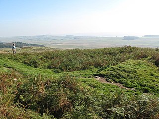
Milecastle 51 was a milecastle on Hadrian's Wall.

Milecastle 52

Milecastle 52 (Bankshead) was a milecastle on Hadrian's Wall.

Milecastle 53

Milecastle 53 was a milecastle on Hadrian's Wall.

Milecastle 39

Milecastle 39 is a milecastle on Hadrian's Wall.

Milecastle 38

Milecastle 38 (Hotbank) was a milecastle on Hadrian's Wall in the vicinity of Hotbank Farm,. It is notable for the joint inscription bearing the names of the emperor Hadrian and Aulus Platorius Nepos, the governor of Brittania at the time the Wall was built.

Milecastle 72

Milecastle 72 was one of a series of Milecastles or small fortlets built at intervals of approximately one Roman mile along Hadrian's Wall.

Milecastle 42

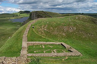
Milecastle 42 (Cawfields) is a milecastle on Hadrian's Wall.

Milecastle 47

Milecastle 47 was a milecastle on Hadrian's Wall.

Milecastle 44

Milecastle 44 (Allolee) was a milecastle on Hadrian's Wall.

Milecastle 37

Milecastle 37 is one of the milecastles on Hadrian's Wall. It is immediately west of the Housesteads Roman Fort.

Milecastle 35

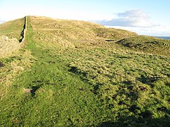
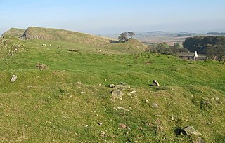
Milecastle 35 (Sewingshields) is one of the milecastles on Hadrian's Wall. The remains still exist as exposed masonry.

Milecastle 36

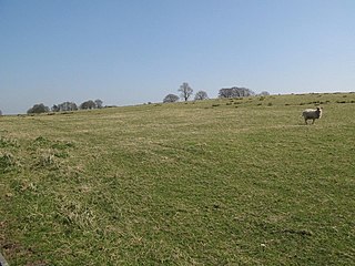
Milecastle 36 was one of the milecastles on Hadrian's Wall. There is little to see on the ground as most of the walls have been robbed and quarried away.

Milecastle 40

Milecastle 40 (Winshields) was a milecastle on Hadrian's Wall.

Milecastle 43

Milecastle 43 was a milecastle on Hadrian's Wall. It was obliterated when the fort at Great Chesters (Aesica) was built.

Milecastle 45

Milecastle 45 (Walltown) was a milecastle on Hadrian's Wall.

Milecastle 46

Milecastle 46 (Carvoran) was a milecastle on Hadrian's Wall.

Milecastle 57

Milecastle 57 (Cambeckhill) was a milecastle on Hadrian's Wall.

Milecastle 68

Milecastle 68 is a conjectured milecastle of the Roman Hadrian's Wall. The site of the milecastle has been calculated from measurement to known milecastle sites, but no remains providing proof of its existence have been identified.

References

  1. 1 2 3 4 MILECASTLE 41, Pastscape, retrieved 3 December 2013
  2. 1 2 3 4 TURRET 41A, Pastscape, retrieved 3 December 2013
  3. 1 2 TURRET 41B, Pastscape, retrieved 3 December 2013

Commons-logo.svg Media related to Milecastle 41 at Wikimedia Commons