Aballava

Last updated

Aballava
Cumbria, England
Houses at Burgh by Sands - geograph.org.uk - 1945694.jpg
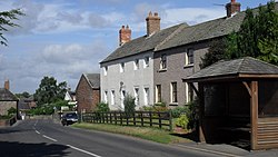
Village centre of Burgh by Sands,
the site of Aballava
Location map United Kingdom City of Carlisle.svg
Red pog.svg
Aballava
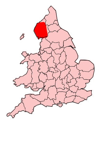
Location in the City of Carlisle district, Cumbria
Cumbria UK location map.svg
Red pog.svg
Aballava
Location in Cumbria, England
Coordinates 54°55′19″N3°03′00″W / 54.922°N 3.050°W / 54.922; -3.050
Grid reference NY327591

Aballava or Aballaba (with the modern name of Burgh by Sands) was a Roman fort on Hadrian's Wall, between Petriana (Stanwix) to the east and Coggabata (Drumburgh) to the west. It is about one and a half miles south of the Solway Firth, and its purpose was to guard the south end of two important Solway fords, the Peat Wath and the Sandwath, which were also to become favourite routes for medieval border raiders.

Contents

The fort is five and a half miles west of Stanwix. The word 'Aballava' possibly means '(apple) orchard'. [1] The fort was an oblong, straddling the Wall, and measured 500 feet (150 m) north to south by 400 feet (120 m) east to west, occupying an area of 5 acres (20,000 m2). Only the location of the eastern wall is known for certain. It is believed that it was built over the site of turret 71b. There is a fortified border church on the site built almost entirely of Roman stones, and it is believed that this stands on the site of the principia of the fort.

There was a vicus to the south-west of the fort, and it is believed that a cemetery existed to the south of the fort.

Garrison

The second-century garrison was the Ala I Tungrorum [2] followed by a part mounted cavalry regiment, Cohors I Nerviorum. [3] The third-century garrison was a mounted detachment (cuneus) of Frisians. The epigraphic evidence for the location of this unit is attested by two sandstone altars [4] [5] found in the 19th century at Cockermouth Castle in Cumbria. These most probably came originally from the nearby Roman fort at Papcastle (Derventio). Some confusion had previously arisen among Romano-British historians concerning the precise location of Aballava and its identification with Papcastle. It has now been recognized that the Roman fort at Burgh by Sands is the correct location. [6] The unit, (Cuneus Frisiorum) apparently remained there long enough to acquire the title, 'Aballavensium'. [5] In the mid third century an infantry detachment (numerus) of Aurelian Moors (Morocco) is also attested. [7]

Excavations

Excavations were carried out in 1922, during which it was established that the fort straddled the Wall. Two other forts were found on the same site, by aerial photography, in 1976 and 1977. The second fort, discovered in 1976, and excavated 13 years earlier, is thought to pre-date Hadrian's Wall. It has been claimed that this fort was an extension to the Stanegate system of forts, but this is largely conjecture.

A small-scale excavation 200 metres south of the fort undertaken by Headland Archaeology [8] uncovered a group of features associated with the vicus. Features included post-pits for a substantial building, postholes and beamslots relating to other timber buildings and shallow ditches and gullies; all dated to the mid-2nd century. There was no evidence for the later 2nd and 3rd century occupation identified during the previous investigations, suggesting some discontinuity in the use of the site.

In fiction

Related Research Articles

<span class="mw-page-title-main">Coventina</span> Romano-British goddess

Coventina was a Romano-British goddess of wells and springs. She is known from multiple inscriptions at one site in Northumberland, England, an area surrounding a wellspring near Carrawburgh on Hadrian's Wall. It is possible that other inscriptions, two from Hispania and one from Narbonensis, refer to Coventina, but this is disputed.

In Romano-British culture and Germanic polytheism, the Alaisiagae were a quartet of Celtic and Germanic goddesses deifying victory.
<span class="mw-page-title-main">Carvetii</span> British tribe of the Iron Age and Roman era

The Carvetii were a Brittonic Celtic tribe living in what is now Cumbria, in North-West England during the Iron Age, and were subsequently identified as a civitas (canton) of Roman Britain.

... Rufinus is the fragment of the name of a governor of Britannia Superior, a province of Roman Britain probably some time during the early third century AD. He may have been the same man as Aulus Triarius Rufinus who was suffect consul around 210, although Quintus Aradius Rufinus who was consul ten or fifteen years later is another possibility.

<span class="mw-page-title-main">Housesteads Roman Fort</span> Roman fort in Northumberland, England

Housesteads Roman Fort is the remains of an auxiliary fort on Hadrian's Wall, at Housesteads, Northumberland, England, south of Broomlee Lough. The fort was built in stone around AD 124, soon after the construction of the wall began in AD 122 when the area was part of the Roman province of Britannia. Its name has been variously given as Vercovicium, Borcovicus, Borcovicium, and Velurtion. The 18th-century farmhouse Housesteads gives the modern name. The site is owned by the National Trust and is in the care of English Heritage. Finds can be seen at the site, in the museum at Chesters, and in the Great North Museum: Hancock in Newcastle upon Tyne.

In ancient Celtic polytheism, Latis is the name of two Celtic deities worshipped in Roman Britain. One is a goddess, the other a god, and they are both known from a single inscription each.

<span class="mw-page-title-main">Burgh by Sands</span> Village and parish in England

Burgh by Sands is a village and civil parish in the Cumberland unitary authority area of Cumbria, England, situated near the Solway Firth. The parish includes the village of Burgh by Sands along with Longburgh, Dykesfield, Boustead Hill, Moorhouse and Thurstonfield. It is notable as the site of the first recorded North African (Mauri) military unit in Roman Britain, garrisoning the frontier fort of Aballava on Hadrian's Wall in the 3rd century AD. It is also where Edward I of England died in 1307.

<span class="mw-page-title-main">Magnis (Carvoran)</span> Roman fort in Northumberland, England

Magnis or Magna was a Roman fort near Hadrian's Wall in northern Britain. Its ruins are now known as Carvoran Roman Fort and are located near Carvoran, Northumberland, in northern England. It was built on the Stanegate frontier and Roman road, before the building of Hadrian's Wall.

<span class="mw-page-title-main">Alauna (Maryport)</span> Roman fort and settlement on the site of present-day Maryport in Cumbria, England

Alauna was a castrum or fort in the Roman province of Britannia. It occupied a coastal site just north of the town of Maryport in the English county of Cumbria.

<span class="mw-page-title-main">Bremetennacum</span> Ruins of a Roman fort in Ribchester, England

Bremetennacum,, or Bremetennacum Veteranorum, was a Roman fort on the site of the present day village of Ribchester in Lancashire, England. The site is a Scheduled Monument.

<span class="mw-page-title-main">Vinovia</span> Roman fort in County Durham, England

Vinovia or Vinovium was a Roman fort and settlement situated just over 1 mile (1.6 km) to the north of the town of Bishop Auckland on the banks of the River Wear in County Durham, England. The fort was the site of a hamlet until the late Middle Ages, but the modern-day village of Binchester is about 2 miles (3 km) to the east, near Spennymoor. The ruins are now known as the Binchester Roman Fort.

<span class="mw-page-title-main">Condercum</span> Roman fort in England

Condercum was a Roman fort on the site of the modern-day Condercum Estate in Benwell, a suburb of Newcastle upon Tyne, England. It was the third fort on Hadrian's Wall, after Segedunum (Wallsend) and Pons Aelius (Newcastle), and was situated on a hilltop 2 miles (3 km) to the west of the city.

<span class="mw-page-title-main">Petriana</span> Roman fort in Cumbria, England

Uxelodunum was a Roman fort with associated civilian settlement (vicus) in modern-day Carlisle, Cumbria, England. It was the largest fort on Hadrian's Wall and is now buried beneath the suburb of Stanwix.

The Rudge Cup is a small enamelled bronze cup found in 1725 at Rudge, near Froxfield, in Wiltshire, England. The cup was found down a well on the site of a Roman villa. It is important in that it lists five of the forts on the western section of Hadrian's Wall, thus aiding scholars in identifying the forts correctly. The information on the cup has been compared with the two major sources of information regarding forts on the Wall, the Notitia Dignitatum and the Ravenna Cosmography.

<span class="mw-page-title-main">Coggabata</span> Roman fort in Cumbria, England

Coggabata, or Congavata / Concavata, was a Roman fort on Hadrian's Wall, between Aballava to the east and Mais (Bowness-on-Solway) to the west. It was built on a hill commanding views over the flatter land to the east and west and to the shore of the Solway Firth to the north. Its purpose was to guard the southern end of two important Solway fords, the Stonewath and the Sandwath.

<span class="mw-page-title-main">Mais (Bowness)</span> Roman fort in Cumbria, England

Maia, or Mais, in Cumbria, England was a Roman fort on Hadrian's Wall, and was the last fort at the western end of the Wall, overlooking the Solway Firth.

<span class="mw-page-title-main">Milecastle 72</span>

Milecastle 72 (Fauld Farm) was one of a series of Milecastles or small fortlets built at intervals of approximately one Roman mile along Hadrian's Wall (grid reference NY32415913).

<span class="mw-page-title-main">Milecastle 70</span>

Milecastle 70 (Braelees) was one of a series of Milecastles or small fortlets built at intervals of approximately one Roman mile along Hadrian's Wall (grid reference NY35155898).

Derventio was a Roman settlement at Papcastle on the river Derwent near Cockermouth, Cumbria, England. It was the site of a Roman fort, which was originally built in timber and rebuilt in stone. There was also a civilian settlement (vicus). It is sometimes called Derventio Carvetiorum by modern writers to distinguish it from other places named Derventio, but there is no evidence of that extended name being used in the Roman period.

Susanna Maria Appleby was a British antiquarian who is principally known for excavating a Roman bath house north east of Camboglanna, Castlesteads Roman Fort, near Hadrian's Wall in 1741.
References

  1. Watts, Victor (2007). The Cambridge Dictionary of English Place-Names. Cambridge University Press. p. 1. ISBN   978-0521168557.
  2. "RIB 2045. Fragmentary dedication | Roman Inscriptions of Britain". romaninscriptionsofbritain.org. Retrieved 17 January 2024.
  3. "RIB 2041. Altar dedicated to Jupiter Optimus Maximus | Roman Inscriptions of Britain". romaninscriptionsofbritain.org. Retrieved 17 January 2024.
  4. "RIB 882. Dedication of the cuneus of the Frisians of Aballava | Roman Inscriptions of Britain". romaninscriptionsofbritain.org. Retrieved 17 January 2024.
  5. 1 2 "RIB 883. Dedication of the cuneus of the Frisians of Aballava | Roman Inscriptions of Britain". romaninscriptionsofbritain.org. Retrieved 17 January 2024.
  6. I.A. Richmond, Archaeologia Aeliana Series 4, xii (1935) 341; confirmed from RIB 2042 by Nesselhauf, Journal of Roman Studies xxviii (1938) 203, Germania xxiii (1939) and Birley, Transactions of the Cumberland and Westmorland Antiquarian and Archaeological Society Series 2 xxxix (1939) 190.
  7. "RIB 2042. Altar dedicated to Jupiter Optimus Maximus and to the Divinities of the two Emperors and the Genius Numeri | Roman Inscriptions of Britain". romaninscriptionsofbritain.org. Retrieved 17 January 2024.
  8. Masser, P. and J. Evans, ‘Excavations within the vicus at Amberfield, Burgh by Sands, Cumbria’, Transactions of the Cumberland and Westmorland Antiquarian and Archaeological Society

Further reading