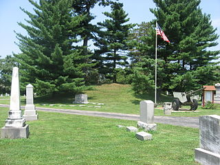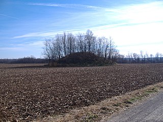
The Criel Mound, also known as the South Charleston Mound, is a Native American burial mound located in South Charleston, West Virginia. It is one of the few surviving mounds of the Kanawha Valley Mounds that were probably built in the Woodland period after 500 B.C. The mound was built by the Adena culture, probably around 250–150 BC, and lay equidistant between two “sacred circles”, earthwork enclosures each 556 feet (169 m) in diameter. It was originally 33 feet (10 m) high and 173 feet (53 m) in diameter at the base, making it the second-largest such burial mound in the state of West Virginia. This archaeological site is listed on the National Register of Historic Places.

The Grave Creek Mound in the Ohio River Valley in West Virginia is one of the largest conical-type burial mounds in the United States, now standing 62 feet (19 m) high and 240 feet (73 m) in diameter. The builders of the site, members of the Adena culture, moved more than 60,000 tons of dirt to create it about 250–150 BC.

Chester Township is one of the twelve townships of Meigs County, Ohio, United States. The 2000 census found 2,332 people in the township.

The Mathew Mound is a Native American mound in the southwestern part of the U.S. state of Ohio. Located off Oak Road near the village of Evendale, the mound is believed to have been built by members of the Adena or Hopewell peoples during the Woodland period.

The Odd Fellows' Cemetery Mound is a Native American mound in the southwestern part of the U.S. state of Ohio. Located in the village of Newtown in Hamilton County, the mound is an oval approximately 110 feet (34 m) long and 90 feet (27 m) wide; its height is 11.3 feet (3.4 m). It is believed to have been built by the Adena culture.

The Arledge Mounds are a pair of Native American mounds in the south central part of the U.S. state of Ohio. Located near Circleville in Pickaway County, the two mounds lie in the middle of a farm field, far from any roads. These two mounds are disparate in size: while the smaller mound's height is 5 feet (1.5 m), the other's is 20 feet (6.1 m), and their diameters are approximately 65 feet (20 m) and 120 feet (37 m) respectively.

Mound Cemetery in Marietta, Ohio, is a historic cemetery developed around the base of a prehistoric Adena burial mound known as the Great Mound or Conus. The city founders preserved the Great Mound from destruction by establishing the city cemetery around it in 1801.
The Reeves Mound is a Native American mound in the southeastern part of the U.S. state of Ohio. Located north of the unincorporated community of Alfred, the mound is part of an archaeological site that appears to have been built by peoples of the Adena culture.

The Carl Potter Mound is a historic Native American mound in southern Champaign County, Ohio, United States. Located near Mechanicsburg, it lies on a small ridge in a pasture field in southeastern Union Township. In 1974, the mound was listed on the National Register of Historic Places as a potential archaeological site, primarily because of its use as a burial mound.
The Zaleski Mound Group is a collection of three burial mounds in the village of Zaleski, Ohio, United States. Built by people of the prehistoric Adena culture, these earthworks are valuable archaeological sites.

The Austin Brown Mound, also known as the "Dwight Fullerton Mound," is a subconical Native American mound located northwest of the city of Chillicothe in Ross County, Ohio, United States. In 1897, the Ohio Historical Society sponsored an excavation of the mound under the leadership of Clarence Loveberry, who oversaw the digging of a large tunnel into the mound's side. Loveberry's investigation yielded artifacts of the Adena culture and evidence of rotten logs on the floor of the mound, but in publishing the results of his excavation, he observed that neither a tomb nor any isolated burials were discovered within the mound. Since 1897, other Adena mounds have been excavated and shown to have wooden tombs in off-center locations, presumably to complicate the efforts of those who would loot the mounds; accordingly, it is possible that the Brown mound likewise has an off-center tomb.

The W.C. Clemmons Mound is a Native American mound in the south central portion of the U.S. state of Ohio. Located near the unincorporated community of Fox, it lies in the middle of a farm field near a creek. A cone measuring approximately 22 feet (6.7 m) high and 144 feet (44 m) in diameter, its shape is almost exactly circular.
The Old Maid's Orchard Mound is a Native American mound in the central portion of the U.S. state of Ohio. Located near the village of Lithopolis in Fairfield County, the mound lies within the boundaries of Chestnut Ridge Metro Park, in northern Bloom Township.
The Fortner Mounds are a pair of Native American mounds in the central part of the U.S. state of Ohio. Located northeast of the city of Pickerington in Fairfield County, they are two of several mounds in the Pickerington vicinity, but the only pair of mounds in the area. As such, they are of special interest to archaeologists: some of the mound-building peoples of prehistoric North America lived in groups of two or three houses, which were often covered with piles of earth when the families would move to other places. Therefore, it is likely that these mounds cover groups of postholes, and buried bodies may also be located within them. From their shape, it is apparent that the mounds were constructed by people of the Adena culture, who lived in central Ohio between approximately 500 BC and AD 400.

The Coon Hunters Mound is a Native American mound in the central part of the U.S. state of Ohio. Located near the village of Carroll, it sits on the grounds of the Central Ohio Coonhunters Association.

The Beam Farm Woodland Archaeological District is a group of archaeological sites in the southwestern part of the U.S. state of Ohio. Located at 3983 Stone Road near the village of Sabina in Clinton County, the district is composed of one Native American mound and two other archaeological sites spread out over an area of 2 acres (0.81 ha). Known as the Beam Farm Mound and the Beam Sites 9 and 12, the sites that compose the district have yielded artifacts from the Adena culture and the Hopewell tradition, both of which inhabited southwestern Ohio during the Woodland period. Because both the Adena and the Hopewell lived around the mound, and because both cultures built mounds, the identity of the people who constructed the Beam Farm Mound cannot be established; all that can be known with reasonable certainty is that it was raised during the early or middle portion of the Woodland period, or between 800 BC and AD 500.

The Hodgen's Cemetery Mound is a Native American mound in the far eastern part of the U.S. state of Ohio. Located in the village of Tiltonsville along the Ohio River shoreline of Jefferson County, the mound is a prehistoric earthwork and archaeological site, and it has been named a historic site.
Indian Mound Reserve is a public country park near the village of Cedarville, Ohio, United States. Named for two different earthworks within its bounds — the Williamson Mound and the Pollock Works — the park straddles Massies Creek as it flows through a small canyon.

The McLaughlin Mound, also called Cemetery Mound, is a Native American mound in the central part of the U.S. state of Ohio. Located in Mound View Cemetery near the city of Mount Vernon in Knox County, it is an important archaeological site.


