Mount Barney, Queensland

Last updated

Mount Barney
Queensland
Mt Barney over the fog from Lillydale - panoramio.jpg
Looking across the farmland to Mount Barney, 2013
Australia Queensland location map.svg
Red pog.svg
Mount Barney
Coordinates 28°16′39″S152°42′28″E / 28.27750°S 152.70778°E / -28.27750; 152.70778 Coordinates: 28°16′39″S152°42′28″E / 28.27750°S 152.70778°E / -28.27750; 152.70778
Population22 (2016 census) [1]
Postcode(s) 4287
Location120 km (75 mi) SSW of Brisbane
LGA(s) Scenic Rim Region
State electorate(s) Scenic Rim
Federal Division(s) Wright
Suburbs around Mount Barney:
Burnett Creek Maroon Barney View
Burnett Creek Mount Barney Palen Creek
New South Wales Mount Lindesay Palen Creek

Mount Barney is a locality within the Scenic Rim Region, Queensland, Australia. [2]

Contents

Geography

Track on farmland at the foot of Mount Barney, circa 1952 Track on farmland at the foot of Mount Barney in Queensland, circa 1952.jpg
Track on farmland at the foot of Mount Barney, circa 1952

The locality takes its name from the mountain of the same name which occupies most of the western side of the locality, is part of the Mount Barney National Park and is undeveloped bushland. Farm land lies in a valley of the Logan River in the eastern part of the locality which separates the mountain Mount Barney from Mount Gillies in the very east of the locality. There are crops and grazing in the valley. [3]

History

Mount Barney State School children with teacher Miss Bedelia Brennan, 1901 StateLibQld 2 297119 Mount Barney State School children with teacher Miss Bedelia Brennan, 1901.jpg
Mount Barney State School children with teacher Miss Bedelia Brennan, 1901

The Thulumbah Provisional School opened in 1901 and became Thulumbah State School on 1 January 1909. In 1916 it was renamed Mount Barney State School. The school closed in 1962. [4]

Demographics

Mount Barney has a population of 22 at the 2016 census. The locality contains 23 households, in which 50.0% of the population are males and 50.0% of the population are females with a median age of 31, 7 years below the national average. The average weekly household income is $0, $1,438 below the national average. [1]

Related Research Articles

Mount Lindesay (Queensland) Suburb of Scenic Rim Region, Queensland, Australia

Mount Lindesay is a rural locality in the Scenic Rim Region, Queensland, Australia. In the 2016 census, Mount Lindesay had a population of 3 people.

Kooralbyn, Queensland Suburb of Scenic Rim Region, Queensland, Australia

Kooralbyn is a rural locality in the Scenic Rim Region, Queensland, Australia. In the 2016 census, Kooralbyn had a population of 1,725 people.

Maroon, Queensland Town in Queensland, Australia

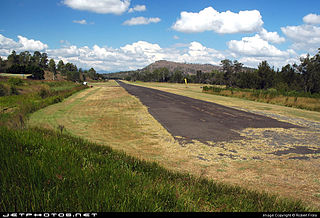
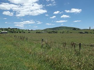
Maroon is a rural locality in the Scenic Rim Region, Queensland, Australia. In the 2016 census, Maroon had a population of 149 people.

Mount Walker, Queensland Suburb of Scenic Rim Region, Queensland, Australia

Mount Walker is a mountain and locality in the Scenic Rim Region of Queensland, Australia. The western boundary of Mount Walker is marked by the Bremer River. The central eastern parts of the locality rise to elevations above 400 m around Mount Walker. At the 2016 census Mount Walker and surrounds recorded a population of 134.

Barney View, Queensland Suburb of Scenic Rim Region, Queensland, Australia

Barney View is a rural locality in the Scenic Rim Region, Queensland, Australia. In the 2016 census, Barney View had a population of 64 people.

Darlington, Queensland Suburb of Scenic Rim Region, Queensland, Australia

Darlington is a locality in the Scenic Rim Region of South East Queensland, Australia.

Hillview, Queensland Town in Queensland, Australia

Hillview is a small town and locality in the Scenic Rim Region of South East Queensland, Australia. In the 2016 census, Hillview had a population of 74.

Christmas Creek, Queensland Suburb of Scenic Rim Region, Queensland, Australia

Christmas Creek is a locality in the Scenic Rim Region of South East Queensland, Australia. The eastern border of the locality is marked by the high point of the JinBroken Range while the west is similar defined by another ridgeline. Christmas Creek, a tributary of the Logan River flows in north/south direction roughly parallel to the only main road in the area called Christmas Creek Road. According to the 2016 census, Christmas Creek has a total population of 53.

Laravale, Queensland Town in Queensland, Australia

Laravale is a locality in the Scenic Rim Region of South East Queensland, Australia. At the 2016 census, Laravale recorded a population total of 189.

Merryvale, Queensland Suburb of Scenic Rim Region, Queensland, Australia

Merryvale is a rural locality in the Scenic Rim Region, Queensland, Australia. In the 2016 census, Merryvale had a population of 22 people.

Frazerview, Queensland Suburb of Scenic Rim Region, Queensland, Australia

Frazerview is a rural locality in the Scenic Rim Region, Queensland, Australia. In the 2016 census, Frazerview had a population of 34 people.

Mount Gipps, Queensland Suburb of Scenic Rim Region, Queensland, Australia

Mount Gipps is a locality in the Scenic Rim Region, Queensland, Australia. Mount Gipps is one end of the Queensland rabbit-proof fence.

Gleneagle, Queensland Suburb of Scenic Rim Region, Queensland, Australia

Gleneagle is a rural locality in the Scenic Rim Region, Queensland, Australia. In the 2016 census, Gleneagle had a population of 1877 people.

Milford, Queensland Suburb of Scenic Rim Region, Queensland, Australia

Milford is a rural locality in the Scenic Rim Region, Queensland, Australia. In the 2016 census, Milford had a population of 207 people.

Mount French, Queensland Suburb of Scenic Rim Region, Queensland, Australia

Mount French is a locality in the Scenic Rim Region, Queensland, Australia.

Charlwood, Queensland Suburb of Scenic Rim Region, Queensland, Australia

Charlwood is a locality in the Scenic Rim Region, Queensland, Australia. In the 2016 census, Charlwood had a population of 139 people.

Fassifern, Queensland Suburb of Scenic Rim Region, Queensland, Australia

Fassifern is a locality in the Scenic Rim Region, Queensland, Australia. In the 2016 census, Fassifern had a population of 21.

Fassifern Valley, Queensland Suburb of Scenic Rim Region, Queensland, Australia

Fassifern Valley is a locality in the Scenic Rim Region, Queensland, Australia. In the 2016 census, Fassifern Valley had a population of 91.

Milora, Queensland Suburb of Scenic Rim Region, Queensland, Australia

Milora is a locality in the Scenic Rim Region, Queensland, Australia.

Moogerah, Queensland Suburb of Scenic Rim Region, Queensland, Australia

Moogerah is a locality in the Scenic Rim Region, Queensland, Australia.

References

  1. 1 2 Australian Bureau of Statistics (27 June 2017). "Mount Barney". 2016 Census QuickStats. Retrieved 20 January 2020. OOjs UI icon edit-ltr-progressive.svg
  2. "Mount Barney - locality (entry 45169)". Queensland Place Names. Queensland Government . Retrieved 12 March 2017.
  3. "Queensland Globe". State of Queensland . Retrieved 12 March 2017.
  4. Queensland Family History Society (2010), Queensland schools past and present (Version 1.01 ed.), Queensland Family History Society, ISBN   978-1-921171-26-0

Commons-logo.svg Media related to Mount Barney at Wikimedia Commons