Mount Sheridan, Queensland

Last updated

Mount Sheridan
Cairns,  Queensland
Mount Sheridan Plaza shopping center.jpg
Mount Sheridan Plaza shopping centre
Australia Queensland location map.svg
Red pog.svg
Mount Sheridan
Mount Sheridan, Queensland
Coordinates 16°59′02″S145°43′44″E / 16.9838°S 145.7288°E / -16.9838; 145.7288 (Mount Sheridan (centre of suburb))
Population8,271 (2016 census) [1]
 • Density1,234/km2 (3,197/sq mi)
Postcode(s) 4868
Area6.7 km2 (2.6 sq mi)
Time zone AEST (UTC+10:00)
Location
LGA(s) Cairns Region
State electorate(s) Mulgrave
Federal division(s)
Suburbs around Mount Sheridan:
Lamb Range Bayview Heights Woree
Lamb Range Mount Sheridan White Rock
Bentley Park Bentley Park Edmonton

Mount Sheridan is a suburb of Cairns in the Cairns Region, Queensland, Australia. [2] In the 2016 census, Mount Sheridan had a population of 8,271 people. [1]

Contents

Geography

The Bruce Highway and the North Coast railway line immediately to its east form the eastern boundary of the suburb. [3]

History

Mount Sheridan is situated in the Yidinji traditional Aboriginal country. [4]

The suburb takes its name from the mountain of the same name, which is not located within the suburb but to the west in Lamb Range. [5]

In the 2016 census, Mount Sheridan had a population of 8,271 people. [1]

Education

There are no schools in Mount Sheridan. The nearest government primary schools are White Rock State School in neighbouring White Rock to the east, Bentley Park State School in neighbouring Bentley Park to the south, and Woree State School in neighbouring Woree to the north. The nearest government secondary schools are Bentley Park College in Bentley Park and Woree State High School in Woree. [3]

Facilities

Forest View Cemetery is at 65-77 Foster Road ( 16°59′17″S145°44′05″E / 16.9880°S 145.7347°E / -16.9880; 145.7347 (Forest View Cemetery) ). [6] Cairns Crematorium is adjacent at 79-85 Foster Road ( 16°59′15″S145°44′03″E / 16.9875°S 145.7343°E / -16.9875; 145.7343 (Cairns Crematorium) ). [7]

Amenities

Shopping centres in the suburb include:

There are a number of parks in the area, including:

Related Research Articles

<span class="mw-page-title-main">Cairns</span> City in Queensland, Australia

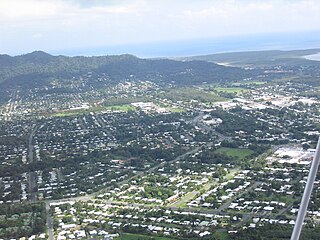
Cairns is a city in Queensland, Australia, on the tropical north east coast of Far North Queensland. In the 2021 census, Cairns had a population of 153,181 people.

<span class="mw-page-title-main">Woree, Queensland</span> Suburb of Cairns, Queensland, Australia

Woree is a suburb of Cairns in the Cairns Region, Queensland, Australia. In the 2016 census, Woree had a population of 4,821 people.

<span class="mw-page-title-main">Edmonton, Queensland</span> Suburb of Cairns, Queensland, Australia

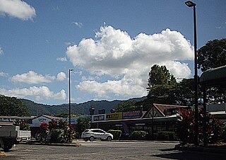
Edmonton is a town and suburb in the Cairns Region, Queensland, Australia. In the 2016 census, Edmonton had a population of 10,753 people.

<span class="mw-page-title-main">Mount Molloy, Queensland</span> Town in Queensland, Australia

Mount Molloy is a rural town and locality in the Shire of Mareeba, Queensland, Australia. It is a historic mining and timber town, 55 kilometres (34 mi) north of Cairns. The dominant industry in the area is cattle grazing; the town itself consists of a few shops and an old hotel. In the 2021 census, the locality of Mount Molloy had a population of 266 people.

<span class="mw-page-title-main">Yorkeys Knob, Queensland</span> Suburb of Cairns, Queensland, Australia

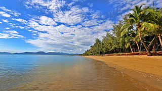
Yorkeys Knob is a coastal suburb of Cairns in the Cairns Region, Queensland, Australia. In the 2016 census, Yorkeys Knob had a population of 2,759 people.

<span class="mw-page-title-main">Holloways Beach, Queensland</span> Suburb of Cairns, Queensland, Australia

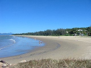
Holloways Beach is a residential coastal suburb of Cairns, Queensland, Australia. In the 2021 census, Holloways Beach had a population of 2,398 people. II is located about 10 kilometres north of the city of Cairns between the suburbs of Machans Beach and Yorkeys Knob.

<span class="mw-page-title-main">Aeroglen</span> Suburb of Cairns, Queensland, Australia

Aeroglen is a coastal suburb of Cairns in the Cairns Region, Queensland, Australia. In the 2016 census, Aeroglen had a population of 403 people.

<span class="mw-page-title-main">Bungalow, Queensland</span> Suburb of Cairns, Queensland, Australia

Bungalow is an inner suburb of Cairns in the Cairns Region, Queensland, Australia. In the 2016 census Bungalow had a population of 2,159 people.

<span class="mw-page-title-main">Cairns City, Queensland</span> Suburb of Cairns, Queensland, Australia

Cairns City is a coastal suburb at the centre of Cairns in the Cairns Region, Queensland, Australia. It is also known as the Cairns Central Business District (CBD). In the 2016 census, Cairns City had a population of 2,737 people.

<span class="mw-page-title-main">Manoora, Queensland</span> Suburb of Cairns, Queensland, Australia

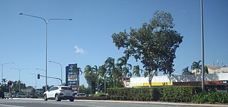
Manoora is a suburb of Cairns in the Cairns Region, Queensland, Australia. In the 2016 census, Manoora had a population of 6,027 people.

<span class="mw-page-title-main">Cairns North, Queensland</span> Suburb of Cairns, Queensland, Australia

Cairns North is a coastal suburb of Cairns in the Cairns Region, Queensland, Australia. In the 2021 census, Cairns North had a population of 5,334 people.

<span class="mw-page-title-main">Whitfield, Queensland</span> Suburb of Cairns, Queensland, Australia

Whitfield is a suburb of Cairns in the Cairns Region, Queensland, Australia. In the 2016 census, Whitfield had a population of 4,275 people.

<span class="mw-page-title-main">Redlynch, Queensland</span> Suburb of Cairns, Queensland, Australia

Redlynch is a semi-rural town and suburb of Cairns in the Cairns Region, Queensland, Australia. In the 2016 census, the suburb of Redlynch had a population of 9,728 people.

<span class="mw-page-title-main">Earlville, Queensland</span> Suburb of Cairns, Queensland, Australia

Earlville is a suburb of Cairns in the Cairns Region, Queensland, Australia. In the 2016 census, Earlville had a population of 4,030 people.

<span class="mw-page-title-main">White Rock, Queensland (Cairns Region)</span> Suburb of Cairns, Queensland, Australia

White Rock is a suburb of Cairns in the Cairns Region, Queensland, Australia. In the 2016 census, White Rock had a population of 4,730 people.

<span class="mw-page-title-main">Manunda, Queensland</span> Suburb of Cairns, Queensland, Australia

Manunda is a suburb of Cairns in the Cairns Region, Queensland, Australia. In the 2016 census, Manunda had a population of 5,390 people.

<span class="mw-page-title-main">Mount Peter, Queensland</span> Suburb of Cairns Region, Queensland, Australia

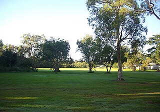
Mount Peter is a rural locality in the Cairns Region, Queensland, Australia. In the 2021 census, Mount Peter had a population of 689 people.

<span class="mw-page-title-main">Portsmith</span> Suburb of Cairns, Queensland, Australia

Portsmith is a suburb of Cairns in the Cairns Region, Queensland, Australia. In the 2021 census, Portsmith had a population of 314 people.

<span class="mw-page-title-main">Westcourt, Queensland</span> Suburb of Cairns, Queensland, Australia

Westcourt is a suburb of Cairns in the Cairns Region, Queensland, Australia. In the 2016 census, Westcourt had a population of 3,918 people.

<span class="mw-page-title-main">Macalister Range, Queensland</span> Suburb of Cairns Region, Queensland, Australia

Macalister Range is a coastal locality in the Cairns Region, Queensland, Australia. In the 2021 census, Macalister Range had a population of 0 people.

References

  1. 1 2 3 Australian Bureau of Statistics (27 June 2017). "Mount Sheridan (SSC)". 2016 Census QuickStats. Retrieved 20 October 2018. OOjs UI icon edit-ltr-progressive.svg
  2. "Mount Sheridan – suburb in Cairns Region (entry 48790)". Queensland Place Names. Queensland Government . Retrieved 26 December 2020.
  3. 1 2 "Queensland Globe". State of Queensland . Retrieved 27 January 2022.
  4. "Indigenous culture and history". Cairns Regional Council. Archived from the original on 9 April 2020. Retrieved 23 June 2020.
  5. "Mount Sheridan – mountain in the Cairns Region (entry 30723)". Queensland Place Names. Queensland Government . Retrieved 27 January 2022.
  6. "Cemetery Areas - Queensland". Queensland Open Data. Queensland Government. 12 November 2020. Archived from the original on 15 November 2020. Retrieved 12 November 2020.
  7. "Building points - Queensland". Queensland Open Data. Queensland Government. 17 November 2020. Archived from the original on 25 November 2020. Retrieved 25 November 2020.
  8. "Cairns Shopping centre located 10 km south of Cairns CBD – Mt Sheridan Plaza". Mount Sheridan Plaza Shopping Centre Cairns. Retrieved 13 January 2021.
  9. 1 2 "Land for public recreation - Queensland". Queensland Open Data. Queensland Government. 20 November 2020. Archived from the original on 22 November 2020. Retrieved 22 November 2020.
  10. Council, Cairns Regional (18 January 2017). "George Cannon Drive Park". Cairns Regional Council. Retrieved 13 January 2021.
  11. Council, Cairns Regional (29 September 2020). "Tom Murray Park". Cairns Regional Council. Retrieved 13 January 2021.