Redlynch, Queensland

Last updated

Map all coordinates using: OpenStreetMap
Redlynch
Cairns,  Queensland
View from Kuranda Scenic Railway, Kuranda - panoramio (2).jpg
Redlynch residential housing as seen from the Kuranda Scenic Railway, 2013
Australia Queensland location map.svg
Red pog.svg
Redlynch
Coordinates 16°53′22″S145°41′52″E / 16.8894°S 145.6977°E / -16.8894; 145.6977 (Redlynch (town centre))
Population10,571 (2021 census) [1]
 • Density416.2/km2 (1,077.9/sq mi)
Postcode(s) 4870
Area25.4 km2 (9.8 sq mi)
Time zone AEST (UTC+10:00)
Location
LGA(s) Cairns Region
State electorate(s) Barron River
Federal division(s) Leichhardt
Suburbs around Redlynch:
Barron Gorge Kamerunga Freshwater
Barron Gorge Redlynch Brinsmead
Lamb Range Lamb Range Kanimbla

Redlynch is a semi-rural town and suburb of Cairns in the Cairns Region, Queensland, Australia. [2] [3] In the 2016 census, the suburb of Redlynch had a population of 9,728 people. [4]

Contents

Geography

Redlynch lies along the valley created by Freshwater Creek with the Redlynch Intake Road being the major artery running from north to south roughly parallel and west of the creek. [5]

Redlynch has the following mountains in the Whitfield Range: [6]

Most of the land east of Redlynch Intake Road down to Freshwater Creek is used to grow sugarcane. The residential development occurs to the west of Redlynch Intake Road, while far eastern and far western parts of the suburb are undeveloped bushland on steep slopes rising to 500–600 metres which form part of the Barron Gorge National Park. The Kuranda Scenic Railway winds its way up the north-eastern slopes of Redlynch with two stations in the suburb:

Jump Up is a neighbourhood in the suburb ( 16°53′31″S145°41′29″E / 16.8919°S 145.6913°E / -16.8919; 145.6913 (Jump Up (neighbourhood)) ). [11]

History

Redlynch is situated in the Yidinji traditional Aboriginal country. [12]

Red Beret Hotel, 2018 Red Beret Hotel, Redlynch, 2018.jpg
Red Beret Hotel, 2018

The first stage of the Cairns-to-Herberton railway line was from Cairns to a location that was known to the project as the Eight Mile Camp. [13] This first stage opened in November 1887 at which time the railway station at the Eight Mile Camp was named Redlynch railway station. [14] According to the Queensland Railway Department, the name Redlynch refers to Redlynch, Wiltshire in England, [15] but other government information suggests it was named after Redlynch, Somerset in England. [2]

In anticipation of the railway's opening, Thomas Dillon constructed the Terminus Hotel built near the Redlynch railway station. [16] The hotel was sold to Joseph Best in December 1888, [17] and passed to Thomas Lavercombe in July 1889. [18] Subsequent licensees included Samuel Thomas Walker and William Arthur. [19] In March 1891, Arthur was bankrupted and the hotel was sold to Mangus Petersen. [20] It was destroyed by fire in the 1920s.

The Redlynch Hotel was constructed in 1926 opposite the railway station; it is now known as the Red Beret Hotel. [13] The hotel was built opposite to the Terminus Hotel, which burned down in the 1920s [21]

Original Redlynch State School Original Redlynch State School.jpg
Original Redlynch State School

Redlynch State School opened on 15 February 1932 on Intake Road with an initial enrolment of 80 students. Circa 1994, the school moved to a new site further along Intake Road on a former sugarcane farm, opening with 180 students. In 2007, a secondary school was added to create Redlynch State College. [22] [23] [24]

St Andrew's Catholic College opened in 2001, [23] initially offering Pre-School to Year 4. It had an initial 89 students under founding principal Mrs Lauretta Graham. All Saint's Chapel was opened in 2009. [25]

The Redlynch Central Shopping Centre opened in 2005 and expanded in 2014. [26]

In the 2016 census, the suburb of Redlynch had a population of 9,728 people. [4]

In 2019, a deadly fungus, poison fire coral, was found in a pocket of rainforest in the suburb. [27]

Heritage listings

Redlynch has the following heritage listings:

Education

Redlynch State College is a government primary and secondary (Prep-12) school for boys and girls at Jungara Road ( 16°54′33″S145°41′45″E / 16.9092°S 145.6958°E / -16.9092; 145.6958 (Redlynch State College) ). [30] [31] In 2018, the school had an enrolment of 1,827 students with 152 teachers (141 full-time equivalent) and 73 non-teaching staff (57 full-time equivalent). [32] It includes a special education program. [30]

Freshwater Christian College is the nearest Christian private independent school, it has an accredited Kindergarten and is a Prep to Year 12 school.

St Andrew's Catholic College Redlynch Valley is a Catholic primary and secondary (Prep-12) school for boys and girls at 185-205 Intake Road ( 16°54′14″S145°41′57″E / 16.9040°S 145.6992°E / -16.9040; 145.6992 (St Andrew's Catholic College Redlynch Valley) ). [30] [33] In 2018, the school had an enrolment of 1,682 students with 132 teachers (125 full-time equivalent) and 89 non-teaching staff (54 full-time equivalent). [32]

Amenities

Redlynch Shopping Village, 2018 Redlynch Shopping Village, Kamerunga Road, Redlynch, 2018 01.jpg
Redlynch Shopping Village, 2018

Redlynch Shopping Village is opposite the hotel and diagonally opposite the railway station on the corner of Redlynch Intake Road and Margaret Street. Redlynch Central Shopping Centre is located in Larsen Road off Redlynch Connection Road. [26]

All Saints' Catholic Chapel is at St Andrew's College at Intake Road. It is within the Northern Beaches Parish of the Roman Catholic Diocese of Cairns. [34]

Related Research Articles

<span class="mw-page-title-main">Cairns</span> City in Queensland, Australia

Cairns is a city in Queensland, Australia, on the tropical north east coast of Far North Queensland. The population as of the Census 2021 was 169,312, having grown on average 1.02% annually over the preceding five years. The city is the 5th-most-populous in Queensland, and 15th in Australia.

<span class="mw-page-title-main">Woree, Queensland</span> Suburb of Cairns Region, Queensland, Australia

Woree is a suburb of Cairns in the Cairns Region, Queensland, Australia. In the 2016 census, Woree had a population of 4,821 people.

<span class="mw-page-title-main">Edmonton, Queensland</span> Suburb of Cairns, Queensland, Australia

Edmonton is a town and suburb in the Cairns Region, Queensland, Australia. In the 2016 census, Edmonton had a population of 10,753 people.

<span class="mw-page-title-main">Kuranda, Queensland</span> Town in Queensland, Australia

Kuranda is a rural town and locality on the Atherton Tableland in the Shire of Mareeba, Queensland, Australia. In the 2016 census, Kuranda had a population of 3,008 people. It is 25 kilometres (16 mi) from Cairns, via the Kuranda Range road. It is surrounded by tropical rainforest and adjacent to the Wet Tropics of Queensland World Heritage listed Barron Gorge National Park.

<span class="mw-page-title-main">Mareeba</span> Town in Queensland, Australia

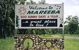
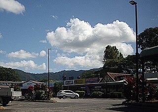
Mareeba is a rural town and locality in the Shire of Mareeba in Far North Queensland, Australia. Between 2008 and 2013, it was within the Tablelands Region. The town's name is derived from an Aboriginal word meaning meeting of the waters. In the 2021 census, the locality of Mareeba had a population of 11,825 people.

<span class="mw-page-title-main">Mount Molloy, Queensland</span> Town in Queensland, Australia

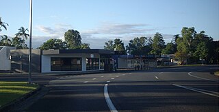
Mount Molloy is a rural town and locality in the Shire of Mareeba, Queensland, Australia. It is a historic mining and timber town, 55 kilometres (34 mi) north of Cairns. The dominant industry in the area is cattle grazing; the town itself consists of a few shops and an old hotel.

<span class="mw-page-title-main">Kuranda Scenic Railway</span>

The Kuranda Scenic Railway is a tourist railway service that operates along the heritage-listed Cairns-to-Kuranda railway line. Constructed in 1891, the line runs from Cairns, Queensland, over the Great Dividing Range to the town of Kuranda on the Atherton Tableland. Along the way, the route passes through the Macalister Range, as well as the suburbs of Stratford, Freshwater and Redlynch. Along the way, the train also stops at a lookout, which provides views of Barron Falls.

<span class="mw-page-title-main">Smithfield, Queensland</span> Suburb of Cairns, Queensland, Australia

Smithfield is a suburb of Cairns in the Cairns Region, Queensland, Australia. In the 2021 census Smithfield had a population of 6,664 people.

<span class="mw-page-title-main">Freshwater, Queensland</span> Suburb of Cairns, Queensland, Australia

Freshwater is a suburb of Cairns in the Cairns Region, Queensland, Australia. In the 2016 census, Freshwater had a population of 2,023 people.

<span class="mw-page-title-main">Stratford, Queensland</span> Suburb of Cairns Region, Queensland, Australia

Stratford is a suburb of Cairns in the Cairns Region, Queensland, Australia. In the 2016 census, Stratford had a population of 1,138 people.

<span class="mw-page-title-main">Mooroobool, Queensland</span> Suburb of Cairns, Queensland, Australia

Mooroobool is a suburb of Cairns in the Cairns Region, Queensland, Australia. In the 2016 census, Mooroobool had a population of 7,222 people.

<span class="mw-page-title-main">Bungalow, Queensland</span> Suburb of Cairns, Queensland, Australia

Bungalow is an inner suburb of Cairns in the Cairns Region, Queensland, Australia. In the 2016 census Bungalow had a population of 2,159 people.

<span class="mw-page-title-main">Cairns City, Queensland</span> Suburb of Cairns, Queensland, Australia

Cairns City is a coastal suburb at the centre of Cairns in the Cairns Region, Queensland, Australia. It is also known as the Cairns Central Business District (CBD). In the 2016 census, Cairns City had a population of 2,737 people.

<span class="mw-page-title-main">Kamerunga, Queensland</span> Suburb of Cairns, Queensland, Australia

Kamerunga is a suburb of Cairns in the Cairns Region, Queensland, Australia. In the 2016 census, Kamerunga had a population of 1,049 people.

<span class="mw-page-title-main">Cairns North, Queensland</span> Suburb of Cairns, Queensland, Australia

Cairns North is a coastal suburb of Cairns in the Cairns Region, Queensland, Australia. In the 2021 census, Cairns North had a population of 5,334 people.

<span class="mw-page-title-main">Parramatta Park, Queensland</span> Suburb of Cairns, Queensland, Australia

Parramatta Park is a suburb of Cairns in the Cairns Region, Queensland, Australia. In the 2016 census, Parramatta Park had a population of 3,508 people.

<span class="mw-page-title-main">Barron, Queensland</span> Suburb of Cairns, Queensland, Australia

Barron is a suburb of Cairns in the Cairns Region, Queensland, Australia. In the 2016 census Barron had a population of 42 people.

<span class="mw-page-title-main">Barron Gorge, Queensland</span> Suburb of Cairns Region, Queensland, Australia

Barron Gorge is a rural locality in the Cairns Region, Queensland, Australia. In the 2016 census Barron Gorge had a population of 0 people.

<span class="mw-page-title-main">Portsmith</span> Suburb of Cairns, Queensland, Australia

Portsmith is a suburb of Cairns in the Cairns Region, Queensland, Australia. In the 2021 census, Portsmith had a population of 314 people.

<span class="mw-page-title-main">Freshwater railway station, Queensland</span>

Freshwater railway station is on the Cairns-to-Kuranda railway line in Queensland, Australia. It is located at Kamerunga Road, Barron in Cairns.

References

  1. 1 2 "Redlynch – town in Cairns Region (entry 28277)". Queensland Place Names. Queensland Government . Retrieved 13 February 2022.
  2. "Redlynch – suburb in Cairns Region (entry 48852)". Queensland Place Names. Queensland Government . Retrieved 13 February 2022.
  3. 1 2 Australian Bureau of Statistics (27 June 2017). "Redlynch (SSC)". 2016 Census QuickStats. Retrieved 20 October 2018. OOjs UI icon edit-ltr-progressive.svg
  4. "Queensland Globe". State of Queensland . Retrieved 5 April 2016.
  5. "Mountain ranges beaches and sea passages - Queensland". Queensland Open Data. Queensland Government. 12 November 2020. Archived from the original on 25 November 2020. Retrieved 25 November 2020.
  6. 1 2 "Mountain peaks and capes - Queensland". Queensland Open Data. Queensland Government. 12 November 2020. Archived from the original on 25 November 2020. Retrieved 25 November 2020.
  7. "Boiboi Peak – mountain in Cairns Region (entry 3482)". Queensland Place Names. Queensland Government . Retrieved 25 November 2020.
  8. "Mooroobool Peak – mountain in Cairns Region (entry 22743)". Queensland Place Names. Queensland Government . Retrieved 25 November 2020.
  9. 1 2 "Railway stations and sidings - Queensland". Queensland Open Data. Queensland Government. 2 October 2020. Archived from the original on 5 October 2020. Retrieved 5 October 2020.
  10. "Jump Up – locality unbounded in Cairns Regional (entry 17451)". Queensland Place Names. Queensland Government . Retrieved 13 February 2022.
  11. "First people cultural history". Cairns Regional Council. Archived from the original on 9 April 2020. Retrieved 23 June 2020.
  12. 1 2 Randall, Brian (17 November 2011). "Cairns suburbs - Redlynch". SLQ blogs - John Oxley Library. Archived from the original on 13 May 2018. Retrieved 13 May 2018.
  13. "Holiday Sports". Cairns Post . Vol. V, no. 262. Queensland, Australia. 12 November 1887. p. 3. Archived from the original on 19 February 2022. Retrieved 13 May 2018 via National Library of Australia.
  14. "SKETCHER". The Queenslander . No. 2457. Queensland, Australia. 18 April 1914. p. 8. Archived from the original on 19 February 2022. Retrieved 13 May 2018 via National Library of Australia.
  15. "Advertising". Cairns Post . Vol. IV, no. 201. Queensland, Australia. 17 March 1887. p. 3. Archived from the original on 19 February 2022. Retrieved 13 May 2018 via National Library of Australia.
  16. "Monthly Licensing Sessions". Cairns Post . Vol. VI, no. 373. Queensland, Australia. 8 December 1888. p. 2. Archived from the original on 19 February 2022. Retrieved 13 May 2018 via National Library of Australia.
  17. "Advertising". Cairns Post . Vol. VII, no. 440. Queensland, Australia. 31 July 1889. p. 3. Archived from the original on 19 February 2022. Retrieved 13 May 2018 via National Library of Australia.
  18. "Advertising". Cairns Post . Vol. VIII, no. 541. Queensland, Australia. 26 July 1890. p. 3. Archived from the original on 19 February 2022. Retrieved 13 May 2018 via National Library of Australia.
  19. "Advertising". Cairns Post . Vol. VIII, no. 608. Queensland, Australia. 21 March 1891. p. 2. Archived from the original on 19 February 2022. Retrieved 13 May 2018 via National Library of Australia.
  20. Randall, Brian (17 November 2011). "Cairns Suburbs - Redlynch". State Library Of Queensland. Retrieved 1 September 2023.
  21. "Opening and closing dates of Queensland Schools". Queensland Government . Retrieved 18 April 2019.
  22. 1 2 Queensland Family History Society (2010), Queensland schools past and present (Version 1.01 ed.), Queensland Family History Society, ISBN   978-1-921171-26-0
  23. "History". Redlynch State College. 10 October 2018. Archived from the original on 11 March 2021. Retrieved 19 February 2022.
  24. "College History". St Andrew's Catholic College Cairns. Archived from the original on 13 March 2021. Retrieved 19 February 2022.
  25. 1 2 "Redlynch Central Shopping Centre". Archived from the original on 24 September 2018. Retrieved 24 September 2018.
  26. Smee, Ben (2 October 2019). "Deadly fungus native to Japan and Korea discovered in Australian rainforest". The Guardian. ISSN   0261-3077. Archived from the original on 3 October 2019. Retrieved 2 October 2019.
  27. "Xavier and Sadie Herbert's Cottage (former) (entry 601739)". Queensland Heritage Register . Queensland Heritage Council. Retrieved 1 August 2014.
  28. "Cairns Railway, Section from Redlynch to Crooked Creek Bridge (entry 600755)". Queensland Heritage Register . Queensland Heritage Council. Retrieved 1 August 2014.
  29. 1 2 3 "State and non-state school details". Queensland Government. 9 July 2018. Archived from the original on 21 November 2018. Retrieved 21 November 2018.
  30. "Redlynch State College". Redlynch State College. 10 October 2018. Archived from the original on 6 May 2021. Retrieved 19 February 2022.
  31. 1 2 "ACARA School Profile 2018". Australian Curriculum, Assessment and Reporting Authority. Archived from the original on 27 August 2020. Retrieved 28 January 2020.
  32. "St Andrew's Catholic College Redlynch Valley". Archived from the original on 28 February 2019. Retrieved 21 November 2018.
  33. "Northern Beaches Parish". Roman Catholic Diocese of Cairns . Archived from the original on 18 November 2020. Retrieved 18 November 2020.

Commons-logo.svg Media related to Redlynch, Queensland at Wikimedia Commons