Kanimbla, Queensland

Last updated

Kanimbla
Cairns,  Queensland
Harrison Close looking west, Kanimbla, Cairns, 2018.jpg
Harrison Close looking west, 2018
Australia Queensland location map.svg
Red pog.svg
Kanimbla
Kanimbla, Queensland
Coordinates 16°55′19″S145°43′15″E / 16.9219°S 145.7208°E / -16.9219; 145.7208 (Kanimbla (centre of suburb))
Population2,827 (2021 census) [1]
 • Density912/km2 (2,360/sq mi)
Established1989
Postcode(s) 4870
Area3.1 km2 (1.2 sq mi)
Time zone AEST (UTC+10:00)
Location
LGA(s) Cairns Region
State electorate(s) Cairns
Federal division(s) Leichhardt
Suburbs around Kanimbla:
Brinsmead Whitfield Manoora
Redlynch Kanimbla Manoora
Lamb Range Mooroobool Mooroobool

Kanimbla is a suburb of Cairns in the Cairns Region, Queensland, Australia. [2] In the 2021 census, Kanimbla had a population of 2,827 people. [1]

Contents

Geography

Kanimbla is 6 km (3.7 mi) west of the city centre.

The suburb straddles the upper reaches of Moody's Creek and is bordered to the north by the Cairns Western Arterial Road (state route 91). The main road that goes through Kanimbla is Ramsey Drive. Along the middle of the northern boundary is Whites Gap. In the south west elevations reach heights greater than 500 m towards the summit of Mooroobool Peak.[ citation needed ]

History

MV Kanimbla StateLibQld 1 142135 Kanimbla (ship).jpg
MV Kanimbla

Kanimbla is situated in the Yidinji traditional Aboriginal country. [3]

On 11 February 1989, the suburb was created from land previously in Manoora and Mooroobool. The new suburb was named for the MV Kanimbla, a coastal passenger ship which had serviced Cairns before being pressed into military service during World War II (Manoora and Mooroobool also being the names of other coastal passenger ships). [4] [5]

.Cairns Regional Council announced in 2013 that land had been purchased in Kanimbla to build a detention basin to alleviate seasonal flooding in suburbs downstream. [6]

Demographics

In the 2016 census, Kanimbla had a population of 2,670 people. [7]

In the 2021 census, Kanimbla had a population of 2,827 people. [1]

Education

There are no schools in Kanimbla. The nearest government primary schools are Whitfield State School in neighbouring Whitfield to the north and Cairns West State School in Manunda to the east. The nearest government secondary school is Trinity Bay State High School in Manunda. There are also a number of non-government schools in nearby suburbs of Cairns. [8]

Attractions

Campbells Lookout is on Lake Morris Road ( 16°55′44″S145°43′15″E / 16.9290°S 145.7209°E / -16.9290; 145.7209 (Campbells Lookout) ). [9] It offers views across the Cairns suburbs to the Cairns CBD and Trinity Bay beyond. [10] It is a popular lovers' lane. [11]

Related Research Articles

<span class="mw-page-title-main">Woree, Queensland</span> Suburb of Cairns, Queensland, Australia

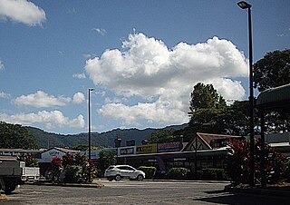
Woree is a suburb of Cairns in the Cairns Region, Queensland, Australia. In the 2021 census, Woree had a population of 5,127 people.

Trinity Bay State High School is a co-educational high school in Manunda, Queensland, Australia. In 2022, it had an enrolment of 1930 students across year levels 7 to 12. The school draws from the surrounding “three M” suburbs of Cairns, in addition to populations in surrounding mortgage belt suburbs. The student population reflects the multicultural nature of the greater city of Cairns, with 48% of students speaking a language other than English at home. Approximately 35% of students identify themselves as being Indigenous.

<span class="mw-page-title-main">Stratford, Queensland</span> Suburb of Cairns, Queensland, Australia

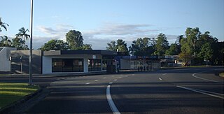
Stratford is a suburb of Cairns in the Cairns Region, Queensland, Australia. In the 2021 census, Stratford had a population of 1,198 people.

<span class="mw-page-title-main">Aeroglen</span> Suburb of Cairns, Queensland, Australia

Aeroglen is a coastal suburb of Cairns in the Cairns Region, Queensland, Australia. It is approximately 5 kilometers north of the Cairns City centre. In the 2021 census, Aeroglen had a population of 405 people.

<span class="mw-page-title-main">Trinity Beach, Queensland</span> Suburb of Cairns, Queensland, Australia

Trinity Beach is a coastal suburb of Cairns in the Cairns Region, Queensland, Australia. In the 2021 census, Trinity Beach had a population of 6,594 people.

<span class="mw-page-title-main">Mooroobool, Queensland</span> Suburb of Cairns, Queensland, Australia

Mooroobool is a suburb of Cairns in the Cairns Region, Queensland, Australia. In the 2021 census, Mooroobool had a population of 7,136 people.

<span class="mw-page-title-main">Bungalow, Queensland</span> Suburb of Cairns, Queensland, Australia

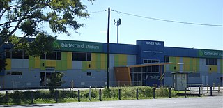
Bungalow is an inner suburb of Cairns in the Cairns Region, Queensland, Australia. In the 2021 census, Bungalow had a population of 2,358 people.

<span class="mw-page-title-main">Manoora, Queensland</span> Suburb of Cairns, Queensland, Australia

Manoora is a suburb of Cairns in the Cairns Region, Queensland, Australia. In the 2021 census, Manoora had a population of 6,175 people.

<span class="mw-page-title-main">Brinsmead, Queensland</span> Suburb of Cairns, Queensland, Australia

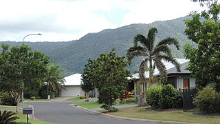
Brinsmead is a suburb of Cairns in the Cairns Region, Far North Queensland, Australia. In the 2021 census, Brinsmead had a population of 5,537 people.

The Cairns Western Arterial Road is a numbered state route in the Cairns Region of Queensland, Australia. The road provides a primary access route across the Brinsmead Gap for suburbs west of the Whitfield Range, and is one of two major crossings over the Barron River. In 2007, it was estimated that 24,000 vehicles per day used the road.

<span class="mw-page-title-main">Edge Hill, Queensland</span> Suburb of Cairns Region, Queensland, Australia

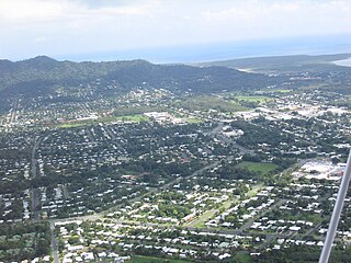
Edge Hill is an inner suburb of the city of Cairns in Far North Queensland, Australia located approximately four kilometres north west of the city centre. In the 2021 census, Edge Hill had a population of 4,088 people.

<span class="mw-page-title-main">Whitfield, Queensland</span> Suburb of Cairns, Queensland, Australia

Whitfield is a suburb of Cairns in the Cairns Region, Queensland, Australia. In the 2021 census, Whitfield had a population of 4,262 people.

<span class="mw-page-title-main">Redlynch, Queensland</span> Town in Queensland, Australia

Redlynch is a semi-rural town and suburb of Cairns in the Cairns Region, Queensland, Australia. In the 2021 census, the suburb of Redlynch had a population of 10,571 people.

<span class="mw-page-title-main">Earlville, Queensland</span> Suburb of Cairns, Queensland, Australia

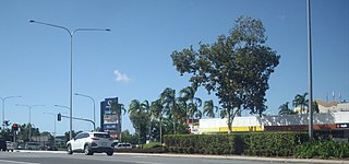
Earlville is a suburb of Cairns in the Cairns Region, Queensland, Australia. In the 2021 census, Earlville had a population of 4,200 people.

<span class="mw-page-title-main">Manunda, Queensland</span> Suburb of Cairns, Queensland, Australia

Manunda is a suburb of Cairns in the Cairns Region, Queensland, Australia. In the 2021 census, Manunda had a population of 5,191 people.

<span class="mw-page-title-main">Portsmith</span> Suburb of Cairns, Queensland, Australia

Portsmith is a suburb of Cairns in the Cairns Region, Queensland, Australia. In the 2021 census, Portsmith had a population of 314 people.

<span class="mw-page-title-main">Trinity Park, Queensland</span> Suburb of Cairns, Queensland, Australia

Trinity Park is a coastal suburb of Cairns in the Cairns Region, Queensland, Australia. In the 2021 census, Trinity Park had a population of 3,536 people.

<span class="mw-page-title-main">Westcourt, Queensland</span> Suburb of Cairns, Queensland, Australia

Westcourt is a suburb of Cairns in the Cairns Region, Queensland, Australia. In the 2021 census, Westcourt had a population of 3,841 people.

<span class="mw-page-title-main">Lamb Range</span> Suburb of Cairns Region, Queensland, Australia

Lamb Range is a locality in the Cairns Region, Queensland, Australia. In the 2021 census, Lamb Range had "no people or a very low population".

<span class="mw-page-title-main">Macalister Range, Queensland</span> Suburb of Cairns Region, Queensland, Australia

Macalister Range is a coastal locality in the Cairns Region, Queensland, Australia. In the 2021 census, Macalister Range had "no people or a very low population".

References

  1. 1 2 3 Australian Bureau of Statistics (28 June 2022). "Kanimbla (SAL)". 2021 Census QuickStats. Retrieved 28 February 2023. OOjs UI icon edit-ltr-progressive.svg
  2. "Kanimbla – suburb in Cairns Region (entry 48693)". Queensland Place Names. Queensland Government . Retrieved 19 July 2021.
  3. "First people cultural history". Cairns Regional Council. Archived from the original on 9 April 2020. Retrieved 23 June 2020.
  4. "Cairns Suburbs". University of Queensland Centre for the Government of Queensland. Archived from the original on 29 July 2017. Retrieved 30 July 2017.
  5. "Item ID3410383, Queensland Place Names Act 1988 - Approval of a Place Name. - Mr W.H. Glasson". Queensland State Archives . Retrieved 12 September 2020. — includes a map
  6. Liam Parsons (21 October 2013). "Cairns Regional Council purchases land to build 100 megalitre flood detention basin". The Cairns Post . Retrieved 31 August 2024.
  7. Australian Bureau of Statistics (27 June 2017). "Kanimbla (SSC)". 2016 Census QuickStats. Retrieved 20 October 2018. OOjs UI icon edit-ltr-progressive.svg
  8. "Layers: Locality; Schools and school catchments". Queensland Globe. Queensland Government. Archived from the original on 19 December 2017. Retrieved 31 August 2024.
  9. "Tourist points - Queensland". Queensland Open Data. Queensland Government. 18 November 2020. Archived from the original on 24 November 2020. Retrieved 24 November 2020.
  10. "Campbells Lookout" (Map). Google Maps . Google. 20 December 2021. Retrieved 20 December 2021.
  11. Calcino, Chris (27 November 2019). "Lover's lane lookout set for $500,000 overhaul". Cairns Post . Archived from the original on 20 December 2021. Retrieved 20 December 2021.

Commons-logo.svg Media related to Kanimbla, Queensland at Wikimedia Commons