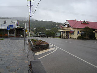
Stratford is 6.8 kilometres (4.2mi) NNW of the Cairns CBD. It is bounded to the north by the Barron River. It is bounded to the east by the Captain Cook Highway. The northern part of the suburb is situated on the lower slopes (10–40 metres above sea level) of Mount Whitfield and Lumley Hill and is used for residential housing. The southern part of the suburb is undeveloped dense bushland on the higher slopes rising to about 160 metres.[3]
European occupation along the banks of the Barron River began in late 1876 when the Douglas Track and Smith's Track were established around Lumley Hill and Mount Whitfield, linking the new port of Cairns to the Hodgkinson goldfields. In early 1877, John Oldham built the Halfway House (also known as the Half-Way Hotel) on the bank of the Barron River. In 1878, Samuel Cochrane became the first farmer in the area when he purchased Lot 160, 110 acres on the southern bank of the Barron River. He built a homestead which he named 'Lily Bank' and grew maize, English potatoes, sweet potatoes and pumpkins.[6]
In 1885, Parliament approved plans for the first section of the Cairns-Herberton railway from Cairns to Redlynch, and this led to increased interest in the area. Surveyor Thomas Behan purchased a 13-acre lease with water frontage on the Barron, where he built a steam-powered rice mill (now the site of the Stratford Bowls Club) and a house, Cochrane opened the Lilybank Hotel, Alexander Finlayson opened the Range Hotel and store nearby, and Martin & Sons built the Union Sawmill on the river-bank.[7] The land adjacent to Lily Bank farm was subdivided into 50 five- and ten-acre blocks and auctioned off as the River-View Estate.[8] Construction of the railway began in April 1886, with the lines laid to the Five-mile Siding by June 1887, and passenger services commencing on 8 October 1887.[9] In December 1887, William Henry Boden rented Behan's house at the Five-mile and applied for a publican's license to run the premises to be known as Stratford Hotel.[10][11] Around this time the Five-Mile railway siding was renamed Stratford railway station. Another station was opened further along the line at Lilybank.
On 19 July 1877, Constable Michael Dwyer of the Special Division of Escort, which guarded the transportation of gold from the Hodgkinson to Trinity Bay, was shooting scrub turkeys with a packer, William Guilfoyle, near the Halfway House Hotel, when Dwyer tripped and accidentally shot himself in the side. Badly wounded he was taken to the Hotel and Guilfoyle rode off to Old Smithfield township town to get help. He returned with George Rutherford, the local chemist, and shortly afterwards Dr Myers arrived from Cairns. Despite their best efforts, Dwyer died that evening and was buried built near the hotel. A headstone was erected, making this the first marked European grave in the Cairns area.[12][13]
In 1878, Samuel Cochrane became the first farmer in the area when he purchased 'Lot 160', 110 acres on the southern bank of the Barron. He built a homestead which he named 'Lily Bank' and grew maize, English potatoes, sweet potatoes and pumpkins.[14]
In 1901, the Stratford explosives magazine and detonator store were constructed beside the railway line at Stratford by the Queensland Government's Marine Department, which was the government authority then responsible for storing large quantity of explosives, whether government- or privately-owned, being shipped into the port of Cairns.[15] At that time, Cairns was receiving shipments of explosives at the rate of 2,716 cases per annum and that the amount was increasing rapidly, due to demand from mining companies and merchants on the Atherton tinfields and Chillagoe copperfields. Also, explosives were used in the construction of the privately-funded Mareeba-to-Chillagoe railway, which commenced operation in October 1900, opening up even more new mineral fields and plantations, and creating a greater demand for explosives, in the process. The Stratford explosives store could hold over 6,000 cases of explosives and the capacity was expanded over the years.[15]
At the outbreak of the Second World War in September 1939, a military guard of 19 men was stationed at the Stratford magazine. By early 1940, the Government had made the decision to erect new magazine facilities, including caretaker's quarters, at Queerah, on the southern outskirts of Cairns. The Queerah magazine buildings were completed in October 1941, and by March 1942, all explosives from the Stratford store had been transferred there. From early June 1942 until mid May 1945, the Stratford store was occupied by the Australian Military Forces, who used the concrete buildings to store explosives.[15]
The Stratford public library opened in 1956 and underwent a major refurbishment in 2008.[17]
Cairns Rudolf Steiner School opened on 29 January 2002.[18] It subsequently[when?] relocated to Kuranda and was renamed Cairns Hinterland Steiner School.[19]
Demographics
In the 2006 census, Stratford had a population of 1,178 people.[20]
In the 2011 census, Stratford had a population of 1,109 people.[21]
In the 2016 census, Stratford had a population of 1,138 people.[22]
In the 2021 census, Stratford had a population of 1,198 people.[1]
In 2009 for the Q150 commemorations, the Stratford and Freshwater Community Association built a heritage trail, with 29 signposted sites in Stratford and 22 signposted sites in the neighbouring suburb of Freshwater.[25]
Cairns is a city in the Cairns Region, Queensland, Australia, on the tropical north east coast of Far North Queensland. In the 2021 census, Cairns had a population of 153,181 people.
Atherton is a rural town and locality in the Tablelands Region, Queensland, Australia. In the 2021 census, the locality of Atherton had a population of 7,724 people.
Kuranda is a rural town and locality on the Atherton Tableland in the Shire of Mareeba, Queensland, Australia. It is 25 kilometres (16 mi) from Cairns, via the Kuranda Range road. It is surrounded by tropical rainforest and adjacent to the Wet Tropics of Queensland World Heritage listed Barron Gorge National Park. In the 2021 census, the locality of Kuranda had a population of 3,273 people.
Herberton is a rural town and locality in the Tablelands Region, Queensland, Australia. In the 2021 census, the locality of Herberton had a population of 895 people.
Mount Molloy is a rural town and locality in the Shire of Mareeba, Queensland, Australia. It is a historic mining and timber town, 55 kilometres (34 mi) north of Cairns. The dominant industry in the area is cattle grazing; the town itself consists of a few shops and an old hotel. In the 2021 census, the locality of Mount Molloy had a population of 266 people.
The Shire of Mareeba is a local government area at the base of Cape York Peninsula in Far North Queensland, inland from Cairns. The shire, administered from the town of Mareeba, covered an area of 53,491 square kilometres (20,653.0 sq mi), and existed as a local government entity from 1879 until 2008, when it amalgamated with several councils in the Atherton Tableland area to become the Tablelands Region.
The Kuranda Scenic Railway is a tourist railway service that operates along the heritage-listed Cairns-to-Kuranda railway line. Constructed in 1891, the line runs from Cairns, Queensland, over the Great Dividing Range to the town of Kuranda on the Atherton Tableland. The route passes through the Macalister Range, as well as the suburbs of Stratford, Freshwater and Redlynch.
Smithfield is a suburb of Cairns in the Cairns Region, Queensland, Australia. In the 2021 census, Smithfield had a population of 6,664 people.
Freshwater is a suburb of Cairns, Queensland, Australia. In the 2021 census, Freshwater had a population of 2,142 people.
Aeroglen is a coastal suburb of Cairns in the Cairns Region, Queensland, Australia. It is approximately 5 kilometers north of the Cairns City centre. In the 2021 census, Aeroglen had a population of 405 people.
Caravonica is a suburb of Cairns in the Cairns Region, Queensland, Australia. In the 2021 census, Caravonica had a population of 2,183 people.
Cairns City is a coastal suburb at the centre of Cairns in the Cairns Region, Queensland, Australia. It is also known as the Cairns Central Business District (CBD). In the 2021 census, Cairns City had a population of 3,616 people.
Brinsmead is a suburb of Cairns in the Cairns Region, Far North Queensland, Australia. In the 2021 census, Brinsmead had a population of 5,537 people.
Kamerunga is a town and a suburb of Cairns in the Cairns Region, Queensland, Australia. In the 2021 census, the suburb of Kamerunga had a population of 962 people.
Explosives Magazine and Detonator Store is a heritage-listed former gunpowder magazine at Magazine Street, Stratford, Cairns, Cairns Region, Queensland, Australia. It was built in 1901 by JC Thomson. It was added to the Queensland Heritage Register on 21 October 1992.
Redlynch is a semi-rural town and suburb of Cairns in the Cairns Region, Queensland, Australia. In the 2021 census, the suburb of Redlynch had a population of 10,571 people.
The Cairns-to-Kuranda Railway is a heritage-listed railway line from the Cairns Region to the Shire of Mareeba, both in Queensland, Australia. It commences at Redlynch, a suburb of Cairns and travels up the Great Dividing Range to Kuranda within the Shire of Mareeba on the Atherton Tableland. It was built from 1913 to 1915 by Queensland Railways. Components of it include Stoney Creek Bridge, the Rail Bridge over Christmas Creek, Kuranda railway station, and Surprise Creek Rail Bridge. It was added to the Queensland Heritage Register on 21 August 1992. The railway is used to operate a tourist rail service, the Kuranda Scenic Railway. It forms part of the Tablelands railway line.
Barron is a suburb of Cairns in the Cairns Region, Queensland, Australia. In the 2021 census, Barron had a population of 68 people.
Barron Gorge is a rural locality in the Cairns Region, Queensland, Australia. In the 2021 census, Barron Gorge had "no people or a very low population".
Freshwater railway station is on the Cairns-to-Kuranda railway line in Queensland, Australia. It is located at Kamerunga Road, Barron in Cairns.
↑ "Local Items". Cairns Post. Queensland, Australia. 18 June 1885. p.2. Archived from the original on 28 January 2022. Retrieved 20 July 2020– via National Library of Australia.
↑ "Local Items". Cairns Post. Queensland, Australia. 11 June 1887. p.2. Archived from the original on 28 January 2022. Retrieved 20 July 2020– via National Library of Australia.
↑ "Advertising". Cairns Post. Vol.V, no.268. Queensland, Australia. 3 December 1887. p.3. Retrieved 1 November 2024– via National Library of Australia.
↑ "The Cairns Post". Cairns Post. Vol.V, no.286. Queensland, Australia. 4 February 1888. p.2. Retrieved 1 November 2024– via National Library of Australia.
↑ "Telegraphic". The Brisbane Courier. Vol.XXXII, no.3, 182. Queensland, Australia. 30 July 1877. p.3. Archived from the original on 28 January 2022. Retrieved 28 January 2022– via National Library of Australia.
↑ "Dwyer's Grave". Stratford Heritage Trail. Stratford and Freshwater Community Association. Archived from the original on 15 April 2021. Retrieved 28 January 2022.
This page is based on this Wikipedia article Text is available under the CC BY-SA 4.0 license; additional terms may apply. Images, videos and audio are available under their respective licenses.