Goldsborough, Queensland

Last updated

Goldsborough
Queensland
Mulgrave River at Goldsborough Valley - panoramio.jpg
Mulgrave River at Goldsborough Valley
Australia Queensland location map.svg
Red pog.svg
Goldsborough
Coordinates 17°11′24″S145°44′10″E / 17.19°S 145.7361°E / -17.19; 145.7361 (Goldsborough (centre of locality))
Population1,099 (2021 census) [1]
 • Density16.677/km2 (43.19/sq mi)
Postcode(s) 4865
Area65.9 km2 (25.4 sq mi)
Time zone AEST (UTC+10:00)
Location
LGA(s) Cairns Region
State electorate(s) Mulgrave
Federal division(s) Kennedy
Suburbs around Goldsborough:
Lamb Range Little Mulgrave Gordonvale
Gadgarra Goldsborough Wooroonooran
Gadgarra Gadgarra Wooroonooran

Goldsborough is a locality in the Cairns Region, Queensland, Australia. [2] In the 2021 census, Goldsborough had a population of 1,099 people. [1]

Contents

Geography

The Mulgrave River flows from the south to the north-east of the locality, forming its northern boundary. The river which is at 20–60 metres above sea level forms a north–south valley through the locality with mountainous land rising on the east (to an unnamed peak of 560 metres) and to Mount Mac (just beyond the locality's western boundary at 900 metres). [3]

The most northerly part of the locality is somewhat lower (100–140 metres above sea level) and is freehold, containing the residential component of the locality and some agriculture use. Further south, the land to the west of the Mulgrave River is freehold but is mostly undeveloped apart from some residential and agriculture use along the river, while the land to the east of the river is undeveloped and forms part of the Wooroonooran National Park, which is part of the Wet Tropics World Heritage Area. [3] [4]

Road access into Goldsborough is via the Gillies Range Road which passes through neighbouring Little Mulgrave to the north of the locality. There is road access to the areas using for housing and agriculture, but beyond that there are only a few tracks through the mountainous terrain. [3]

History

River Mulgrave at Goldsborough, 1890 River Mulgrave at Goldsborough, 1890.jpg
River Mulgrave at Goldsborough, 1890

The Goldsborough Valley is the traditional country of the Dulabed Malanbarra Yidinji speaking clan, part of the Yidinji people. [4]

In 1879, W Diecke discovered gold near the Mulgrave River resulting in a goldrush for a few years. Alluvial gold was found in the Mulgrave River and its tributaries, the Toohey and Butcher Creeks. Two settlements formed, one called Top Camp on Butcher Creek and the other called Lower Camp or Fanning Town on Toohey Creek. Fanning Town was named after police magistrate Major Matthew Patrick Boyle Fanning but was later renamed Goldsborough. The Mulgrave goldfield yielded 3894 ounces of gold between 1879 and 1886, and by the early 1990s no more gold was found and many storekeepers in the settlements moved to the better located Gordonvale. [4] [5] [6] [7] [8]

As a result of the gold rush, large quantities of valuable red cedar trees ( Toona ciliata ) were found in the forests, attracting loggers in the 1880s. By the early 1890s little red cedar remained in the area. Some farmers and graziers were also attracted into the area including grazier Frank Kearney after whom Kearneys Falls and Kearneys Flat were named. [4]

Demographics

In the 2016 census, Goldsborough had a population of 929 people. [9]

In the 2021 census, Goldsborough had a population of 1,099 people. [1]

Education

There are no schools in Goldsborough. The nearest government primary and secondary schools are Gordonvale State School and Gordonvale State High School, both in Gordonvale to the north-east. [10]

Amenities

Goldsborough Community Church is at 10-12 Aitken Close ( 17°08′56″S145°45′16″E / 17.1490°S 145.75455°E / -17.1490; 145.75455 (Goldsborough Community Church) ). It is part of the Wesleyan Methodist Church. [11]

Related Research Articles

<span class="mw-page-title-main">Wooroonooran National Park</span> Protected area in Queensland, Australia

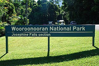
Wooroonooran National Park is a national park in Queensland, Australia, 1,367 km northwest of Brisbane, between Innisfail and Cairns.

<span class="mw-page-title-main">Cairns</span> City in Queensland, Australia

Cairns is a city in Queensland, Australia, on the tropical north east coast of Far North Queensland. In the 2021 census, Cairns had a population of 153,181 people.

<span class="mw-page-title-main">Gordonvale, Queensland</span> Suburb of Cairns, Queensland, Australia

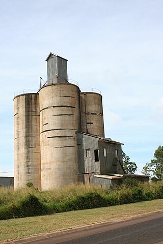
Gordonvale is a rural sugar-growing town and locality situated on the southern side of Cairns in the Cairns Region, Queensland, Australia. In the 2021 census, the locality of Gordonvale had a population of 6,944 people.

<span class="mw-page-title-main">Aloomba, Queensland</span> Town in Queensland, Australia

Aloomba is a rural town and a locality in the Cairns Region, Queensland, Australia. In the 2021 census, the locality of Aloomba had a population of 576 people.

The Kearneys Falls is a cascade waterfall on a tributary of the Mulgrave River, in the Wooroonooran National Park, in the Goldsborough Valley of Far North region of Queensland, Australia.

<span class="mw-page-title-main">Kairi, Queensland</span> Town in Queensland, Australia

Kairi is a rural town and locality in the Tablelands Region, Queensland, Australia. In the 2016 census, Kairi had a population of 442 people.

<span class="mw-page-title-main">Gillies Highway</span>

The Gillies Highway is a road that runs from Gordonvale in the Cairns Region through the Gillies Range to Atherton in the Tablelands Region, both in Queensland, Australia. Its official name is Gillies Range Road, and it was originally known as the Cairns Range Road.

<span class="mw-page-title-main">Cairns Region</span> Local government area of Queensland, Australia

The Cairns Region is a local government area in Far North Queensland, Queensland, Australia, centred on the regional city of Cairns. It was established in 2008 by the amalgamation of the City of Cairns and the Shires of Douglas and Mulgrave. However, following public protest and a referendum in 2013, on 1 January 2014, the Shire of Douglas was de-amalgamated from the Cairns Region and re-established as a separate local government authority.

<span class="mw-page-title-main">Mulgrave River</span> River in Queensland, Australia

The Mulgrave River, incorporating the East Mulgrave River and the West Mulgrave River, is a river system in Far North Queensland, Australia. The 70-kilometre (43 mi)-long river flows towards the Coral Sea and is located approximately 50 kilometres (31 mi) south of Cairns.

<span class="mw-page-title-main">Bellenden Ker Range</span> Mountain range in Queensland, Australia

The Bellenden Ker Range, also known as the Wooroonooran Range is a coastal mountain range in Far North Queensland, Australia. Part of the Great Dividing Range it is located between Gordonvale and Babinda.

<span class="mw-page-title-main">Woopen Creek, Queensland</span> Suburb of Cairns Region, Queensland, Australia

Woopen Creek is a rural locality in the Cairns Region, Queensland, Australia. In the 2016 census, Woopen Creek had a population of 141 people.

<span class="mw-page-title-main">East Trinity</span> Suburb of Cairns Region, Queensland, Australia

East Trinity is a coastal rural locality in the Cairns Region, Queensland, Australia. It was formerly known as Trinity East. In the 2021 census, East Trinity had a population of 238 people.

<span class="mw-page-title-main">Deeral, Queensland</span> Town in Queensland, Australia

Deeral is a town and coastal locality in the Cairns Region, Queensland, Australia. In the 2016 census, Deeral had a population of 141 people.

<span class="mw-page-title-main">Fishery Falls, Queensland</span> Suburb of Cairns Region, Queensland, Australia

Fishery Falls is a locality in the Cairns Region, Queensland, Australia. In the 2021 census, Fishery Falls had a population of 205 people.

<span class="mw-page-title-main">Mount Peter, Queensland</span> Suburb of Cairns Region, Queensland, Australia

Mount Peter is a rural locality in the Cairns Region, Queensland, Australia. In the 2021 census, Mount Peter had a population of 689 people.

<span class="mw-page-title-main">Little Mulgrave, Queensland</span> Suburb of Cairns Region, Queensland, Australia

Little Mulgrave is a locality in the Cairns Region, Queensland, Australia. In the 2016 census, Little Mulgrave had a population of 249 people.

<span class="mw-page-title-main">Wrights Creek, Queensland</span> Suburb of Cairns Region, Queensland, Australia

Wrights Creek is a rural locality in the Cairns Region, Queensland, Australia. In the 2021 census, Wrights Creek had a population of 160 people.

<span class="mw-page-title-main">Wooroonooran, Queensland</span> Suburb of Cairns Region, Queensland, Australia

Wooroonooran is an undeveloped locality split among the Cairns Region, the Cassowary Coast Region and the Tablelands Region in Queensland, Australia. In the 2021 census, Wooroonooran had a population of 4 people.

<span class="mw-page-title-main">Packers Camp</span> Suburb of Cairns Region, Queensland, Australia

Packers Camp is a rural locality in the Cairns Region, Queensland, Australia. In the 2021 census, Packers Camp had a population of 136 people.

<span class="mw-page-title-main">Green Hill, Queensland</span> Suburb of Cairns Region, Queensland, Australia

Green Hill is a rural locality in the Cairns Region, Queensland, Australia. In the 2021 census, Green Hill had a population of 177 people.

References

  1. 1 2 3 Australian Bureau of Statistics (28 June 2022). "Goldsborough (SAL)". 2021 Census QuickStats. Retrieved 28 February 2023. OOjs UI icon edit-ltr-progressive.svg
  2. "Goldsborough – locality in Cairns Region (entry 48659)". Queensland Place Names. Queensland Government . Retrieved 29 December 2017.
  3. 1 2 3 "Queensland Globe". State of Queensland . Retrieved 21 April 2018.
  4. 1 2 3 4 "Goldsborough Valley, Wooroonooran National Park: Nature, culture and history". Department of National Parks, Sport and Racing. Queensland Government. 28 March 2017. Archived from the original on 3 April 2016. Retrieved 22 April 2018.
  5. "Goldsborough Road 2 Park". Cairns Regional Council. Archived from the original on 10 May 2017. Retrieved 22 April 2018.
  6. "Goldsborough Valley Cairns, Australia". Cairns Attractions. Archived from the original on 10 March 2018. Retrieved 22 April 2018.
  7. "G Suburbs" (PDF). Cairns Regional Council. Archived (PDF) from the original on 28 March 2015. Retrieved 22 April 2018.
  8. "DEATH OF MAJOR FANNING". Morning Bulletin . Vol. LXVII, no. 12, 378. Queensland, Australia. 22 August 1905. p. 4. Archived from the original on 12 September 2023. Retrieved 22 April 2018 via National Library of Australia.
  9. Australian Bureau of Statistics (27 June 2017). "Goldsborough (SSC)". 2016 Census QuickStats. Retrieved 20 October 2018. OOjs UI icon edit-ltr-progressive.svg
  10. "Layers: Locality; Schools and school catchments". Queensland Globe. Queensland Government. Archived from the original on 19 December 2017. Retrieved 12 September 2023.
  11. "North Queensland". Wesleyan Methodist Church Australia. Archived from the original on 18 August 2021. Retrieved 18 August 2021.

Commons-logo.svg Media related to Goldsborough, Queensland at Wikimedia Commons