
Tully is a rural town and locality in the Cassowary Coast Region, Queensland, Australia. It is adjacent to the Bruce Highway, approximately 140 kilometres (87 mi) south of Cairns by road and 210 kilometres (130 mi) north of Townsville. Tully is perhaps best known for being one of the wettest towns in Australia, and home to the 7.9 m tall Golden Gumboot.

Gordonvale is a rural sugar-growing town and locality situated on the southern side of Cairns in the Cairns Region, Queensland, Australia. In the 2021 census, the locality of Gordonvale had a population of 6,944 people.

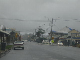
Mount Garnet is a rural town and locality in the Tablelands Region, Queensland, Australia. In the 2021 census, the locality of Mount Garnet had a population of 532 people.
Babinda is a rural town and locality in the Cairns Region, Queensland, Australia. Babinda and Tully annually compete for the Golden Gumboot, an award for Australia's wettest town. Babinda is usually the winner, recording an annual average rainfall of over 4,279.4 millimetres (168.48 in) each year. In the 2021 census, the locality of Babinda had a population of 1,287 people.

Aloomba is a rural town and a locality in the Cairns Region, Queensland, Australia. In the 2021 census, the locality of Aloomba had a population of 576 people.

Bramston Beach is a coastal town and rural locality in Cairns Region, Queensland, Australia. In the 2021 census, the locality of Bramston Beach had a population of 173 people.
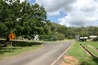
Irvinebank is a rural town and locality in the Shire of Mareeba, Queensland, Australia. In the 2021 census, the locality of Irvinebank had a population of 113 people.

The Russell River is a river in Far North Queensland, Australia. The 59-kilometre (37 mi)-long river flows towards the Coral Sea and is located approximately 60 kilometres (37 mi) south of Cairns.

Mirriwinni is a rural town and locality in the Cairns Region, Queensland, Australia. The spelling Miriwinni has also been used historically, but Mirriwinni is the official spelling from 8 October 2010. In the 2021 census, the locality of Mirriwinni had a population of 492 people.

Woopen Creek is a rural locality in the Cairns Region, Queensland, Australia. In the 2021 census, Woopen Creek had a population of 135 people.

Bartle Frere is a rural locality in the Cairns Region, Queensland, Australia. In the 2021 census, Bartle Frere had a population of 169 people.

East Trinity is a coastal rural locality in the Cairns Region, Queensland, Australia. It was formerly known as Trinity East. In the 2021 census, East Trinity had a population of 238 people.

Bellenden Ker is a rural town and locality in the Cairns Region, Queensland, Australia. In the 2021 census, the locality of Bellenden Ker had a population of 229 people.

Deeral is a town and coastal locality in the Cairns Region, Queensland, Australia. In the 2021 census, the locality of Deeral had a population of 151 people.

Fishery Falls is a locality in the Cairns Region, Queensland, Australia. In the 2021 census, Fishery Falls had a population of 205 people.

Eubenangee is a coastal locality split between the Cairns Region and the Cassowary Coast Region, Queensland, Australia. In the 2021 census, Eubenangee had a population of 247 people.

Mowbray is a coastal locality in the Shire of Douglas, Queensland, Australia. In the 2021 census, Mowbray had a population of 362 people.

Wooroonooran is an undeveloped locality split among the Cairns Region, the Cassowary Coast Region and the Tablelands Region in Queensland, Australia. In the 2021 census, Wooroonooran had "no people or a very low population".

Waugh Pocket is a locality in the Cairns Region, Queensland, Australia. In the 2021 census, Waugh Pocket had a population of 46 people.

Gulgibarra is the name for the local Aboriginal Australian group who are particularly associated with, and 'belong to', the sandy seashores and the lower saltwater reaches of the Mulgrave and Russell Rivers including the Mutchero Inlet, where 'the waters flow through sand' in North East Queensland's wet tropics


