Portsmith

Last updated

Portsmith
Cairns,  Queensland
Inlet to Bulk Sugar Terminal, Cairns QUT-7290.jpg
View from the Bulk Sugar Terminal across Trinity Inlet, 1964
Australia Queensland location map.svg
Red pog.svg
Portsmith
Portsmith
Coordinates 16°56′42″S145°46′00″E / 16.945°S 145.7666°E / -16.945; 145.7666 (Portsmith (centre of suburb))
Population314 (SAL 2021) [1]
Postcode(s) 4870
Area15.6 km2 (6.0 sq mi)
Time zone AEST (UTC+10:00)
Location
LGA(s) Cairns Region
State electorate(s)
Federal division(s)
Suburbs around Portsmith:
Bungalow Parramatta Park Cairns City
Woree Portsmith East Trinity
White Rock Edmonton Wrights Creek

Portsmith is a suburb of Cairns in the Cairns Region, Queensland, Australia. [2] In the 2021 census, Portsmith had a population of 314 people. [3]

Contents

Geography

The Big Boat Shed, 2018 The Big Boat Shed, Tingira Street, Portsmith, 2018.jpg
The Big Boat Shed, 2018

The suburb consists of two distinct areas: the north-western part which is the mainland (adjacent with suburbs Woree, Bungalow, Parramatta Park and Cairns City) and the south-eastern part which is a pair of islands (Admiralty Island and a smaller unnamed island) [4] bounded to the west by Smiths Creek and to the east by Trinity Inlet. The mainland part is developed land while the islands are undeveloped. The entire suburb is flat low-lying land, less than 10 metres above sea level. [5]

Portsmith railway yards, 2018 Portsmith railway yards, 2018 01.jpg
Portsmith railway yards, 2018

The mainland part is principally used for industrial purposes with those nearest Smiths Creek being used for maritime purposes such as boat building, shipping services, trawlers and fish markets. [5] [6]

Ray Jones Drive/Bruce Highway is an arterial road that runs from the south-west to the north-east through the mainland area (being known at the north-east end as Comport Street). The North Coast railway line runs south and roughly parallel with the arterial road with the Portsmith railway station ( 16°56′46″S145°45′51″E / 16.9461°S 145.7641°E / -16.9461; 145.7641 (Portsmith railway station) ) and Portsmith railway yards serving the suburb. [5] [7]

History

Portsmith is situated in the Yidinji traditional Aboriginal country. [8] The origin of the suburb name is from an early pioneer named William Smith. [9]

Demographics

In the 2016 census, Portsmith had a population of 260 people. [10]

In the 2021 census, Portsmith had a population of 314 people. [3]

Education

There are no schools in Portsmith. The nearest government primary schools are Parramatta State School in neighbouring Parramatta Park to the north and Balaclava State School in Mooroobool to the north-west. The nearest government secondary school is Trinity Bay State High School in Manunda to the north. [5]

Great Barrier Reef International Marine College is a technical college specialising in maritime training. It is at 55-61 Tingira Street ( 16°56′57″S145°46′12″E / 16.9491°S 145.7699°E / -16.9491; 145.7699 (technical college) ). [11] [12] It has a training ship in addition to a number of simulators, engineering workshops, and an immersion pool. [13]

Amenities

There is a boat ramp, floating walkway and pontoon at Tingira Street into Smiths Creek ( 16°57′09″S145°46′22″E / 16.9526°S 145.7729°E / -16.9526; 145.7729 (Tingira Street boat ramp) ). It is managed by the Cairns Regional Council. [14]

There is a boat ramp and floating walkway at Fearnley Street into Trinity Inlet ( 16°56′29″S145°46′31″E / 16.9413°S 145.7754°E / -16.9413; 145.7754 (Fearnley Street boat ramp) ). It is managed by the Cairns Regional Council. [14]

Related Research Articles

<span class="mw-page-title-main">Woree, Queensland</span> Suburb of Cairns, Queensland, Australia

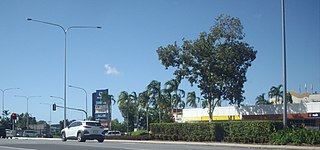
Woree is a suburb of Cairns in the Cairns Region, Queensland, Australia. In the 2016 census, Woree had a population of 4,821 people.

<span class="mw-page-title-main">Horseshoe Bay, Queensland</span> Town in Queensland, Australia

Horseshoe Bay is a bay, town and suburb on Magnetic Island in the City of Townsville, Queensland, Australia. It is a major tourist accommodation and recreation centre on the island. In the 2016 census, the suburb of Horseshoe Bay had a population of 578 people.

<span class="mw-page-title-main">Railway Estate, Queensland</span> Suburb of Townsville, Queensland, Australia

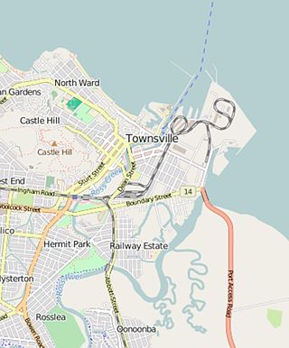
Railway Estate is a suburb of Townsville in the City of Townsville, Queensland, Australia. In the 2016 census Railway Estate had a population of 2,852 people.

<span class="mw-page-title-main">Yorkeys Knob, Queensland</span> Suburb of Cairns, Queensland, Australia

Yorkeys Knob is a coastal suburb of Cairns in the Cairns Region, Queensland, Australia. In the 2016 census, Yorkeys Knob had a population of 2,759 people.

<span class="mw-page-title-main">Holloways Beach, Queensland</span> Suburb of Cairns, Queensland, Australia

Holloways Beach is a residential coastal suburb of Cairns, Queensland, Australia. In the 2021 census, Holloways Beach had a population of 2,398 people. II is located about 10 kilometres north of the city of Cairns between the suburbs of Machans Beach and Yorkeys Knob.

<span class="mw-page-title-main">Stratford, Queensland</span> Suburb of Cairns, Queensland, Australia

Stratford is a suburb of Cairns in the Cairns Region, Queensland, Australia. In the 2016 census, Stratford had a population of 1,138 people.

<span class="mw-page-title-main">Aeroglen</span> Suburb of Cairns, Queensland, Australia

Aeroglen is a coastal suburb of Cairns in the Cairns Region, Queensland, Australia. In the 2016 census, Aeroglen had a population of 403 people.

<span class="mw-page-title-main">Bungalow, Queensland</span> Suburb of Cairns, Queensland, Australia

Bungalow is an inner suburb of Cairns in the Cairns Region, Queensland, Australia. In the 2016 census Bungalow had a population of 2,159 people.

<span class="mw-page-title-main">Cairns City, Queensland</span> Suburb of Cairns, Queensland, Australia

Cairns City is a coastal suburb at the centre of Cairns in the Cairns Region, Queensland, Australia. It is also known as the Cairns Central Business District (CBD). In the 2016 census, Cairns City had a population of 2,737 people.

<span class="mw-page-title-main">Manoora, Queensland</span> Suburb of Cairns, Queensland, Australia

Manoora is a suburb of Cairns in the Cairns Region, Queensland, Australia. In the 2016 census, Manoora had a population of 6,027 people.

<span class="mw-page-title-main">Kamerunga, Queensland</span> Suburb of Cairns, Queensland, Australia

Kamerunga is a suburb of Cairns in the Cairns Region, Queensland, Australia. In the 2016 census, Kamerunga had a population of 1,049 people.

<span class="mw-page-title-main">Cairns North, Queensland</span> Suburb of Cairns, Queensland, Australia

Cairns North is a coastal suburb of Cairns in the Cairns Region, Queensland, Australia. In the 2021 census, Cairns North had a population of 5,334 people.

<span class="mw-page-title-main">Earlville, Queensland</span> Suburb of Cairns, Queensland, Australia

Earlville is a suburb of Cairns in the Cairns Region, Queensland, Australia. In the 2016 census, Earlville had a population of 4,030 people.

<span class="mw-page-title-main">White Rock, Queensland (Cairns Region)</span> Suburb of Cairns, Queensland, Australia

White Rock is a suburb of Cairns in the Cairns Region, Queensland, Australia. In the 2016 census, White Rock had a population of 4,730 people.

<span class="mw-page-title-main">Mount Sheridan, Queensland</span> Suburb of Cairns, Queensland, Australia

Mount Sheridan is a suburb of Cairns in the Cairns Region, Queensland, Australia. In the 2016 census, Mount Sheridan had a population of 8,271 people.

<span class="mw-page-title-main">Parramatta Park, Queensland</span> Suburb of Cairns, Queensland, Australia

Parramatta Park is a suburb of Cairns in the Cairns Region, Queensland, Australia. In the 2016 census, Parramatta Park had a population of 3,508 people.

<span class="mw-page-title-main">Manunda, Queensland</span> Suburb of Cairns, Queensland, Australia

Manunda is a suburb of Cairns in the Cairns Region, Queensland, Australia. In the 2016 census, Manunda had a population of 5,390 people.

<span class="mw-page-title-main">Trinity Park, Queensland</span> Suburb of Cairns, Queensland, Australia

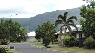
Trinity Park is a coastal suburb of Cairns in the Cairns Region, Queensland, Australia. In the 2021 census, Trinity Park had a population of 3,536 people.

<span class="mw-page-title-main">Westcourt, Queensland</span> Suburb of Cairns, Queensland, Australia

Westcourt is a suburb of Cairns in the Cairns Region, Queensland, Australia. In the 2016 census, Westcourt had a population of 3,918 people.

<span class="mw-page-title-main">Newell, Queensland</span> Town in Queensland, Australia

Newell is a coastal town and rural locality in the Shire of Douglas, Queensland, Australia. It is a sugarcane growing district.

References

  1. Australian Bureau of Statistics (28 June 2022). "Portsmith (suburb and locality)". Australian Census 2021 QuickStats. Retrieved 28 June 2022.  OOjs UI icon edit-ltr-progressive.svg
  2. "Portsmith – suburb in Cairns Region (entry 48848)". Queensland Place Names. Queensland Government . Retrieved 29 December 2017.
  3. 1 2 Australian Bureau of Statistics (28 June 2022). "Portsmith (SAL)". 2021 Census QuickStats. Retrieved 28 February 2023. OOjs UI icon edit-ltr-progressive.svg
  4. "Admiralty Island – island in Cairns Region (entry 130)". Queensland Place Names. Queensland Government . Retrieved 4 March 2018.
  5. 1 2 3 4 "Queensland Globe". State of Queensland . Retrieved 18 January 2023.
  6. "Portsmith – Woree Industrial District" (PDF). CairnsPlan. Cairns Regional Council. March 2009. Archived (PDF) from the original on 4 March 2018. Retrieved 5 March 2018.
  7. "Railway stations and sidings - Queensland". Queensland Open Data. Queensland Government. 2 October 2020. Archived from the original on 5 October 2020. Retrieved 5 October 2020.
  8. "First people cultural history". Cairns Regional Council. Archived from the original on 9 April 2020. Retrieved 23 June 2020.
  9. "P Suburbs" (PDF). Cairns Regional Council. Archived from the original (PDF) on 22 April 2018. Retrieved 27 June 2020.
  10. Australian Bureau of Statistics (27 June 2017). "Portsmith (SSC)". 2016 Census QuickStats. Retrieved 20 October 2018. OOjs UI icon edit-ltr-progressive.svg
  11. "Great Barrier Reef International Marine College - Cairns Maritime Training". www.gbrimc.com.au. Archived from the original on 11 August 2023. Retrieved 18 August 2023.
  12. "Landmark Areas - Queensland". Queensland Open Data. Queensland Government. 18 November 2020. Archived from the original on 21 November 2020. Retrieved 21 October 2020.
  13. "World Class Facilities - Great Barrier Reef International Marine College - Cairns North Queensland". www.gbrimc.com.au. Archived from the original on 25 June 2023. Retrieved 18 August 2023.
  14. 1 2 "Recreational Boating Facilities Queensland". Queensland Open Data. Queensland Government. 12 November 2020. Archived from the original on 22 November 2020. Retrieved 22 November 2020.