Earlville, Queensland

Last updated

Earlville
Cairns,  Queensland
Mulgrave Road Earlville.jpg
Mulgrave Road/Bruce Highway (Alt)
Australia Queensland location map.svg
Red pog.svg
Earlville
Earlville, Queensland
Coordinates 16°56′52″S145°43′52″E / 16.9477°S 145.7311°E / -16.9477; 145.7311 (Earlville (centre of suburb))
Population4,200 (2021 census) [1]
 • Density1,200/km2 (3,110/sq mi)
Postcode(s) 4870
Elevation10–170 m (33–558 ft)
Area3.5 km2 (1.4 sq mi)
Time zone AEST (UTC+10:00)
LGA(s) Cairns Region
State electorate(s) Cairns
Federal division(s) Leichhardt
Suburbs around Earlville:
Lamb Range Mooroobool Bungalow
Lamb Range Earlville Woree
Lamb Range Bayview Heights Woree

Earlville is a suburb of Cairns in the Cairns Region, Queensland, Australia. [2] In the 2021 census, Earlville had a population of 4,200 people. [1]

Contents

Geography

Earlville is approximately 4 kilometres (2.5 miles) south-west of the Cairns City centre.

The north-eastern part of the suburb is low-lying, less than 10 metres (33 ft) above sea level but the land gradually rises towards the west becoming more mountainous in the western part of the suburb. Most of the residential land is in the centre and eastern parts of the suburb, while the more mountainous western part is undeveloped. [3]

Mulgrave Road goes through the suburb from the north-east (Mooroobool / Bungalow) and then bends through the suburb to the south-east (Woree). [3]

Gaviolis Hill is in the south-west corner of the suburb ( 16°57′09″S145°44′02″E / 16.9525°S 145.7338°E / -16.9525; 145.7338 (Gaviolis Hill) ) at 74 metres (243 ft) above sea level. It's also known as Henleys Hill and the hill is a park known as Henleys Hill Park. [4] [3]

History

Earlville is situated in the Yidinji traditional Aboriginal country. [5]

Most of the eastern part of the present suburb formed part of the pioneer Hap Wah sugarcane plantation which was developed from 1878 by a Chinese consortium led by Andrew Leon. In 1886, after not finding it profitable, the plantation was sold. [6] Mulgrave Road was then known as Hap Wah Road. [7]

The origin of the suburb name is from the Earl family who lived in the area. [8] The historical name of Balaclava deriving from the historical estate name is still retained in business and organisation names, as well as in the naming of Balaclava Road, a prominent thoroughfare in the suburb. [9]

Our Lady Help of Christians Catholic School was established on 28 January 1964 by the Sisters of Mercy. There was an initial enrolment of 51 students with principal Sister M Consilia Wallwork assisted by a second teacher Sister M Agatha. The sisters lived at St Joseph's in Parramatta Park and travelled to the school each day. One of the classrooms was used for church services until the church was built. [10] [11]

The Roman Catholic parish of Earlville was established with the appointment of the Reverend Pat McKenna as parish priest from 1 January 1965. It had previously been part of the Parramatta Park parish. The church dedicated to Our Lady Help of Christians was blessed and opened by Bishop John Torpie on 22 July 1973. [12]

The current Earlville Public Library opened in 1983, with a major refurbishment in 2003 and a minor refurbishment in 2007. [13]

Demographics

In the 2016 census, Earlville had a population of 4,030 people. [14]

In the 2021 census, Earlville had a population of 4,200 people. [1]

Education

Our Lady Help of Christians School is a Catholic primary (Prep-6) school for boys and girls at 18 Balaclava Road ( 16°56′35″S145°44′14″E / 16.9430°S 145.7371°E / -16.9430; 145.7371 (Our Lady Help of Christians School) ). [15] [16] In 2018, the school had an enrolment of 551 students with 35 teachers (32 full-time equivalent) and 25 non-teaching staff (20 full-time equivalent). [17]

There are no government schools in Earlville. The nearest government primary schools are Balaclava State School in neighbouring Mooroobool to the north-east and Woree State School in neighbouring Woree to the south-east. The nearest government secondary schools are Woree State High School in Woree and Trinity Bay State High School in Manunda to the north-east. [3]

Amenities

Stockland Cairns Shopping Centre is on Mulgrave Road ( 16°56′38″S145°44′24″E / 16.944°S 145.740°E / -16.944; 145.740 (Stockland Cairns Shopping Centre) ) in the suburb. [18] Within it are:

The Earlville branch of the Queensland Country Women's Association meets at 38-40 Yarrum Street. [23]

Our Lady Help of Christian's Catholic Church is at 18 Balaclava Street. It is within the Earlville Parish of the Roman Catholic Diocese of Cairns. [12]

Cairns Southside International Hotel is on Mulgrave Road ( 16°56′23″S145°44′34″E / 16.9396°S 145.7427°E / -16.9396; 145.7427 (community or commercial building) ). It offers accommodation, restaurants and bars. [18] [24]

Seville Mercy Conference Centre is a conference centre with on-site accommodation and dining at 35 Bauhinia Avenue (16.9472°S 145.7255°E). It is operated by the Sisters of Mercy. [18] [25]

Related Research Articles

<span class="mw-page-title-main">Cairns</span> City in Queensland, Australia

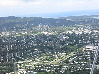
Cairns is a city in the Cairns Region, Queensland, Australia, on the tropical north east coast of Far North Queensland. In the 2021 census, Cairns had a population of 153,181 people.

<span class="mw-page-title-main">Gordonvale, Queensland</span> Town in Queensland, Australia

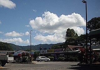
Gordonvale is a rural sugar-growing town and locality situated on the southern side of Cairns in the Cairns Region, Queensland, Australia. In the 2021 census, the locality of Gordonvale had a population of 6,944 people.

<span class="mw-page-title-main">Woree, Queensland</span> Suburb of Cairns, Queensland, Australia

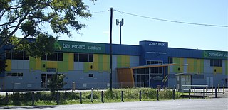
Woree is a suburb of Cairns in the Cairns Region, Queensland, Australia. In the 2016 census, Woree had a population of 4,821 people.

<span class="mw-page-title-main">Edmonton, Queensland</span> Town in Queensland, Australia

Edmonton is a town and suburb in the Cairns Region, Queensland, Australia. In the 2016 census, Edmonton had a population of 10,753 people.

<span class="mw-page-title-main">Smithfield, Queensland</span> Suburb of Cairns, Queensland, Australia

Smithfield is a suburb of Cairns in the Cairns Region, Queensland, Australia. In the 2021 census Smithfield had a population of 6,664 people.

<span class="mw-page-title-main">Cairns Region</span> Local government area of Queensland, Australia

The Cairns Region is a local government area in Far North Queensland, Queensland, Australia, centred on the regional city of Cairns. It was established in 2008 by the amalgamation of the City of Cairns and the Shires of Douglas and Mulgrave. However, following public protest and a referendum in 2013, on 1 January 2014, the Shire of Douglas was de-amalgamated from the Cairns Region and re-established as a separate local government authority.

<span class="mw-page-title-main">Holloways Beach, Queensland</span> Suburb of Cairns, Queensland, Australia

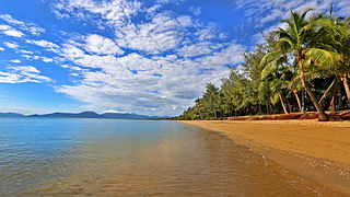
Holloways Beach is a residential coastal suburb of Cairns, Queensland, Australia. It is located about 10 kilometres north of the city of Cairns between the suburbs of Machans Beach and Yorkeys Knob. In the 2021 census, the suburg of Holloways Beach had a population of 2,398 people.

<span class="mw-page-title-main">Freshwater, Queensland</span> Suburb of Cairns, Queensland, Australia

Freshwater is a suburb of Cairns, Queensland, Australia. In the 2021 census, Freshwater had a population of 2,142 people.

<span class="mw-page-title-main">Trinity Beach, Queensland</span> Suburb of Cairns, Queensland, Australia

Trinity Beach is a coastal suburb of Cairns in the Cairns Region, Queensland, Australia. In the 2021 census, Trinity Beach had a population of 6,594 people.

<span class="mw-page-title-main">Mooroobool, Queensland</span> Suburb of Cairns, Queensland, Australia

Mooroobool is a suburb of Cairns in the Cairns Region, Queensland, Australia. In the 2016 census, Mooroobool had a population of 7,222 people.

<span class="mw-page-title-main">Bungalow, Queensland</span> Suburb of Cairns, Queensland, Australia

Bungalow is an inner suburb of Cairns in the Cairns Region, Queensland, Australia. In the 2021 census, Bungalow had a population of 2,358 people.

<span class="mw-page-title-main">Cairns City, Queensland</span> Suburb of Cairns, Queensland, Australia

Cairns City is a coastal suburb at the centre of Cairns in the Cairns Region, Queensland, Australia. It is also known as the Cairns Central Business District (CBD). In the 2021 census, Cairns City had a population of 3,616 people.

<span class="mw-page-title-main">Brinsmead, Queensland</span> Suburb of Cairns, Queensland, Australia

Brinsmead is a suburb of Cairns in the Cairns Region, Far North Queensland, Australia. In the 2021 census, Brinsmead had a population of 5,537 people.

<span class="mw-page-title-main">Kamerunga, Queensland</span> Town in Queensland, Australia

Kamerunga is a town and a suburb of Cairns in the Cairns Region, Queensland, Australia. In the 2016 census, Kamerunga had a population of 1,049 people.

<span class="mw-page-title-main">Redlynch, Queensland</span> Town in Queensland, Australia

Redlynch is a semi-rural town and suburb of Cairns in the Cairns Region, Queensland, Australia. In the 2016 census, the suburb of Redlynch had a population of 9,728 people.

<span class="mw-page-title-main">Mount Sheridan, Queensland</span> Suburb of Cairns, Queensland, Australia

Mount Sheridan is a suburb of Cairns in the Cairns Region, Queensland, Australia. In the 2016 census, Mount Sheridan had a population of 8,271 people.

<span class="mw-page-title-main">Parramatta Park, Queensland</span> Suburb of Cairns, Queensland, Australia

Parramatta Park is a suburb of Cairns in the Cairns Region, Queensland, Australia. In the 2016 census, Parramatta Park had a population of 3,508 people.

<span class="mw-page-title-main">Manunda, Queensland</span> Suburb of Cairns, Queensland, Australia

Manunda is a suburb of Cairns in the Cairns Region, Queensland, Australia. In the 2016 census, Manunda had a population of 5,390 people.

<span class="mw-page-title-main">Portsmith</span> Suburb of Cairns, Queensland, Australia

Portsmith is a suburb of Cairns in the Cairns Region, Queensland, Australia. In the 2021 census, Portsmith had a population of 314 people.

<span class="mw-page-title-main">Westcourt, Queensland</span> Suburb of Cairns, Queensland, Australia

Westcourt is a suburb of Cairns in the Cairns Region, Queensland, Australia. In the 2016 census, Westcourt had a population of 3,918 people.

References

  1. 1 2 3 Australian Bureau of Statistics (28 June 2022). "Earlville (SAL)". 2021 Census QuickStats. Retrieved 28 February 2023. OOjs UI icon edit-ltr-progressive.svg
  2. "Earlville – suburb in Cairns Region (entry 48613)". Queensland Place Names. Queensland Government . Retrieved 2 December 2020.
  3. 1 2 3 4 "Queensland Globe". State of Queensland . Retrieved 2 December 2020.
  4. "Gaviolis Hill – hill in Cairns Regional (entry 43532)". Queensland Place Names. Queensland Government . Retrieved 2 December 2020.
  5. "First people cultural history". Cairns Regional Council. Archived from the original on 21 April 2017. Retrieved 23 June 2020.
  6. "COUNTRY MAILS". The Brisbane Courier . Vol. XLI, no. 8, 871. Queensland, Australia. 21 June 1886. p. 3. Retrieved 2 December 2020 via National Library of Australia.
  7. "Queensland History: Far North Queensland Place names - h". Queensland History. 18 March 2011. Archived from the original on 2 December 2020. Retrieved 2 December 2020.
  8. "Cairns Heritage: E Suburbs" (PDF). Cairns Regional Council. Archived from the original (PDF) on 22 April 2018. Retrieved 23 June 2020.
  9. "Cairns street and suburb name history". Cairns Regional Council . Retrieved 13 November 2020.
  10. Queensland Family History Society (2010), Queensland schools past and present (Version 1.01 ed.), Queensland Family History Society, ISBN   978-1-921171-26-0
  11. "History and Mercy Traditions". Our Lady Help of Christians School, Earlville. Archived from the original on 2 December 2020. Retrieved 2 December 2020.
  12. 1 2 "Earlville Parish". Roman Catholic Diocese of Cairns . Archived from the original on 16 April 2020. Retrieved 18 November 2020.
  13. "Earlville Public Library" (PDF). Queensland Public Libraries Statistical Bulletin 2016-2017" (PDF). Public Libraries Connect. November 2017. November 2017. Retrieved 22 January 2018.
  14. Australian Bureau of Statistics (27 June 2017). "Earlville". 2016 Census QuickStats. Retrieved 17 March 2018. OOjs UI icon edit-ltr-progressive.svg
  15. "State and non-state school details". Queensland Government. 9 July 2018. Archived from the original on 21 November 2018. Retrieved 21 November 2018.
  16. "Our Lady Help of Christians School" . Retrieved 21 November 2018.
  17. "ACARA School Profile 2018". Australian Curriculum, Assessment and Reporting Authority . Retrieved 28 January 2020.
  18. 1 2 3 "Building areas - Queensland". Queensland Open Data. Queensland Government. 17 November 2020. Archived from the original on 23 October 2020. Retrieved 17 November 2020.
  19. "Community facilities - Queensland". Queensland Open Data. Queensland Government. 22 October 2020. Archived from the original on 23 October 2020. Retrieved 23 October 2020.
  20. "Earlville Post Shop". Australia Post . Retrieved 2 December 2020.
  21. "Earlville Public Library". Public Libraries Connect. 14 July 2014. Retrieved 22 January 2018.
  22. "Emergency services facilities - Queensland". Queensland Open Data. Queensland Government. 18 November 2020. Archived from the original on 24 November 2020. Retrieved 24 November 2020.
  23. "Branch Locations". Queensland Country Women's Association. Archived from the original on 26 December 2018. Retrieved 26 December 2018.
  24. "Cairns Southside International Hotel". www.cairnssouthsideinternational.com.au. Retrieved 2 December 2020.
  25. "Seville Mercy Conference Centre" . Retrieved 2 December 2020.