Edge Hill, Queensland

Last updated

Edge Hill
Queensland
WWII RAN Fuel Installation, Edge Hill, 2008.jpg
Former World War II fuel installation, now arts centre, 2008
Australia Queensland location map.svg
Red pog.svg
Edge Hill
Edge Hill, Queensland
Coordinates 16°54′07″S145°44′35″E / 16.9019°S 145.7430°E / -16.9019; 145.7430 (Edge Hill (centre of suburb))
Population4,088 (2021 census) [1]
 • Density1,572/km2 (4,070/sq mi)
Postcode(s) 4870
Area2.6 km2 (1.0 sq mi)
Time zone AEST (UTC+10:00)
Location
LGA(s) Cairns Region
State electorate(s) Cairns
Federal division(s) Leichhardt
Suburbs around Edge Hill:
Whitfield Whitfield Whitfield
Whitfield Edge Hill Cairns North
Manoora Manoora Manunda

Edge Hill is an inner suburb of the city of Cairns in Far North Queensland, Australia [2] located approximately four kilometres north west of the city centre. In the 2021 census, Edge Hill had a population of 4,088 people. [1]

Contents

History

Original one-classroom school building, Edge Hill State School, circa 1940 Original one-classroom school building, Edge Hill State School, circa 1940.jpg
Original one-classroom school building, Edge Hill State School, circa 1940

Edge Hill is situated in the Yidinji traditional Aboriginal country. [3]

The origin of the suburb name is from the name given to the township developed near the historical Edgecliff quarry site. This township became known as Edge Hill because of the location situated on the foothills of Mount Whitfield. [4]

Edge Hill State School opened on 5 February 1940 with one classroom and one teacher. [5] [6]

Demographics

In the 2016 census, Edge Hill had a population of 3,916 people. [7]

In the 2021 census, Edge Hill had a population of 4,088 people. [1]

Heritage listings

Fleckers Botanic Gardens, 2015 Fleckers Botanic Gardens, July 2015.jpg
Fleckers Botanic Gardens, 2015

Edge Hill has the following heritage listings:

Education

Edge Hill State School is a government primary (Prep-6) school for boys and girls at 254 Pease Street ( 16°54′19″S145°44′33″E / 16.9052°S 145.7424°E / -16.9052; 145.7424 (Edge Hill State School) ). [11] [12] In 2018, the school had an enrolment of 1,158 students with 75 teachers (68 full-time equivalent) and 48 non-teaching staff (30 full-time equivalent). [13] It includes a special education program. [11]

There are no secondary schools in Edge Hill. The nearest government secondary schools are Trinity Bay State High School in neighbouring Manunda to the south-east and Cairns State High School in neighbouring Cairns North to the east. [14]

Amenities

The Church of Jesus Christ of Latter-Day Saints is at 147 Woodward Street ( 16°54′05″S145°44′12″E / 16.9014°S 145.7368°E / -16.9014; 145.7368 (CHURCH OF JESUS CHRIST) ). [15] [16]

Edge Hill Memorial Bowls Club is a lawn bowls club at 181 Woodward Street ( 16°54′04″S145°44′05″E / 16.9012°S 145.7347°E / -16.9012; 145.7347 (EDGE MEMORIAL BOWLS CLUB) ). [15] [17]

The Serbian Cultural Centre is at 67 Greenslopes Street ( 16°54′14″S145°44′51″E / 16.9040°S 145.7475°E / -16.9040; 145.7475 (place of worship) ). [15] [18]

There are a number of parks in the area:

Related Research Articles

<span class="mw-page-title-main">Dimbulah, Queensland</span> Town in Queensland, Australia

Dimbulah is a rural town and locality in Far North Queensland, Australia, 114 kilometres (71 mi) from Cairns by road, on the Atherton Tableland. It is within the local government area of Shire of Mareeba. In the 2021 census, the locality of Dimbulah had a population of 975 people, a decrease from the 1,050 people in the 2016 census.

<span class="mw-page-title-main">Gordonvale, Queensland</span> Town in Queensland, Australia

Gordonvale is a rural sugar-growing town and locality situated on the southern side of Cairns in the Cairns Region, Queensland, Australia. In the 2021 census, the locality of Gordonvale had a population of 6,944 people.

<span class="mw-page-title-main">Woree, Queensland</span> Suburb of Cairns, Queensland, Australia

Woree is a suburb of Cairns in the Cairns Region, Queensland, Australia. In the 2021 census, Woree had a population of 5,127 people.

<span class="mw-page-title-main">Edmonton, Queensland</span> Town in Queensland, Australia

Edmonton is a town and suburb in the Cairns Region, Queensland, Australia. In the 2021 census, the suburb of Edmonton had a population of 11,409 people.

<span class="mw-page-title-main">Kuranda, Queensland</span> Town in Queensland, Australia

Kuranda is a rural town and locality on the Atherton Tableland in the Shire of Mareeba, Queensland, Australia. It is 25 kilometres (16 mi) from Cairns, via the Kuranda Range road. It is surrounded by tropical rainforest and adjacent to the Wet Tropics of Queensland World Heritage listed Barron Gorge National Park. In the 2021 census, the locality of Kuranda had a population of 3,273 people.

<span class="mw-page-title-main">Babinda</span> Town in Queensland, Australia

Babinda is a rural town and locality in the Cairns Region, Queensland, Australia. Babinda and Tully annually compete for the Golden Gumboot, an award for Australia's wettest town. Babinda is usually the winner, recording an annual average rainfall of over 4,279.4 millimetres (168.48 in) each year. In the 2021 census, the locality of Babinda had a population of 1,287 people.

<span class="mw-page-title-main">Mount Molloy, Queensland</span> Town in Queensland, Australia

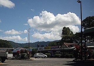
Mount Molloy is a rural town and locality in the Shire of Mareeba, Queensland, Australia. It is a historic mining and timber town, 55 kilometres (34 mi) north of Cairns. The dominant industry in the area is cattle grazing; the town itself consists of a few shops and an old hotel. In the 2021 census, the locality of Mount Molloy had a population of 266 people.

<span class="mw-page-title-main">Yorkeys Knob, Queensland</span> Suburb of Cairns, Queensland, Australia

Yorkeys Knob is a coastal suburb of Cairns in the Cairns Region, Queensland, Australia. In the 2021 census, Yorkeys Knob had a population of 2,794 people.

<span class="mw-page-title-main">Stratford, Queensland</span> Suburb of Cairns, Queensland, Australia

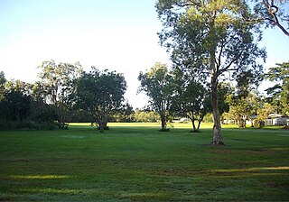
Stratford is a suburb of Cairns in the Cairns Region, Queensland, Australia. In the 2021 census, Stratford had a population of 1,198 people.

<span class="mw-page-title-main">Aeroglen</span> Suburb of Cairns, Queensland, Australia

Aeroglen is a coastal suburb of Cairns in the Cairns Region, Queensland, Australia. It is approximately 5 kilometers north of the Cairns City centre. In the 2021 census, Aeroglen had a population of 405 people.

<span class="mw-page-title-main">Kewarra Beach</span> Suburb of Cairns, Queensland, Australia

Kewarra Beach is a coastal suburb of Cairns in the Cairns Region, Queensland, Australia. In the 2021 census, Kewarra Beach had a population of 6,133 people.

<span class="mw-page-title-main">Cairns City, Queensland</span> Suburb of Cairns, Queensland, Australia

Cairns City is a coastal suburb at the centre of Cairns in the Cairns Region, Queensland, Australia. It is also known as the Cairns Central Business District (CBD). In the 2021 census, Cairns City had a population of 3,616 people.

<span class="mw-page-title-main">Manoora, Queensland</span> Suburb of Cairns, Queensland, Australia

Manoora is a suburb of Cairns in the Cairns Region, Queensland, Australia. In the 2021 census, Manoora had a population of 6,175 people.

<span class="mw-page-title-main">Brinsmead, Queensland</span> Suburb of Cairns, Queensland, Australia

Brinsmead is a suburb of Cairns in the Cairns Region, Far North Queensland, Australia. In the 2021 census, Brinsmead had a population of 5,537 people.

<span class="mw-page-title-main">Cairns North, Queensland</span> Suburb of Cairns, Queensland, Australia

Cairns North is a coastal suburb of Cairns in the Cairns Region, Queensland, Australia. In the 2021 census, Cairns North had a population of 5,334 people.

<span class="mw-page-title-main">Whitfield, Queensland</span> Suburb of Cairns, Queensland, Australia

Whitfield is a suburb of Cairns in the Cairns Region, Queensland, Australia. In the 2021 census, Whitfield had a population of 4,262 people.

<span class="mw-page-title-main">Redlynch, Queensland</span> Town in Queensland, Australia

Redlynch is a semi-rural town and suburb of Cairns in the Cairns Region, Queensland, Australia. In the 2021 census, the suburb of Redlynch had a population of 10,571 people.

<span class="mw-page-title-main">Earlville, Queensland</span> Suburb of Cairns, Queensland, Australia

Earlville is a suburb of Cairns in the Cairns Region, Queensland, Australia. In the 2021 census, Earlville had a population of 4,200 people.

<span class="mw-page-title-main">White Rock, Queensland (Cairns Region)</span> Suburb of Cairns, Queensland, Australia

White Rock is a suburb of Cairns in the Cairns Region, Queensland, Australia. In the 2021 census, White Rock had a population of 4,918 people.

<span class="mw-page-title-main">Westcourt, Queensland</span> Suburb of Cairns, Queensland, Australia

Westcourt is a suburb of Cairns in the Cairns Region, Queensland, Australia. In the 2021 census, Westcourt had a population of 3,841 people.

References

  1. 1 2 3 Australian Bureau of Statistics (28 June 2022). "Edge Hill (SAL)". 2021 Census QuickStats. Retrieved 28 February 2023. OOjs UI icon edit-ltr-progressive.svg
  2. "Edge Hill – suburb in Cairns Region (entry 48617)". Queensland Place Names. Queensland Government . Retrieved 30 July 2017.
  3. "First people cultural history". Cairns Regional Council. Archived from the original on 9 April 2020. Retrieved 23 June 2020.
  4. "Cairns Heritage: E Suburbs" (PDF). Cairns Regional Council. Archived from the original (PDF) on 22 April 2018. Retrieved 12 July 2020.
  5. "Opening and closing dates of Queensland Schools". Queensland Government . Retrieved 18 April 2019.
  6. "History". Edge Hill State School. 14 April 2020. Archived from the original on 13 March 2024. Retrieved 25 April 2024.
  7. Australian Bureau of Statistics (27 June 2017). "Edge Hill (SSC)". 2016 Census QuickStats. Retrieved 20 October 2018. OOjs UI icon edit-ltr-progressive.svg
  8. "Flecker Botanical Gardens (entry 602541)". Queensland Heritage Register . Queensland Heritage Council. Retrieved 7 July 2013.
  9. "WWII RAN Fuel Installation (entry 602605)". Queensland Heritage Register . Queensland Heritage Council. Retrieved 7 July 2013.
  10. "Tanks Arts Centre". Tanks Arts Centre. Archived from the original on 27 March 2024. Retrieved 28 March 2024.
  11. 1 2 "State and non-state school details". Queensland Government. 9 July 2018. Archived from the original on 21 November 2018. Retrieved 21 November 2018.
  12. "Edge Hill State School". Edge Hill State School. 29 November 2020. Archived from the original on 27 March 2024. Retrieved 25 April 2024.
  13. "ACARA School Profile 2018". Australian Curriculum, Assessment and Reporting Authority. Archived from the original on 27 August 2020. Retrieved 28 January 2020.
  14. "Layers: Locality; Schools and school catchments". Queensland Globe. Queensland Government. Archived from the original on 19 December 2017. Retrieved 25 April 2024.
  15. 1 2 3 "Building areas - Queensland". Queensland Open Data. Queensland Government. 17 November 2020. Archived from the original on 23 October 2020. Retrieved 17 November 2020.
  16. "Edge Hill, QLD". Church of Jesus Christ of Latter-Day Saints . Archived from the original on 25 April 2024. Retrieved 25 April 2024.
  17. "Edge Hill Bowls Club Cairns". edgehillbowls.com.au. Archived from the original on 27 March 2024. Retrieved 25 April 2024.
  18. "About Us". Serbian Centre CNS. Archived from the original on 25 April 2024. Retrieved 25 April 2024.
  19. 1 2 3 "Land for public recreation - Queensland". Queensland Open Data. Queensland Government. 20 November 2020. Archived from the original on 22 November 2020. Retrieved 22 November 2020.