Gordonvale is a rural sugar-growing town and locality situated on the southern side of Cairns in the Cairns Region, Queensland, Australia. In the 2021 census, the locality of Gordonvale had a population of 6,944 people.
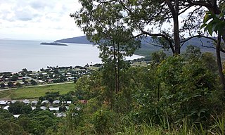
Yarrabah is a coastal town and locality in the Aboriginal Shire of Yarrabah, Queensland, Australia. It is an Aboriginal community. In the 2021 census, the locality of Yarrabah had a population of 2,505 people.

Aloomba is a town and a locality in the Cairns Region, Queensland, Australia. In the 2016 census, Aloomba had a population of 529 people.

Mirriwinni is a rural town and locality in the Cairns Region, Queensland, Australia. The spelling Miriwinni has also been used historically, but Mirriwinni is the official spelling from 8 October 2010. In the 2016 census, the locality of Mirriwinni had a population of 447 people.

Woopen Creek is a rural locality in the Cairns Region, Queensland, Australia. In the 2016 census, Woopen Creek had a population of 141 people.

Bloomfield is a town in the Shire of Cook and a coastal locality which is split between the Shire of Cook and the Shire of Douglas in Queensland, Australia. The neighbourhood of Ayton is within the locality. In the 2016 census, Bloomfield had a population of 204 people.
Redbank Creek is a rural locality in the Somerset Region, Queensland, Australia. In the 2021 census, Redbank Creek had a population of 124 people.

East Trinity is a coastal rural locality in the Cairns Region, Queensland, Australia. It was formerly known as Trinity East. In the 2016 census, East Trinity had a population of 212 people.

Fishery Falls is a locality in the Cairns Region, Queensland, Australia. In the 2021 census, Fishery Falls had a population of 205 people.

Mount Peter is a rural locality in the Cairns Region, Queensland, Australia. In the 2021 census, Mount Peter had a population of 689 people.

Little Mulgrave is a locality in the Cairns Region, Queensland, Australia. In the 2016 census, Little Mulgrave had a population of 249 people.

Wrights Creek is a locality in the Cairns Region, Queensland, Australia. In the 2016 census, Wrights Creek had a population of 156 people.
Lake Barrine is a rural locality in the Tablelands Region, Queensland, Australia. In the 2021 census, Lake Barrine had a population of 170 people.

Killaloe is a coastal rural locality in the Shire of Douglas, Queensland, Australia. In the 2021 census, Killaloe had a population of 124 people.

Barron is a suburb of Cairns in the Cairns Region, Queensland, Australia. In the 2016 census Barron had a population of 42 people.

Glen Boughton is a rural locality in the Cairns Region, Queensland, Australia. In the 2021 census, Glen Boughton had a population of 19 people.

Goldsborough is a locality in the Cairns Region, Queensland, Australia. In the 2021 census, Goldsborough had a population of 1,099 people.

Wooroonooran is a locality split among the Cairns Region, the Cassowary Coast Region and the Tablelands Region in Queensland, Australia. In the 2016 census, Wooroonooran had no population.

Green Hill is a rural locality in the Cairns Region, Queensland, Australia. In the 2016 census, Green Hill had a population of 159 people.

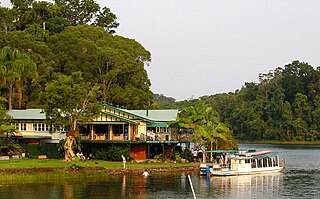
Lower Daintree is a coastal rural locality in the Shire of Douglas, Queensland, Australia. In the 2021 census, Lower Daintree had a population of 83 people.