Whitfield, Queensland

Last updated

Whitfield
Cairns,  Queensland
Red Arrow walk on Mount Whitfield - panoramio.jpg
Red Arrow walk on Mount Whitfield
Australia Queensland location map.svg
Red pog.svg
Whitfield
Whitfield, Queensland
Coordinates 16°54′06″S145°43′41″E / 16.9016°S 145.7280°E / -16.9016; 145.7280 (Whitfield (centre of suburb))
Population4,275 (2016 census) [1]
 • Density713/km2 (1,845/sq mi)
Postcode(s) 4870
Area6.0 km2 (2.3 sq mi)
Time zone AEST (UTC+10:00)
Location
LGA(s) Cairns Region
State electorate(s) Cairns
Federal division(s) Leichhardt
Suburbs around Whitfield:
Stratford Stratford Aeroglen
Brinsmead Whitfield Edge Hill
Kanimbla Mooroobool Manoora

Whitfield is a suburb of Cairns in the Cairns Region, Queensland, Australia. [2] In the 2016 census, Whitfield had a population of 4,275 people. [1]

Contents

Geography

Looking south on Gloucester Street in the residential area, 2018 Looking south on Gloucester Street, Whitfield, 2018 01.jpg
Looking south on Gloucester Street in the residential area, 2018

Whitfield has the following mountains:

The southern portion of Whitfield is developed as residential land rising from sea level to about 50m up the slopes of Mount Whitfield. The northern part of the suburb is undeveloped bushland within the Mount Whitfield Conservation Park ( 16°53′13″S145°44′17″E / 16.8869°S 145.7381°E / -16.8869; 145.7381 (Mount Whitfield Conservation Park) ) which occupies the upper slopes of Mount Whitfield which rises to 350m. [6] [7]

History

Whitfield is situated in the Yidinji traditional Aboriginal country. [8]

Whitfield State School opened on 23 January 1989. [9]

In the 2011 census, Whitfield had a population of 4,176 people. [10]

In the 2016 census, Whitfield had a population of 4,275 people. [1]

Heritage listings

Whitfield has heritage listings including:

Education

School gate, Whitfield State School, circa 2022 School gate, Whitfield State School, circa 2022.jpg
School gate, Whitfield State School, circa 2022

Whitfield State School is a government primary (Prep-6) school for boys and girls at 42-74 McManus Street ( 16°54′42″S145°43′44″E / 16.9118°S 145.7288°E / -16.9118; 145.7288 (Whitfield State School) ). [12] [13] In 2018, the school had an enrolment of 831 students with 64 teachers (60 full-time equivalent) and 38 non-teaching staff (25 full-time equivalent). [14] It includes a special education program. [12]

There are no secondary schools in Whitfield. The nearest government secondary schools are Trinity Bay State High School in Manunda to the south-east and Cairns State High School in Cairns North to the east. [7]

Amenities

There are a number of parks in the area:

Related Research Articles

<span class="mw-page-title-main">Woree, Queensland</span> Suburb of Cairns, Queensland, Australia

Woree is a suburb of Cairns in the Cairns Region, Queensland, Australia. In the 2016 census, Woree had a population of 4,821 people.

<span class="mw-page-title-main">Edmonton, Queensland</span> Suburb of Cairns, Queensland, Australia

Edmonton is a town and suburb in the Cairns Region, Queensland, Australia. In the 2016 census, Edmonton had a population of 10,753 people.

<span class="mw-page-title-main">Mutchilba, Queensland</span> Town in Queensland, Australia

Mutchilba is a rural town and locality in the Shire of Mareeba, in Far North Queensland, Australia. It is known for its production of mangoes.

<span class="mw-page-title-main">Mount Molloy, Queensland</span> Town in Queensland, Australia

Mount Molloy is a rural town and locality in the Shire of Mareeba, Queensland, Australia. It is a historic mining and timber town, 55 kilometres (34 mi) north of Cairns. The dominant industry in the area is cattle grazing; the town itself consists of a few shops and an old hotel. In the 2021 census, the locality of Mount Molloy had a population of 266 people.

<span class="mw-page-title-main">Smithfield, Queensland</span> Suburb of Cairns, Queensland, Australia

Smithfield is a suburb of Cairns in the Cairns Region, Queensland, Australia. In the 2021 census Smithfield had a population of 6,664 people.

<span class="mw-page-title-main">Yorkeys Knob, Queensland</span> Suburb of Cairns, Queensland, Australia

Yorkeys Knob is a coastal suburb of Cairns in the Cairns Region, Queensland, Australia. In the 2016 census, Yorkeys Knob had a population of 2,759 people.

<span class="mw-page-title-main">Stratford, Queensland</span> Suburb of Cairns, Queensland, Australia

Stratford is a suburb of Cairns in the Cairns Region, Queensland, Australia. In the 2016 census, Stratford had a population of 1,138 people.

<span class="mw-page-title-main">Aeroglen</span> Suburb of Cairns, Queensland, Australia

Aeroglen is a coastal suburb of Cairns in the Cairns Region, Queensland, Australia. In the 2016 census, Aeroglen had a population of 403 people.

<span class="mw-page-title-main">Manoora, Queensland</span> Suburb of Cairns, Queensland, Australia

Manoora is a suburb of Cairns in the Cairns Region, Queensland, Australia. In the 2016 census, Manoora had a population of 6,027 people.

<span class="mw-page-title-main">Kamerunga, Queensland</span> Suburb of Cairns, Queensland, Australia

Kamerunga is a suburb of Cairns in the Cairns Region, Queensland, Australia. In the 2016 census, Kamerunga had a population of 1,049 people.

<span class="mw-page-title-main">East Trinity</span> Suburb of Cairns Region, Queensland, Australia

East Trinity is a coastal rural locality in the Cairns Region, Queensland, Australia. It was formerly known as Trinity East. In the 2016 census, East Trinity had a population of 212 people.

<span class="mw-page-title-main">Redlynch, Queensland</span> Suburb of Cairns, Queensland, Australia

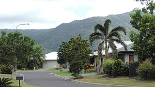
Redlynch is a semi-rural town and suburb of Cairns in the Cairns Region, Queensland, Australia. In the 2016 census, the suburb of Redlynch had a population of 9,728 people.

<span class="mw-page-title-main">Earlville, Queensland</span> Suburb of Cairns, Queensland, Australia

Earlville is a suburb of Cairns in the Cairns Region, Queensland, Australia. In the 2016 census, Earlville had a population of 4,030 people.

<span class="mw-page-title-main">Mount Sheridan, Queensland</span> Suburb of Cairns, Queensland, Australia

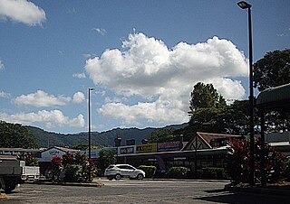
Mount Sheridan is a suburb of Cairns in the Cairns Region, Queensland, Australia. In the 2016 census, Mount Sheridan had a population of 8,271 people.

<span class="mw-page-title-main">Mowbray, Queensland</span> Suburb of Shire of Douglas, Queensland, Australia

Mowbray is a coastal locality in the Shire of Douglas, Queensland, Australia. In the 2021 census, Mowbray had a population of 362 people.

<span class="mw-page-title-main">Barron Gorge, Queensland</span> Suburb of Cairns Region, Queensland, Australia

Barron Gorge is a rural locality in the Cairns Region, Queensland, Australia. In the 2016 census Barron Gorge had a population of 0 people.

<span class="mw-page-title-main">Portsmith</span> Suburb of Cairns, Queensland, Australia

Portsmith is a suburb of Cairns in the Cairns Region, Queensland, Australia. In the 2021 census, Portsmith had a population of 314 people.

<span class="mw-page-title-main">Trinity Park, Queensland</span> Suburb of Cairns, Queensland, Australia

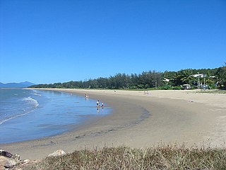
Trinity Park is a coastal suburb of Cairns in the Cairns Region, Queensland, Australia. In the 2021 census, Trinity Park had a population of 3,536 people.

<span class="mw-page-title-main">Wooroonooran, Queensland</span> Suburb of Cairns Region, Queensland, Australia

Wooroonooran is an undeveloped locality split among the Cairns Region, the Cassowary Coast Region and the Tablelands Region in Queensland, Australia. In the 2021 census, Wooroonooran had a population of 4 people.

<span class="mw-page-title-main">Danbulla, Queensland</span> Suburb of Tablelands Region, Queensland, Australia

Danbulla is a locality in the Tablelands Region, Queensland, Australia. In the 2021 census, Danbulla had a population of 88 people.

References

  1. 1 2 3 Australian Bureau of Statistics (27 June 2017). "Whitfield (SSC)". 2016 Census QuickStats. Retrieved 20 October 2018. OOjs UI icon edit-ltr-progressive.svg
  2. "Whitfield – suburb in Cairns Region (entry 48933)". Queensland Place Names. Queensland Government . Retrieved 6 March 2022.
  3. 1 2 "Mountain peaks and capes - Queensland". Queensland Open Data. Queensland Government. 12 November 2020. Archived from the original on 25 November 2020. Retrieved 25 November 2020.
  4. "Lumley Hill – mountain in Cairns Region (entry 20261)". Queensland Place Names. Queensland Government . Retrieved 25 November 2020.
  5. "Mount Whitfield – mountain in Cairns Region (entry 37369)". Queensland Place Names. Queensland Government . Retrieved 25 November 2020.
  6. "Mount Whitfield Conservation Park – conservation park in the Cairns Region (entry 51470)". Queensland Place Names. Queensland Government . Retrieved 13 March 2022.
  7. 1 2 "Queensland Globe". State of Queensland . Retrieved 13 March 2022.
  8. "First people cultural history". Cairns Regional Council. Archived from the original on 9 April 2020. Retrieved 23 June 2020.
  9. "Opening and closing dates of Queensland Schools". Queensland Government . Retrieved 18 April 2019.
  10. Australian Bureau of Statistics (31 October 2012). "Whitfield (SSC)". 2011 Census QuickStats. Retrieved 5 April 2016. OOjs UI icon edit-ltr-progressive.svg
  11. "Oribin Studio (entry 602825)". Queensland Heritage Register . Queensland Heritage Council. Retrieved 1 August 2014.
  12. 1 2 "State and non-state school details". Queensland Government. 9 July 2018. Archived from the original on 21 November 2018. Retrieved 21 November 2018.
  13. "Whitfield State School". Whitfield State School. 20 November 2019. Archived from the original on 8 March 2022. Retrieved 13 March 2022.
  14. "ACARA School Profile 2018". Australian Curriculum, Assessment and Reporting Authority. Archived from the original on 27 August 2020. Retrieved 28 January 2020.
  15. 1 2 3 "Land for public recreation - Queensland". Queensland Open Data. Queensland Government. 20 November 2020. Archived from the original on 22 November 2020. Retrieved 22 November 2020.

Commons-logo.svg Media related to Whitfield, Queensland at Wikimedia Commons