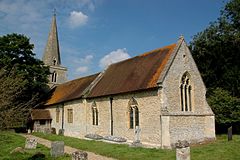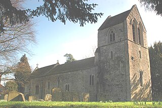
Ickford is a village and civil parish in the unitary authority area of Buckinghamshire, England. It is on the boundary with Oxfordshire, about 4 miles (6.4 km) west of the market town of Thame.

Culham is a village and civil parish in a bend of the River Thames, 1 mile (1.6 km) south of Abingdon in Oxfordshire. The parish includes Culham Science Centre and Europa School UK. The parish is bounded by the Thames to the north, west and south, and by present and former field boundaries to the east. It is low-lying and fairly flat, rising from the Thames floodplain in the south to a north-facing escarpment in the north up to 260 feet (80 m) above sea level. The 2011 Census recorded its population as 453.

Merton is a village and civil parish near the River Ray, about 4 miles (6.4 km) south of Bicester in Oxfordshire, England. The 2011 Census recorded the parish's population as 424.

Berrick Salome is a village and civil parish in South Oxfordshire, England, about 3 miles (5 km) north of Wallingford. Since the 1992 boundary changes, the parish has included the whole of Roke and Rokemarsh and Berrick Prior. The 2011 Census recorded the parish's population as 326. In 1965, Reginald Ernest Moreau (1897–1970), an eminent ornithologist, and a Berrick Salome resident from 1947, realized that he could build up a picture of the village as it had been in the decades before the First World War, based on the recollections of elderly villagers. His study, which was published in 1968 as The Departed Village: Berrick Salome at the Turn of the Century, also included an introduction to local history. This provided much of the information for "A Village History" which appeared in The Berrick and Roke Millennium Book and is the major source for this article.

Asthall or Asthal is a village and civil parish on the River Windrush in the West Oxfordshire district, in Oxfordshire, about 6 miles (10 km) west of Witney. It includes the hamlets of Asthall Leigh, Field Assarts, Stonelands, Worsham and part of Fordwells. The 2011 Census recorded the parish's population as 252. Asthall village is just south of the River Windrush, which also forms the south-eastern part of its boundary. The remainder of the parish including all of its hamlets lie north of the river. A minor road through Fordwells forms most of the parish's northern boundary. Most of the remainder of the parish's boundary is formed by field boundaries.
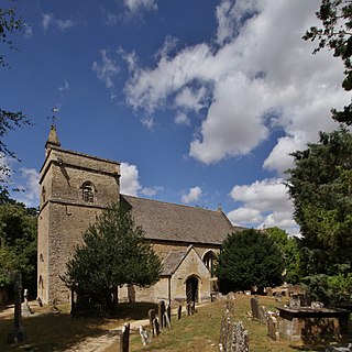
Bletchingdon is a village and civil parish 2 miles (3 km) north of Kidlington and 6 miles (10 km) southwest of Bicester in Oxfordshire, England. Bletchingdon parish includes the hamlet of Enslow just over 1 mile (1.6 km) west of the village. The 2011 Census recorded the parish's population as 910.

Hampton Poyle is a village in the civil parish of Hampton Gay and Poyle, in the Cherwell district, in the county of Oxfordshire, England. It is the Cherwell in valley, about 1 mile (1.6 km) northeast of Kidlington and about 5 miles (8 km) north of the centre of Oxford.

Chalgrove is a village and civil parish in South Oxfordshire about 10 miles (16 km) southeast of Oxford. The parish includes the hamlet of Rofford and the former parish of Warpsgrove with which it merged in 1932. The 2011 Census recorded the parish population as 2,830. Chalgrove is the site of a small Civil War battle in 1643, the Battle of Chalgrove Field. The Parliamentarian John Hampden was wounded in the battle, and died of his wounds six days later.
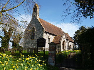
Britwell Salome is a village and civil parish in South Oxfordshire, England centred 4+1⁄2 miles (7 km) northeast of Wallingford. The 2011 Census recorded the parish's population as 204.

Drayton St. Leonard is a village and civil parish on the River Thame in Oxfordshire, about 8 miles (13 km) southeast of Oxford.
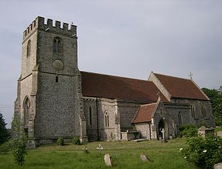
Lewknor is a village and civil parish about 5 miles (8 km) south of Thame in Oxfordshire. The civil parish includes the villages of Postcombe and South Weston. The 2011 Census recorded the parish's population as 663.

Somerton is a village and civil parish in Oxfordshire, England, in the Cherwell valley about 6 miles (10 km) northwest of Bicester. The 2011 Census recorded the parish's population as 305.

South Newington is a village and civil parish on the south bank of the River Swere in the Cotswold Hills in Oxfordshire, England, about 5 miles (8 km) southwest of Banbury. The 2011 Census recorded the parish's population as 285.

Stratton Audley is a village and civil parish about 2.5 miles (4 km) northeast of Bicester in Oxfordshire, England.

Marsh Baldon is a village and civil parish about 5 miles (8 km) southeast of Oxford in Oxfordshire. Since 2012 it has been part of the Baldons joint parish council area, sharing a parish council with the adjacent civil parish of Toot Baldon. The 2011 Census population is 310.

Hailey is a village and civil parish about 2 miles (3 km) north of Witney, Oxfordshire. The village comprises three neighbourhoods: Middletown on the main road between Witney and Charlbury, Poffley End on the minor road to Ramsden and Delly End on Whiting's Lane. The parish extends from the River Windrush in the south, almost to the village of Ramsden and the hamlet of Wilcote in the north, and it includes the hamlet of New Yatt. The 2011 Census recorded the parish's population as 1,208.

Sydenham is a village and civil parish about 3 miles (5 km) southeast of Thame in Oxfordshire. To the south the parish is bounded by the ancient Lower Icknield Way, and on its other sides largely by brooks that merge as Cuttle Brook, a tributary of the River Thame. The 2011 Census recorded the parish's population as 451.

The Parish Church of Saint Peter ad Vincula, South Newington is the Church of England parish church of South Newington, a village about 5 miles (8 km) southwest of Banbury in Oxfordshire. The church is one of only 15 in England dedicated to St Peter ad Vincula, after the basilica of San Pietro in Vincoli in Rome.

Steeple Barton is a civil parish and scattered settlement on the River Dorn in West Oxfordshire, about 8+1⁄2 miles (13.7 km) east of Chipping Norton, a similar distance west of Bicester and 9 miles (14 km) south of Banbury. Most of the parish's population lives in the village of Middle Barton, about 1 mile (1.6 km) northwest of the settlement of Steeple Barton. The 2011 Census recorded the parish's population as 1,523. Much of the parish's eastern boundary is formed by the former turnpike between Oxford and Banbury, now classified the A4260 road. The minor road between Middle Barton and Kiddington forms part of the western boundary. Field boundaries form most of the rest of the boundaries of the parish.
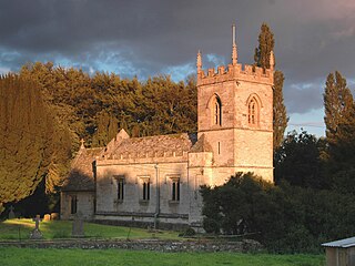
Westcott Barton, also spelt Wescot Barton or Wescote Barton, is a village and civil parish on the River Dorn in West Oxfordshire about 7 miles (11 km) east of Chipping Norton and about 9+1⁄2 miles (15 km) south of Banbury, in the county of Oxfordshire, England. The parish is bounded to the north by Cockley Brook, a tributary of the River Dorn. A minor road to Kiddington forms part of the eastern boundary, another minor road forms part of the western boundary and the remainder of the parish boundaries are field boundaries. Westcott Barton's main area of housing is on the eastern boundary of the parish and contiguous with the village of Middle Barton in the neighbouring parish of Steeple Barton. The 2011 Census recorded the parish's population as 244.
