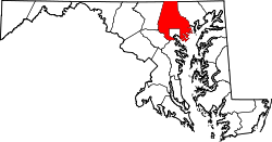
Oella Historic District | |
![]() Long Brick Row in the center of Oella, Maryland | |
Location | Oella Ave., Glen Rd., Hollow Rd., Oella, Maryland |
---|---|
Coordinates | 39°16′32″N76°47′14″W / 39.27556°N 76.78722°W |
Area | 130 acres (53 ha) |
Built | 1812 |
NRHP reference No. | 76000979 [1] |
Added to NRHP | November 7, 1976 |
Oella is a mill town on the Patapsco River in western Baltimore County, Maryland, United States, located between Catonsville and Ellicott City. It is a 19th-century village of millworkers' homes.
Oella was founded in 1808 by the Union Manufacturing Company as a working class community for the company's mill workers. It was one of the earliest and most extensive cotton factories in the United States and used water-powered looms as early as 1819.
The Union Manufacturing Company was motivated by the Embargo Act of 1807 which required Baltimore merchants to manufacture finished goods in the United States rather than England. Stock in the company was issued to fund a series of industrial mills, the largest working with cotton and wool. Child and indigent labor was used reaching 150 employees in 1811. [2] After the War of 1812 ended the embargo, cotton prices fell. A fire at the largest mill on 13 December 1815 took a decade to rebuild and recover from. The Mill rebounded with water driven looms, and expanded to three mill buildings before finally dissolving in 1887 after another drop in textile prices. [3] William J. Dickey of Dickeysville (Gwynns Falls) purchased the mill in 1887, operating it as W.J. Dickey and Sons, naming the mill "Oella" after the first woman to spin cotton in America. [4]
The Oella Historic District includes the village that consists of 19th century workers housing and one late 19th century church. The only known 20th century building is the W.J. Dickey Company Mill constructed in 1919 as a rebuild after a 1918 fire. The plant was eventually used for the city. [5] A drawing from 1812 by Maximilian Godefroy shows most of the stone buildings. The brick houses date from the mid-19th century, while the frame buildings were constructed at the end of the century. The Oella Methodist Church is a simple frame building with a tower on the northeast corner, which has been converted into offices. The Patapsco River continued to provide power to generate electricity until 1972, when Hurricane Agnes flooded the power plant. That same year, the Dickey Company ceased manufacturing. [6]
It was added to the National Register of Historic Places in 1976. [1] Also listed on the National Register at Oella are the Ellicott's Mills Historic District and Mount Gilboa Chapel. [1]
Oella is along the route of the Trolley Line Number 9 Trail.
A park commemorating Benjamin Banneker is located in a stream valley woodland at the former site of Banneker's farm and residence at the eastern edge of the Oella community. [7] The Baltimore County Department of Recreation and Parks manages the park, which was dedicated on June 9, 1998. [8] The park, which encompasses 138 acres (56 ha) and contains archaeological sites and extensive nature trails, is the largest original African American historical site in the United States. [9] The primary focus of the park is a museum highlighting Banneker's contributions. [10]
Oella is the type locality of the Oella Formation, a Late Proterozoic or early Cambrian schist.
Benjamin Banneker was an African-American naturalist, mathematician, astronomer and almanac author. A landowner, he also worked as a surveyor and farmer.
Catonsville is a census-designated place (CDP) in Baltimore County, Maryland. The population was 41,567 at the 2010 census. The community lies to the west of Baltimore along the city's border. Catonsville contains the majority of the University of Maryland, Baltimore County (UMBC), a major public research university with close to 14,000 students.
Elkridge is an unincorporated community and census-designated place (CDP) in Howard County, Maryland, United States. The population was 15,593 at the 2010 census. Founded early in the 18th century, Elkridge is adjacent to two other counties, Anne Arundel and Baltimore.
Ellicott City is an unincorporated community and census-designated place in, and the county seat of, Howard County, Maryland, United States. Part of the Baltimore metropolitan area, its population was 65,834 at the 2010 census, making it the most populous unincorporated county seat in the country.
St. Charles College was a minor seminary in Catonsville, Maryland, originally located in Ellicott City, Maryland.
The Patterson Viaduct was built by the Baltimore and Ohio Railroad (B&O) as part of its Old Main Line during May to December 1829. The viaduct spanned the Patapsco River at Ilchester, Maryland. It was heavily damaged by a flood in 1868 and subsequently replaced with other structures.
Maryland Route 144 is a collection of state highways in the U.S. state of Maryland. These highways are sections of old alignment of U.S. Route 40 between Cumberland and Baltimore. Along with US 40 Scenic, US 40 Alternate, and a few sections of county-maintained highway, MD 144 is assigned to what was once the main highway between the two cities, connecting those endpoints with Hancock, Hagerstown, Frederick, New Market, Mount Airy, Ellicott City, and Catonsville. MD 144 has seven disjoint sections of mainline highway that pass through the Appalachian Mountains in Allegany and Washington counties and the rolling Piedmont of Frederick, Carroll, Howard, and Baltimore counties.
Ilchester is an unincorporated community and census-designated place in Howard County, Maryland, United States. The population was 23,476 at the 2010 census. It was named after the village of Ilchester in the English county of Somerset.
Ellicott City Historic District is a national historic district in Ellicott City, Howard County, Maryland. The Ellicott City Station is a National Historic Landmark located within the district. The district encompasses a predominantly 19th century mill town whose origins date to 1772, including more than 200 18th- and 19th-century buildings. It was listed on the National Register of Historic Places in 1978. The 2016 Maryland flood severely impacted the historic district on July 30, 2016, as did another flood on May 27, 2018.
The Historical Ellicott City/Baltimore Trolley Line #9 Trail is a 1.25-mile (2.0 km) trail in western Baltimore County, Maryland. It begins at the west end of Edmondson Avenue and extends from Catonsville through Oella to Main Street, Ellicott City. The trail follows what was originally part of the Catonsville and Ellicott City Electric Railway Company trolley line that shuttled passengers between Ellicott City and Baltimore from the late 1890s to the mid-1950s.
The Elkridge Furnace Complex is a historic iron works located on approximately 16 acres (6.5 ha) at Elkridge, Howard County, Maryland.
Mount Gilboa Chapel is a historic African Methodist Episcopal Church located in Oella, Baltimore County, Maryland. It is a small stone church measuring 28 feet by 42 feet, built about 1859 by free African Americans. The front façade is ashlar masonry, but the sides and rear are of rubble.
Ellicott's Mills Historic District is a national historic district at Oella, Baltimore County, Maryland, United States. It is on the east bank of the Patapsco River, opposite Ellicott City. This historic district designation relates to the industrial operations of the Ellicott family from the 1770s through the mid-19th century. It consists of the sites of historic buildings including: an 18th-century building, a section of an 18th-century mill incorporated in a 20th-century factory, a 19th-century tavern, 19th-century workers housing, and an 1859 Italianate villa built by John Ellicott. Historically, these industrious mills were served by the major east–west route in Maryland during the early 19th century, the old National Pike. Also in the district is the mammoth multi-story Wilkins-Rogers Company flour plant, which is located on the site of the 1792 Ellicott Flour Mill, the first merchant flour mill in the United States.
The Orange Grove Flour Mill was a flour mill established in 1856. It was one of the leading flour mills in the Mid-Atlantic states until it was destroyed in a fire in 1905.
Thistle Manufacturing Company factory was a historic factory located along the Patapsco River, which runs through Catonsville, Maryland across from Ilchester, Maryland. The 1800s factory was in continuous operation until 2003.
Elysville is an unincorporated community in Howard County, Maryland, United States. A postal stop operated between February 22, 1834, and February 3, 1854.
George Ellicott (1760–1832) was a son of Andrew Ellicott, who with his two brothers founded Ellicott's Mills, Maryland. He was a mathematician, an amateur astronomer, a younger cousin of surveyor Major Andrew Ellicott and a friend of Benjamin Banneker. He was the father of Martha Ellicott Tyson, who became an Elder of the Quaker Meeting in Baltimore, an anti-slavery and women's rights advocate, the author of a biography of Benjamin Banneker, a founder of Swarthmore College and an inductee to the Maryland Women's Hall of Fame.
The Patapsco Valley is a small valley surrounding the Patapsco River in central Maryland. The region is known for its historical significance as a major economic and industrial center in the eighteenth and nineteenth centuries.
A United States postage stamp and the names of a number of recreational and cultural facilities, schools, streets and other facilities and institutions throughout the United States have commemorated Benjamin Banneker's documented and mythical accomplishments throughout the years since he lived (1731–1806). Among such memorializations of this free African American almanac author, surveyor, landowner and farmer who had knowledge of mathematics, astronomy and natural history was a biographical verse that Rita Dove, a future Poet Laureate of the United States, wrote in 1983 while on the faculty of Arizona State University.
{{cite web}}
: CS1 maint: location (link)