Ossun, Louisiana | |
|---|---|
 Ossun  Ossun | |
| Coordinates: 30°16′34″N92°06′44″W / 30.27611°N 92.11222°W | |
| Country | |
| States | |
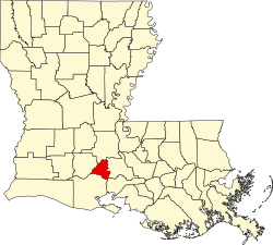
| Parish | Lafayette |
| Area | |
• Total | 3.39 sq mi (8.79 km2) |
| • Land | 3.39 sq mi (8.79 km2) |
| • Water | 0 sq mi (0.00 km2) |
| Elevation | 39 ft (12 m) |
| Population (2020) | |
• Total | 2,145 |
| • Density | 630/sq mi (244/km2) |
| Time zone | UTC-6 (CST) |
| • Summer (DST) | UTC-5 (CDT) |
| Area code | 337 |
| FIPS code | 22-58360 |
Ossun is an unincorporated community and census-designated place in Lafayette Parish, Louisiana, United States. In 2020, its population was 2,145. [2] The community is named after the area of Ossun, France, near Lourdes.[ citation needed ]