
South Goa is one of two districts that comprises the state of Goa in India, within the region known as the Konkan. It is bounded by North Goa district to the north, the Uttara Kannada district of Karnataka state to the east and south, while the Arabian Sea forms its western coast.
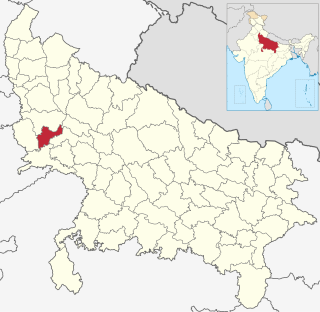
Hathras district is a district of Uttar Pradesh state of India. The city of Hathras is the district headquarters. Hathras district is a part of Aligarh division. The district occupies an area of 1,840 square kilometres (710 sq mi) and has a population of 1,564,708 as of the 2011 census.

Sirsa is a city and a municipal council in Sirsa district in the westernmost region of the Indian state of Haryana, bordering Punjab and Rajasthan. It is located 260 kilometres north-west of New Delhi and 240 kilometres from state capital Chandigarh. Its history dates back to the time of the Mahabharata. At one time, the Sarasvati River flowed in this area.
Chamar is a dalit community classified as a Scheduled Caste under modern India's system of positive discrimination. Historically subject to untouchability, they were traditionally outside the Hindu ritual ranking system of castes known as varna. They are found throughout the Indian subcontinent, mainly in the northern states of India and in Pakistan and Nepal.

Bargur is a selection-grade town panchayat in the Krishnagiri district of the Indian state of Tamil Nadu, that serves as the headquarters of Bargur taluk, one of the seven taluks in Krishnagiri district.

Vimanapura or Baiyyappanahalli Vimanapura is an eastern suburb of Bangalore in Karnataka in India. It is so called because it is near Bangalore HAL airport. Vimanapura houses many of the HAL offices and the HAL hospital. The busy Old Airport Road goes through it.

The Vennar River or Vennaaru is a river and distributary of the Kaveri River in the Kaveri delta. It flows through the Thanjavur, Tiruvarur, and Nagapattinam districts of Tamil Nadu, India.

Polaki is a village in Srikakulam district of Andhra Pradesh in India.
Khemewadi is a village in Belgaum district in Karnataka, India. As of 2011, Khemewadi had a population of 358. 69.44% of the population was literate, male literacy stood at 74.53%, while female literacy stood at 64.42%. A total of 73 houses were counted in 2011.

The Malappuram Metropolitan Area or Malappuram Urban Agglomeration is an urban agglomeration centred around the city of Malappuram, in Malappuram district, Kerala, India. It is the 25th largest urban agglomeration in India and the 4th largest in Kerala.
Fufuao or Rampur Phuphuaon is a village in Dildarnagar Kamsar in the Indian state of Uttar Pradesh.
Baiyyappanahalli or New Baiyyappanahalli Extension is one of the neighbourhoods in Bengaluru. It is part of C. V. Raman Nagar in East Bengaluru. The area is a transport hub and popular for Baiyappanahalli metro station and Baiyyappanahalli railway station.

Badamanavarthekaval or BM Kaval is a village in the southern state of Karnataka, India. It is located in the outskirts of Bangalore situated in Bangalore South Taluk of Bangalore Urban district.
Ramanagar is a village in the southern state of Karnataka, India. It is located in the outskirts of Indi situated in Indi Taluk of Bijapur.
Ramnagar is a village in the southern state of Karnataka, India. It is situated in Bijapur Taluk of Bijapur.
Ramnagar is a village in the southern state of Karnataka, India. It is situated in Basavana Bagevadi Taluk of Bijapur.
Ramnagar is a village in the southern state of Karnataka, India. It is situated in Joida Taluk of Uttara Kannada.
Ramnagar is a village in the southern state of Karnataka, India. It is situated in Afzalpur Taluk of Gulbarga.
Ramnagar is a village in the southern state of Karnataka, India. It is situated in Shorapur Taluk of Yadgir.
