Research stations in Queen Maud Land

Last updated

Research stations in Queen Maud Land
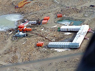
Novolazarevskaya station.jpg
Novolazarevskaya, one of the research stations in Queen Maud Land, pictured during summer, in February 2006.
Antarctica relief location map.jpg
Blue pog.svg
Green pog.svg
Orange pog.svg
Turquoise pog.svg
Brown pog.svg
Cyan pog.svg
Purple pog.svg
Purple pog.svg
Gold pog.svg
Red pog.svg
Black pog.svg
Location of Queen Maud Land research stations in Antarctica.
Legend:

Research stations in Queen Maud Land are connected by the Dronning Maud Land Air Network Project (DROMLAN), which is a cooperative agreement for transportation between eleven nations with research stations in East Antarctica. Long-range aircraft fly between Cape Town, South Africa and either the Troll Airfield, located at the Troll research station, or the runway at the Novolazarevskaya Station. From these two main airfields, smaller aircraft may fly further to other Antarctic destinations. [1]

Contents

Through the Troll Airfield, Norway's Troll station serves as a major hub of the DROMLAN network. [1] Research at Troll include air and atmospheric measurements, [2] monitoring of greenhouse gases and bird colonies, as well as meteorological and climate research. [3] The other Norwegian station, Tor, was established for researching birds at the breeding colony in Svarthamaren Mountain. [4] Activities conducted by Russia's Novolazarevskaya Station include environmental monitoring, geodesy/mapping, geomagnetic and meteorological observations, glaciology, biology, ionospheric  /auroral observations, limnology, geology, geophysics and seismology. [5]

SANAE IV

The SANAE IV station SANAE IV from above the northern buttress.jpg
The SANAE IV station

South Africa's SANAE IV station, the successor to three former stations, was completed in 1997. Research at SANAE IV include invasion biology/ecology, geology, geomorphology and atmospheric sciences. Its facilities include a small hospital and a two-helicopter hangar. [6] SANAE IV consists of three linked modules, each double-story, 44 metres (144 ft) long and 14 metres (46 ft) wide. Two smaller nearby structures contain the satellite dish used for communications and the diesel fuel bunkers. Joined end-on-end in a north–south orientation, the base modules are complemented on the northern end by a large raised helicopter landing area with a lifting section allowing vehicles to be brought up into the hangar for maintenance. C-block, the northernmost module, contains the neutron monitors of the North-West University. [7] The modules are linked by single-story connections that also serve as entrances with stairways down to the surface 4m below the base. Each link contains an entrance hall with two sets of doors (creating a rudimentary 'air-lock' to prevent excessive cooling when entering and exiting the base) as well as a change-room, ablution facility and electronic distribution boards. The base is staffed and maintained year-round by a team of scientists and support personnel. Each overwintering team arrives during the summer expedition and take-over period aboard the research and logistics vessel S. A. Agulhas II , stays at the base through the austral winter and returns to South Africa at the end of the next summer season - an expedition of approximately 16 months.

Nordenskiöld Base

The Aboa station, part of the Nordenskiold Base. Aboa Station, Antarctica.jpg
The Aboa station, part of the Nordenskiöld Base.

The Swedish Wasa station and the Finnish Aboa station together make up the Nordenskiöld Base, and cooperate in research and logistics. Research carried out includes geodesy/mapping, glaciology, human biology, meteorological observations, geology and geophysics. [8]

Neumayer Station III

The German Neumayer Station III, finished in 2009, succeeded two former stations that were buried by snow and ice. [9] It conducts geophysical, meteorological and seismological research, as well as air chemistry measurements and atmospheric ozone monitoring. [10] Germany's other station, Kohnen, was opened as part of a major ice-drilling project. [11]

It is named after geophysicist Georg von Neumayer. The station's assembly kit was transported to its current position early in November 2007. It is moving with the shelf ice at about 200 meters per year towards the open sea. [12] After almost ten years of work on the project, beginning in October 1999, including conception, environmental impact assessment, planning and construction phases, regular operation of the station began on 20 February 2009. The station replaces the Neumayer Station II and the Georg von Neumayer Station that preceded it. The expected lifespan of the station is 25 to 30 years and the entire project is estimated to cost 39 million. [13]

Maitri

Maitri station succeeded Dakshin Gangotri station in 1989, India's first Antarctic base. [14] Maitri's research focus on geology, and the study of the supercontinent Gondwana, when India and Antarctica belonged to the same landmass. It also includes low-temperature engineering research that is relevant to conditions in the Himalayas. [15]

Showa Station

Showa Station is Japan's main research station in Antarctica. A vast array of research is conducted there, including upper atmosphere physics, meteorology, seismology, gravimetry, geodesy/mapping, oceanography, glaciology, geology, marine and terrestrial biology, and medical research. [16] Japan's other station, Dome Fuji Station was opened as part of a major ice-coring project. [17] It mainly studies climate change and conducts deep drilling and atmospheric observations. [18]

Princess Elisabeth Antarctica

Princess Elisabeth Base. Antarctica.belgian station1010034.jpg
Princess Elisabeth Base.

Princess Elisabeth Antarctica was established by Belgium as a project to promote polar sciences, as well as to demonstrate the possibility of building a Zero emission station. [19] Research is conducted by an international team of scientists, studying climatology, glaciology and microbiology. [20] It went into service on February 15, 2009. The station, designed, built and operated by the International Polar Foundation, is the first polar base that combines eco-friendly construction materials, clean and efficient energy use, optimization of the station's energy consumption and clever waste management techniques through the use of a micro smart grid. The station is connected to nine wind turbines that stretch out along the Utsteinen ridge. It houses up to 16 scientists at a time.

The station is built against a ridge (The Utsteinen ridge) that is exposed to gales of up to 300 kilometres per hour (190 mph). The station can withstand such strong winds through its aerodynamic shape and its foundation anchoring of several metres deep into the permafrost. Philippe Samyn, a Belgian architect, was involved in designing the shell and underlying structure. The upper deck of the building is the actual station and looks over the ridge edge. The lower deck contains a garage for snowcat vehicles and other utilities. The station is named after Elisabeth, Duchess of Brabant, Princess of Belgium, the eldest daughter and heiress apparent of Philippe, King of the Belgians.

Kohnen Station

Kohnen station. KohnenStation.JPG
Kohnen station.

Kohnen-Station is a German summer-only station, able to accommodate up to 20 people. It is named after the geophysicist Heinz Kohnen (1938–1997), who was for a long time the head of logistics at the Alfred Wegener Institute. The station opened in 2001, and is the logistic base for the ice coring project in Dronning Maud Land, the European Project for Ice Coring in Antarctica (EPICA). [21] The station is supplied by a convoy of 6 towing vehicles, which resupply it twice a year. [22]

List of current research stations

Novolazarevskaya station. Novolazarevskaya station.jpg
Novolazarevskaya station.

The following table lists the currently operational research stations in Queen Maud Land, sorted from westernmost to easternmost. The population figures show the winter average first (if applicable) and the peak (or maximum capacity in the case of the newly opened Princess Elisabeth Base) population last. [23] [24]

Detailed list of current research outposts
Research stationCountryEst.TypePop.
(winter)
Pop.
(peak)
CoordinatesAltitude
m ft
Wasa (Nordenskiöld Base) Sweden 1989Seasonal020 73°03′S13°25′W / 73.050°S 13.417°W / -73.050; -13.417 4001,300
Aboa (Nordenskiöld Base) Finland 1989Seasonal020 73°03′S13°25′W / 73.050°S 13.417°W / -73.050; -13.417 4001,300
Neumayer Station III Germany 1981Year-round950 70°38′S08°16′W / 70.633°S 8.267°W / -70.633; -8.267 40130
SANAE IV South Africa 1962aYear-round1080 71°40′S02°50′W / 71.667°S 2.833°W / -71.667; -2.833 8412,759
Kohnen Germany 2001Seasonal028 75°00′S00°02′W / 75.000°S 0.033°W / -75.000; -0.033 2,9009,500
Troll Norway 1990bYear-round740 72°00′S02°32′E / 72.000°S 2.533°E / -72.000; 2.533 1,3004,300
Tor Norway 1985Seasonal04 71°53′S05°09′E / 71.883°S 5.150°E / -71.883; 5.150 1,6255,331
Maitri India 1989Year-round2565 70°46′S11°44′E / 70.767°S 11.733°E / -70.767; 11.733 130430
Novolazarevskaya Station Russia 1961Year-round3070 70°46′S11°52′E / 70.767°S 11.867°E / -70.767; 11.867 102335
Princess Elisabeth Base Belgium 2009Seasonal020 71°57′S23°20′E / 71.950°S 23.333°E / -71.950; 23.333 1,3974,583
Showa Station Japan 1957Year-round40110 69°00′S39°35′E / 69.000°S 39.583°E / -69.000; 39.583 2995
Dome Fuji Station Japan 1995Seasonal040 77°19′S39°42′E / 77.317°S 39.700°E / -77.317; 39.700 3,81012,500

a While the original SANAE station was opened in 1962, the current SANAE IV station was opened in 1997, 200 kilometres (120 mi) south of the former stations.
b The Troll station was in 1990 opened as a seasonal summer-only station, then for year-round operations in 2005.

See also

Related Research Articles

<span class="mw-page-title-main">Maitri (research station)</span> Antarctic Research Station

Maitri also known as Friendship Research Centre, is India's second permanent research station in Antarctica as part of the Indian Antarctic Programme. The name was suggested by then-Prime Minister Indira Gandhi. Work on the station was first started by the Indian Expedition which landed there in the end December 1984, with a team led by Dr. B. B. Bhattacharya. Squadron Leader D. P. Joshi, the surgeon of the team, was the first camp commander of the tentage at camp Maitri. The first huts were started by the IV Antarctica Expedition and completed in 1989, shortly before the first station Dakshin Gangotri was buried in ice and abandoned in 1990–91. Maitri is situated in the rocky mountainous region called Schirmacher Oasis. It is only 5 kilometres (3.1 mi) away from the Russian Novolazarevskaya Station.
<span class="mw-page-title-main">New Swabia</span> A territory of Antarctica in Queen Maud Land, first explored by Nazi Germany in 1938/39

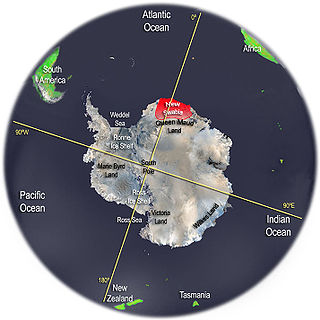
New Swabia was a disputed Antarctic claim by Nazi Germany within the Norwegian territorial claim of Queen Maud Land and is now a cartographic name sometimes given to an area of Antarctica between 20°E and 10°W in Queen Maud Land. New Swabia was explored by Germany in early 1939 and named after that expedition's ship, Schwabenland, itself named after the German region of Swabia.

<span class="mw-page-title-main">Research stations in Antarctica</span>

Multiple governments have set up permanent research stations in Antarctica and these bases are widely distributed. Unlike the drifting ice stations set up in the Arctic, the research stations of the Antarctic are constructed either on rocks or on ice that are fixed in place.

<span class="mw-page-title-main">Pole of Inaccessibility research station</span> Former Antarctic base in Kemp Land

The Pole of Inaccessibility research station is a defunct Soviet research station in Kemp Land, Antarctica, at the southern pole of inaccessibility as defined in 1958 when the station was established. Later definitions give other locations, all relatively near this point. It performed meteorological observations from 14 to 26 December 1958. The Pole of Inaccessibility has the world's coldest year-round average temperature of −58.2 °C (−72.8 °F).

<span class="mw-page-title-main">Troll (research station)</span> Antarctic base

Troll is a Norwegian research station located at Jutulsessen, 235 kilometres (146 mi) from the coast in the eastern part of Princess Martha Coast in Queen Maud Land, Antarctica. It is Norway's only all-year research station in Antarctica, and is supplemented by the summer-only station Tor. Troll is operated by the Norwegian Polar Institute and also features facilities for the Norwegian Meteorological Institute and the Norwegian Institute for Air Research.

<span class="mw-page-title-main">Troll Airfield</span> Airstrip in Queen Maud Land, Antarctica

Troll Airfield is an airstrip located 6.8 kilometres (4.2 mi) from the research station Troll in Princess Martha Coast in Queen Maud Land, Antarctica. Owned and operated by the Norwegian Polar Institute, it consists of a 3,300-by-100-metre runway on glacial blue ice on the Antarctic ice sheet. The airport is located at 1,232 metres (4,042 ft) above mean sea level and is 235 kilometres (146 mi) from the coast.

<span class="mw-page-title-main">Dome F</span> Antarctic base in Queen Maud Land

Dome Fuji, also called Dome F or Valkyrie Dome, is an Antarctic base located in the eastern part of Queen Maud Land. With an altitude of 3,810 metres (12,500 ft) above sea level, it is the second-highest summit or ice dome of the East Antarctic Ice Sheet and represents an ice divide. Dome F is the site of Dome Fuji Station, a research station operated by Japan.
<span class="mw-page-title-main">Princess Elisabeth Antarctica</span> Belgian research station in Queen Maud Land, Antarctica

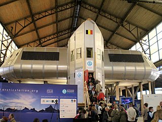
Princess Elisabeth Antarctica, located on Utsteinen Nunatak in Queen Maud Land, is a Belgian scientific polar research station, which went into service on 15 February 2009.

<span class="mw-page-title-main">Schirmacher Oasis</span> Antarctic base in Filchner–Ronne Ice Shelf

The Schirmacher Oasis is a 25 km (16 mi) long and up to 3 km (1.9 mi) wide ice-free plateau with more than 100 freshwater lakes. It is situated in the Schirmacher Hills on the Princess Astrid Coast in Queen Maud Land in East Antarctica and is, on average, 100 m (330 ft) above sea level. With an area of 34 km2 (13 sq mi), the Schirmacher Oasis ranks among the smallest Antarctic oases and is a typical polar desert.

<span class="mw-page-title-main">Queen Maud Land</span> Norways territorial claim in Antarctica

Queen Maud Land is a roughly 2.7-million-square-kilometre (1.0-million-square-mile) region of Antarctica claimed by Norway as a dependent territory. It borders the claimed British Antarctic Territory 20° west and the Australian Antarctic Territory 45° east. In addition, a small unclaimed area from 1939 was annexed in June 2015. Positioned in East Antarctica, it makes out about one-fifth of the continent, and is named after the Norwegian queen Maud of Wales (1869–1938).

<span class="mw-page-title-main">Dependencies of Norway</span> Territories of Norway in the Southern Hemisphere

Norway has three dependent territories, all uninhabited and located in the Southern Hemisphere. Bouvet Island (Bouvetøya) is a sub-Antarctic island in the South Atlantic Ocean. Queen Maud Land is the sector of Antarctica between the 20th meridian west and the 45th meridian east. Peter I Island is a volcanic island located 450 kilometres (280 mi) off the coast of Ellsworth Land of continental Antarctica. Despite being unincorporated areas, neither Svalbard nor Jan Mayen is formally considered a dependency. While the Svalbard Treaty regulates some aspects of that Arctic territory, it acknowledges that the islands are part of Norway. Similarly, Jan Mayen is recognized as an integral part of Norway.

<span class="mw-page-title-main">Jutulsessen</span> Mountain of Antarctica

Jutulsessen is a nunatak in the Gjelsvik Mountains in Queen Maud Land, Antarctica. It is located in Princess Martha Coast, 235 kilometers (146 mi) from the King Haakon VII Sea. Jutulsessen is the site of the Norwegian research station Troll and the affiliated Troll Satellite Station, which has two radomes on top of the mountain. Troll Airfield is located in the vicinity.

<span class="mw-page-title-main">Kohnen Station</span> Antarctic base

Kohnen-Station is a German summer-only polar research station in the Antarctic, able to accommodate up to 28 people. It is named after the geophysicist Heinz Kohnen (1938–1997), who was for a long time the head of logistics at the Alfred Wegener Institute.

Belgium was one of the 12 countries that initially negotiated and signed the Antarctic Treaty.

<span class="mw-page-title-main">Troll Satellite Station</span> Satellite ground station located at Troll in Queen Maud Land, Antarctica

Troll Satellite Station, commonly abbreviated TrollSat, is a satellite ground station located at Troll in Queen Maud Land, Antarctica. The earth station is owned by Kongsberg Satellite Services (KSAT), a joint venture between the Kongsberg Group and the Norwegian Space Center. The radomes are located on top of Jutulsessen, a nunatak area next to the research station at Troll. The research station is operated by the Norwegian Polar Institute, which also maintains the earth station. TrollSat started operations on 1 March 2007 and was officially opened on 20 January 2008.

Dronning Maud Land Air Network Project (DROMLAN) is a coordinated project between eleven countries with bases in Queen Maud Land, Antarctica to create a coordinated logistics service to reduce costs. The participating countries are Belgium, Finland, Germany, India, Japan, the Netherlands, Norway, Russia, South Africa, Sweden and United Kingdom. The services are operated using Russian Ilyushin 76, Norwegian and Swedish C-130 Hercules and Norwegian P-3 Orion aircraft, also occasionally visited by other types of aircraft The flights operate from Cape Town International Airport to Troll Airfield, with a flight time of up to nine hours for a Hercules aircraft, and five and a half hours for an Il-76.

<span class="mw-page-title-main">King Baudouin Ice Shelf</span>

The King Baudouin Ice Shelf in Dronning Maud Land, East Antarctica, is within the Norwegian part of Antarctica. It is named after King Baudouin of Belgium (1930-1993).

<span class="mw-page-title-main">Monika Puskeppeleit</span> German physician (born 1955)

Monika Petra Puskeppeleit is a German physician, public health manager and scientific researcher with special interest in medicine of remote areas, especially polar regions. She is the first German medical doctor and station leader of the first all-woman team to overwinter in Antarctica.

<span class="mw-page-title-main">German Antarctic Expedition (1938–1939)</span> Nazi Germany polar expedition

The German Antarctic Expedition (1938–1939), led by German Navy captain Alfred Ritscher (1879–1963), was the third official Antarctic expedition of the German Reich, by order of the "Commissioner for the Four Year Plan" Hermann Göring. Prussian State Councilor Helmuth Wohlthat was mandated with planning and preparation. The expedition's main objective was of economic nature, in particular the establishment of a whaling station and the acquisition of fishing grounds for a German whaling fleet in order to reduce the Reich's dependence on the import of industrial oils, fats and dietary fats. Preparations took place under strict secrecy as the enterprise was also tasked to make a feasibility assessment for a future occupation of Antarctic territory in the region between 20 ° West and 20 ° East.

References

  1. 1 2 Rubin, 2008, p. 305.
  2. "Antarktis: Troll får nye krefter". Norwegian Institute for Air Research. Archived from the original on July 7, 2010. Retrieved October 4, 2010.
  3. Jaklin, G. S. (2005). "Norge: Året rundt i Antarktis" (PDF). Faktaark (in Norwegian). Norwegian Polar Institute. 10. Retrieved July 18, 2011.
  4. Strøm, Hallvard. "Sjøfuglene i Antarktis". Faktaark (in Norwegian). Norwegian Polar Institute. 14. Archived from the original on September 28, 2011. Retrieved July 11, 2011.
  5. Molle, Kris (December 2, 2010). "Novolazarevskaya". Polar Conservation Organisation. Archived from the original on October 5, 2011. Retrieved August 21, 2011.
  6. Rubin, 2008, pp. 304–305.
  7. "Unit for Space Physics: Neutron Monitor Data". North-West University . Retrieved October 2, 2010.
  8. Molle, Kris (November 2, 2010). "Aboa". Polar Conservation Organisation. Archived from the original on October 5, 2011. Retrieved August 21, 2011.
  9. Rubin, 2008, p. 304.
  10. Molle, Kris (December 2, 2010). "Neumayer". Polar Conservation Organisation. Archived from the original on October 5, 2011. Retrieved August 21, 2011.
  11. Mills, 2003, p. 259.
  12. Heilemann, Michael (February 14, 2009), "Auf Stelzen im Eis", Badische Zeitung
  13. "Deutschlands neuer High-Tech-Bau in der Antarktis", Die Welt , February 19, 2009
  14. Rubin, 2008, p. 306.
  15. McGonigal, 2009, p. 110.
  16. "Syowa". Polar Conservation Organisation. November 3, 2010. Archived from the original on October 5, 2011. Retrieved August 21, 2011.
  17. Mills, 2003, p. 540.
  18. Molle, Kris (November 3, 2010). "Dome Fuji". Polar Conservation Organisation. Archived from the original on October 5, 2011. Retrieved August 21, 2011.
  19. "Princess Elisabeth Antarctica". Princess Elisabeth Antarctica. Retrieved August 21, 2011.
  20. Molle, Kris (November 2, 2010). "Princess Elisabeth". Polar Conservation Organisation. Archived from the original on October 5, 2011. Retrieved August 21, 2011.
  21. Thomas Stocker. "European Project for Ice Coring in Antarctica (EPICA)". European Science Foundation. Archived from the original on June 12, 2012.
  22. "Drilling into the past - The Kohnen Station in the Antarctic". Alfred Wegener Institute for Polar and Marine Research (AWI). Retrieved September 13, 2010.
  23. "Antarctic Facilities". Council of Managers of National Antarctic Programs. March 25, 2009. Archived from the original on April 24, 2008. Retrieved July 11, 2011.
  24. "Antarctic information". Scientific Committee on Antarctic Research. September 2009. Archived from the original on August 18, 2010. Retrieved July 11, 2011.