Rolling Oaks, Florida | |
---|---|
Coordinates: 26°2′26″N80°23′19″W / 26.04056°N 80.38861°W | |
Country | United States |
State | Florida |
County | Broward |
Area | |
• Total | 2.5 sq mi (6.6 km2) |
• Land | 2.5 sq mi (6.6 km2) |
• Water | 0.0 sq mi (0.0 km2) |
Population (2000) | |
• Total | 1,291 |
• Density | 510.4/sq mi (197.1/km2) |
Time zone | UTC-5 (Eastern (EST)) |
• Summer (DST) | UTC-4 (EDT) |
FIPS code | 12-61725 [1] |
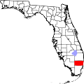
Rolling Oaks was a census-designated place (CDP) in Broward County, Florida, United States. The population was 1,291 at the 2000 census. It was incorporated into the town of Southwest Ranches, Florida in 2000, and is now a neighborhood.
Rolling Oaks is located at 26°2′26″N80°23′19″W / 26.04056°N 80.38861°W (26.040517, -80.388673). [2]
According to the United States Census Bureau, the CDP has a total area of 6.6 km2 (2.5 sq mi), all land.
As of the census [1] of 2000, there were 1,291 people, 392 households, and 332 families residing in the CDP. The population density was 197.0 people/km2 (510 people/sq mi). There were 400 housing units at an average density of 61.0 units/km2 (158 units/sq mi). The racial makeup of the CDP was 90.24% White (69.3% were Non-Hispanic White,) [3] 3.56% African American, 0.15% Native American, 1.08% Asian, 2.63% from other races, and 2.32% from two or more races. Hispanic or Latino of any race were 24.24% of the population.
There were 392 households, out of which 41.1% had children under the age of 18 living with them, 75.5% were married couples living together, 7.4% had a female householder with no husband present, and 15.1% were non-families. 8.4% of all households were made up of individuals, and 1.5% had someone living alone who was 65 years of age or older. The average household size was 3.29 and the average family size was 3.55.
In the CDP, the population was spread out, with 29.4% under the age of 18, 5.5% from 18 to 24, 27.0% from 25 to 44, 30.0% from 45 to 64, and 8.1% who were 65 years of age or older. The median age was 39 years. For every 100 females, there were 97.7 males. For every 100 females age 18 and over, there were 103.8 males.
The median income for a household in the CDP was $83,943, and the median income for a family was $95,194. Males had a median income of $80,468 versus $50,568 for females. The per capita income for the CDP was $37,008. About 3.5% of families and 7.3% of the population were below the poverty line, including 9.6% of those under age 18 and 9.0% of those age 65 or over.
As of 2000, before being annexed to Southwest Ranches, English as a first language accounted for 70.42% of all residents, while Spanish as a mother tongue made up 29.57%% of the population. [4]
Tolsona is a census-designated place (CDP) in Copper River Census Area, Alaska, United States. The population was 12 at the 2020 census, down from 30 in 2010.
Carver Ranches was a census-designated place (CDP) in Broward County, Florida, United States. The population was 4,299 at the 2000 census.
Country Estates was a census-designated place (CDP) in Broward County, Florida, United States. The population was 1,910 at the 2000 census. It is now a neighborhood incorporated into the town of Southwest Ranches, Florida in 2000.
Green Meadow was a census-designated place (CDP) in Broward County, Florida, United States. The population was 1,875 at the 2000 census. It was incorporated into the town of Southwest Ranches, Florida in 2000.
Hillsboro Pines is a census-designated place (CDP) in Broward County, Florida, United States. The population was 496 at the 2020 census.
Hillsboro Ranches was a census-designated place (CDP) in Broward County, Florida, United States in 2000. The population was 47 at the 2000 census. Hillsboro Ranches was not designated a CDP in the 2010 census. As of 2018, Hillsboro Ranches remains an unincorporated neighborhood, part of the Broward Municipal Services District, Northern County.
Ivanhoe Estates was a census-designated place (CDP) in Broward County, Florida, United States. It is located in the Miami metropolitan area. The population was 279 at the 2000 census. It's now a community incorporated into Southwest Ranches, Florida in 2000. Ivanhoe Estates is part of the larger Ivanhoe neighborhood that is split between Southwest Ranches and southwestern Davie, and includes the other Ivanhoe communities, in neighboring Davie, of Hawkes Bluff, Falcon's Lea, Waterford, Cross Bow, and Waverly Hundred, as well as the Les Chateux, Sheridan Glen, The Enclave, and Chelsea at Ivanhoe communities.
Oak Point was a census-designated place (CDP) in Broward County, Florida, United States. The population was 145 at the 2000 census. It now serves as a Hollywood, Florida neighborhood known for its wealthy residents and beautiful large homes. It is more commonly referred to as Arapahoe.
Sunshine Ranches is a former census-designated place (CDP) in Broward County, Florida, United States. The population was 1,704 at the 2000 census. It was incorporated into the town of Southwest Ranches, Florida in 2000, and now serves as a neighborhood.
Massac is a census-designated place (CDP) in McCracken County, Kentucky, United States. The population was 4,635 at the 2020 census. It is part of the Paducah, KY-IL Metropolitan Statistical Area.
Crystal Lake is a census-designated place (CDP) in Polk County, Florida, United States. The population was 5,341 at the 2000 census, an increase from 5,300 in 1990. The 2010 Census reported a population of 5,514. It is part of the Lakeland–Winter Haven Metropolitan Statistical Area.
Cecil-Bishop is a census-designated place (CDP) in Washington County, Pennsylvania, United States. The population was 2,730 at the 2020 census. The census-designated place encompasses two unincorporated communities: larger Cecil in the west and smaller Bishop in the east.
Zapata Ranch is a census-designated place (CDP) in Willacy County, Texas, United States. The population was 87 at the 2020 census.
West Side Highway was a census-designated place (CDP) in Cowlitz County, Washington, named after a state highway running north–south between Longview and Castle Rock. As of the 2010 census, the CDP population was 5,517. Prior to the 2020 census, the CDP was split into two new CDPs, Beacon Hill and Lexington.
Oyehut-Hogans Corner was a census-designated place (CDP) in Grays Harbor County, Washington, United States. The population was 188 at the 2000 census. At the 2010 census Oyehut and Hogans Corner were split into separate CDPs.
Despard is a census-designated place (CDP) in Harrison County, West Virginia, United States. The population was 1,004 at the 2010 census.
Sweeney Ranch is an unincorporated community in Sweetwater County, Wyoming, United States. The population was 17 at the 2000 census, when it was a census-designated place (CDP).
Jollyville is a neighborhood in the northern part of Austin, Texas, United States. In 2010 it was a census-designated place (CDP) in Travis and Williamson counties, but has since been annexed by Austin. The population of the CDP was 16,151 at the 2010 census.
Bridgewater was a census-designated place (CDP) in the town of Bridgewater in Plymouth County, Massachusetts, United States. The CDP ceased to exist when Bridgewater was given de facto city status in 2010. The population was 7,841 at the 2010 census.
Guilford is a census-designated place (CDP) in the town of Guilford in Piscataquis County, Maine, United States. The population was 945 at the 2000 census.