Klickitat Street is a city street located in northeast Portland, Oregon, United States. The main stem of the street is 3.75-mile (6.04 km) long, and runs east-west parallel to—and one block south of—northeast Fremont Street, from the eastern edge of Irving Park to Northeast 67th Avenue. Additional disconnected segments are east of Rocky Butte from 105th to 117th, 148th to 154th, and 163rd to 165th. A segment named Klickitat Court is between 135th and 140th.

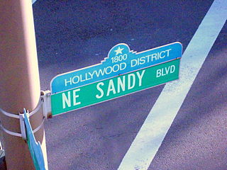
The Hollywood District is a neighborhood of northeast Portland, Oregon, United States renamed for its historic 1920s-era Hollywood Theatre. Although a mixed commercial and residential area, it serves primarily as a shopping district to the adjacent neighborhoods of Grant Park and Laurelhurst, as well as to riders of the MAX Light Rail System. The Hollywood District also figures in Beverly Cleary's Klickitat Street series of books, a fact memorialized in a display at the Hollywood Library, which also provides a Beverly Cleary walking tour. The first pedestrian crossing light in Oregon was installed in the Hollywood District, across the street from the Hollywood theater.

Alberta Arts District is a commercial district in Portland, Oregon which connects the Concordia, King and Vernon neighborhoods in the Northeast quadrant of the city. The district centers on NE Alberta Street, and stretches approximately 1.5 miles (2.4 km), from Martin Luther King Jr. Boulevard to NE 33rd Avenue.

Alameda is a neighborhood in Portland, Oregon, United States that is located on the Alameda Ridge with views of Downtown, the Willamette River, and the Cascades. Northeast Fremont Street is the neighborhood's main east-west thoroughfare and NE 33rd, its main north-south thoroughfare, makes up its eastern boundary. The neighborhood is adjacent to Wilshire Park, a 14.4-acre (58,000 m2) neighborhood park. The community's side streets wind around the hill, past cottages and expansive Craftsman homes. Alameda is located between the business districts of Beaumont Village and the Hollywood District. Locals informally refer to the neighborhood as the Yarn District for its abundance of yarn-based hobbyists.

The Beaumont-Wilshire neighborhood of Portland, Oregon is located in the city's northeast section, on Alameda Ridge with views of Downtown, the Willamette River, and the Cascades. It is bordered by the Alameda, Concordia, Cully, Rose City Park, and Grant Park neighborhoods. "Beaumont Village", located on NE Fremont Street, from NE 33rd Ave. to NE 50th Ave., is the main commercial district in the neighborhood, but the neighborhood also lies within walking distance of the Hollywood District, a major commercial and shopping area to the south.

Irvington is a neighborhood in the Northeast section of Portland, Oregon. According to the city's Office of Community and Civic Life, it consists of a rectangular area extending east to west from NE 7th Ave. to NE 26th Ave., and north to south from NE Fremont St. to NE Broadway. It borders the King, Sabin, and Alameda neighborhoods to the north; Alameda and Grant Park to the east; Sullivan's Gulch and the Lloyd District to the south; and Eliot to the west.

Grant Park refers to both a neighborhood and public park in the Northeast section of Portland, Oregon. The neighborhood is bordered by Alameda and Beaumont-Wilshire to the north; Rose City Park to the east; Hollywood District, Laurelhurst, and Sullivan's Gulch to the south; and Irvington to the west.

Cathedral Park is a neighborhood in Portland, Oregon. It is situated on the North Portland peninsula and lies on the east shore of the Willamette River. The neighborhood is named after Cathedral Park, which is located under the St. Johns Bridge, and was given its name due to the Gothic arches that support the bridge, which resemble a cathedral arch.

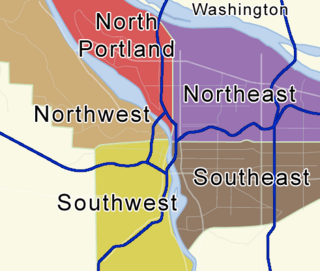
Portland, Oregon is divided into six sections, as of May 1, 2020: North Portland, Northeast Portland, Northwest Portland, South Portland, Southeast Portland, and Southwest Portland. There are 95 officially recognized neighborhoods, each of which is represented by a volunteer-based neighborhood association. No neighborhood associations overlap the Willamette River, but a few overlap the addressing sextants. For example, most addresses in the South Portland Neighborhood Association are South, but a portion of the neighborhood is west of SW View Point Terrace where addresses have a SW prefix. Similarly the Buckman Neighborhood Association spans both NE and SE Portland.

Concordia is a neighborhood in the Northeast section of Portland, Oregon, United States, named after Concordia University, which is located within it. The neighborhood borders are NE 22nd Ave. on the west, NE Columbia Blvd. on the north, and NE 42nd Ave. on the east. On the south, the border is NE Prescott St. and NE Alberta Ct., to the west and east of NE 33rd Ave., respectively. Neighborhoods bordering Concordia are Woodlawn, Vernon, and Sabin on the west, Sunderland on the north, Cully on the east, and Alameda and Beaumont-Wilshire on the south.

Rose City Park is a neighborhood in Northeast Portland, Oregon. It borders Beaumont-Wilshire, Grant Park, and the Hollywood District on the west, Cully on the north, Roseway and Madison South on the east, and Center on the south.

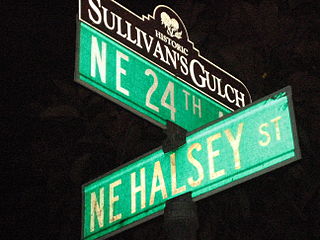
Sullivan's Gulch is a neighborhood in the Northeast section of Portland, Oregon. The name commemorates Timothy Sullivan, an early farmer in the area. Sullivan settled his donation land claim on January 27, 1851. He was born in Ireland in 1805, received citizenship in the United States in 1855, and most likely received title to the claim around 1863.

Piedmont is a neighborhood in the north and northeast sections of Portland, Oregon, United States. The Piedmont subdivision was platted in 1889 by Edward Quackenbush, and promoted in an early flyer as "The Emerald, Portland's Evergreen Suburb, Devoted Exclusively to Dwellings, A Place of Homes." The original subdivision, now known as "Historic Piedmont," includes parts of the Humboldt and King neighborhoods, as well as the modern Piedmont neighborhood south of Rosa Parks Way.

Madison South is a neighborhood in the Northeast section of Portland, Oregon. It is bordered by the Roseway, Sumner, Cully, Parkrose, Montavilla, and Rose City Park neighborhoods, and by the enclave city of Maywood Park. The neighborhood roughly conforms to the boundaries of Interstate 84 to the south, Interstate 205 to the east, NE Sandy Boulevard to the north, and NE 65th Avenue to the west.

Sunderland is a neighborhood in the northeast section of Portland, Oregon, United States. It is bordered by the Columbia River to the north; Woodlawn and Concordia to the south; Portland International Airport and Cully to the east; and East Columbia to the west. There is a city sanctioned transient encampment called Dignity Village in Sunderland between a state prison and the airport.

The Alameda Ridge is a large gravel bar located in Portland, Oregon, United States.

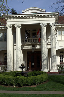
The Edward H. and Bertha R. Keller House is a house located in northeast Portland, Oregon, in the United States, listed on the National Register of Historic Places.

Acadia: A New Orleans Bistro, or simply Acadia, is a Cajun- and Louisiana Creole-style restaurant in northeast Portland, Oregon, in the United States.

Northeast Portland is one of the sextants of Portland, Oregon.


