Parts of this article (those related to the outcome of the proposal) need to be updated. Please help update this article to reflect recent events or newly available information.(January 2024)
San Luis Valley Conservation Area
The upper Rio Grande near Creede
The proposed San Luis Valley Conservation Area showing federal, state, and protected land use
Planning for this conservation area is part of developing the comprehensive conservation plan for the refuges in the San Luis Valley.
After consideration of public comment on the draft plan a portion of the proposed San Luis Valley Conservation Area that has immediate conservation need and opportunities has been identified. This is the proposed Sangre de Cristo Conservation Area.
Public meetings on the draft proposal were held by the Fish and Wildlife Service in May, 2012 in Alamosa, San Luis, and Moffat, Colorado and comments solicited.[2][3]
The draft plan focuses on maintaining wetlands and riparian habitats in the high desert mountain valley. The plan has been criticized by the Rio Grande Water Conservation District, which represents local water users, as limiting the flexibility needed to manage agricultural water use in the San Luis Valley needed to balance the water budget.[4]
The proposed conservation area is defined by the headwaters of the Rio Grande, which begins its nearly 1,900-mile (3,100km) journey to the Gulf of Mexico in the San Juan Mountains and Sangre de Cristo Range that surround the San Luis Valley. Runoff from mountain snowpack creates wetlands and riparian areas in the midst of what otherwise is a high-mountain desert, providing important habitat for dozens of species of migratory birds and other sensitive or imperiled species. The surrounding sagebrush shrublands and mountains provide homes and migration corridors for the Rio Grande cutthroat trout, Canada lynx, and important State game species such as elk and deer.
Conservation easement contracts would specify perpetual protection of habitat for trust species and limits on residential, industrial, or commercial development. Contracts would prohibit alteration of the natural topography, conversion of native grassland to cropland, and drainage or filling of wetlands. When appropriate, easement contracts would prevent the sale of surface water rights or change in water use that would have substantial negative effects on the wildlife value of the property. Easement land would remain in private ownership. Therefore, property tax and invasive plant control would remain the responsibility of the landowner, who also would retain control of public access to the land. Contracts would not restrict grazing on easement land.[5]
Notes
1 2 Ken Salazar; Dave Showalter (June 6, 2011). "Secretary Salazar ~ America's Great Outdoors". Western Wild Dave Showalter's Conservation Photography Weblog. Archived from the original on June 29, 2013. Retrieved September 22, 2012. RIO GRANDE RIVER CORRIDOR/SAN LUIS VALLEY The second America's Great Outdoors project we are announcing today seeks to conserve and protect the Rio Grande River Corridor and the Sangre de Cristo mountain range in the San Luis Valley. The San Luis Valley in Southern Colorado – where my family has ranched the same land for 150 years – is a very special place. It is framed by the beautiful Sangre de Cristo Mountains to the east and the San Juan Mountains to the west. It is carved by many rivers, including the headwaters of the Rio Grande. Like the Yampa River Basin project, the San Luis Valley project will seek to build upon local efforts to conserve the Valley's vibrant ranching community and protect important wildlife resources and wetland habitat on a landscape scale. Interior's Fish and Wildlife Service is already in the early stages of studying a new San Luis Valley Conservation Area in southern Colorado. This is a community-based effort that will use the agency's time-tested and highly-effective voluntary conservation easement program. This approach is a "win-win" proposition that embodies the President's vision for 21st century conservation. It is already producing strong results in places such as the Blackfoot Valley and Rocky Mountain Front of Montana, the Flint Hills of Kansas, the grasslands of the Dakotas and the headwaters of the Everglades in Florida. The Governor and I believe that the San Luis Valley project presents an unparalleled opportunity to align federal and state investment with private efforts in order to achieve truly landscape scale outcomes.
↑ Ruth Heide (May 16, 2012). "FWS seeks plan comments". Valley Courier. Archived from the original on January 16, 2013. Retrieved September 22, 2012.
The San Luis Valley is a region in south-central Colorado with a small portion overlapping into New Mexico. The valley is approximately 122 miles (196 km) long and 74 miles (119 km) wide, extending from the Continental Divide on the northwest rim into New Mexico on the south. It contains 6 counties and portions of 3 others. It is an extensive high-elevation depositional basin of approximately 8,000 square miles (21,000 km2) with an average elevation of 7,664 feet (2,336 m) above sea level. The valley is a section of the Rio Grande Rift and is drained to the south by the Rio Grande, which rises in the San Juan Mountains to the west of the valley and flows south into New Mexico. The San Luis Valley has a cold desert climate but has substantial water resources from the Rio Grande and groundwater.
The Sangre de Cristo Range is a mountain range in the Rocky Mountains in southern Colorado in the United States, running north and south along the east side of the Rio Grande Rift. The mountains extend southeast from Poncha Pass for about 75 mi (121 km) through south-central Colorado to La Veta Pass, approximately 20 mi (32 km) west of Walsenburg, and form a high ridge separating the San Luis Valley on the west from the watershed of the Arkansas River on the east. The Sangre de Cristo Range rises over 7,000 ft (2,100 m) above the valleys and plains to the west and northeast.
Alamosa County is a county located in the U.S. state of Colorado. As of the 2020 census, the population was 16,376. The county seat is Alamosa. The county name is the Spanish language word for a grove of cottonwood trees.
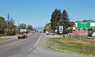
Founded in 1851, the Town of Manassa is a Statutory Town and is the most populous municipality in Conejos County, Colorado, United States. The town's population was 947 at the 2020 United States Census.
Great Sand Dunes National Park and Preserve is an American national park that conserves an area of large sand dunes on the eastern edge of the San Luis Valley, and an adjacent national preserve in the Sangre de Cristo Range, in south-central Colorado, United States. The park was originally designated Great Sand Dunes National Monument on March 17, 1932, by President Herbert Hoover. The original boundaries protected an area of 35,528 acres. A boundary change and redesignation as a national park and preserve was authorized on November 22, 2000, and then established on September 24, 2004. The park encompasses 107,342 acres while the preserve protects an additional 41,686 acres for a total of 149,028 acres. The recreational visitor total was 527,546 in 2019.
The Sangre de Cristo Mountains are the southernmost subrange of the Rocky Mountains. They are located in southern Colorado and northern New Mexico in the United States. The mountains run from Poncha Pass in South-Central Colorado, trending southeast and south, ending at Glorieta Pass, southeast of Santa Fe, New Mexico. The mountains contain a number of fourteen thousand foot peaks in the Colorado portion, as well as several peaks in New Mexico which are over thirteen thousand feet.
Monte Vista National Wildlife Refuge is a United States National Wildlife Refuge located in southern Colorado. The refuge is located in the San Luis Valley south of the town of Monte Vista, Colorado in southeastern Rio Grande County, Colorado, in the watershed of the Rio Grande. It was established in 1953 by the Migratory Bird Conservation Commission to provide a habitat for wildlife, particularly waterfowl, in the San Luis Valley.
The Baca National Wildlife Refuge is a 78,697-acre (31,848 ha) United States National Wildlife Refuge located in southern Colorado. It is within the Sangre de Cristo National Heritage Area.
Louis Moore Bacon is an American investor, hedge fund manager, and philanthropist. He is the founder and chief executive of Moore Capital Management.
The Intermountain West Joint Venture (IWJV) is a partnership of government agencies, nongovernmental organizations, and other public and private landowners for the conservation of bird habitats in the inter-mountain areas of the western United States. It was established in 1994 and focuses on the "implementation of the conservation goals and objectives of five major bird initiatives": North American Waterfowl Management Plan, Partners in Flight, United States Shorebird Conservation Plan, North American Waterbird Conservation Plan and the National Sage Grouse Conservation Planning Framework. Its primary objective is to address conservation issues for about 40 waterbird species which use the marshes, playas, riparian zones, lakes and other wetlands throughout its extent.
Sangre de Cristo National Heritage Area is a federally designated National Heritage Area in the south central portion of the U.S. state of Colorado. The heritage area includes the San Luis Valley and portions of the Sangre de Cristo Range. The region combines influences of Anglo-American, Hispano-American and Native American influences. It also includes portions of the upper Rio Grande valley.
Rio Culebra is a river or creek in Costilla County, Colorado. The Rio Culebra rises in the Sangre de Cristo Mountains and is 48 km (30 mi) long. It empties into the Rio Grande west of the town of San Luis. The region around San Luis features extensive agriculture made possible by irrigation water from the river. Sometimes called the "Culebra Basin" this area is known for the extensive irrigation canals called acequias built by its Hispanic settlers in the 19th century and still in use in the 21st century
The Closed Basin Project is a groundwater extraction project in the San Luis Valley in Colorado, United States, that began in the 1970s, and remains in operation in the 2020s. The project is managed by the United States Bureau of Reclamation.
The Blanca Wetlands Area of Critical Environmental Concern, or Blanca Wildlife Habitat Area, is an area of the San Luis Valley in Colorado, United States, that serves as a refuge for birds, fish and other wildlife. It is about 11 miles (18 km) northeast of Alamosa on County Road 25. The wetlands had been completely destroyed by pumping and diversion of water for irrigation. Starting in 1965 the Bureau of Land Management began to restore them, and they have become an increasingly important ecological habitat for shorebirds, waterbirds and other wildlife and native plants.
San Antonio Mountain is a free-standing volcanic peak in Rio Arriba County, New Mexico. With an elevation of 10,908 feet, San Antonio Mountain is the highest peak within the Taos Plateau volcanic field, the largest volcanic field within the Rio Grande Rift valley.
The San Luis Closed Basin is a 2,940-square-mile (7,600 km2) endorheic basin in the Alamosa and Saguache counties of south-central Colorado. It includes San Luis Creek and its tributary, Saguache Creek. While the basin is east of the majority of the Rocky Mountains, it lies west of the Sangre de Cristo Range. An elevated plateau in Alamosa County, the San Luis Hills, separates the San Luis Closed Basin drainage from most of the San Luis Valley, which is southward-flowing and drains through the Rio Grande.
Lake Alamosa is a former lake in Colorado. It existed from the Pliocene to the middle Pleistocene in the San Luis Valley, fed by glacial meltwater from surrounding mountain ranges. Water levels waxed and waned with the glacial stages until at highstand the lake reached an elevation of 2,335 meters (7,661 ft) and probably a surface of over 4,000 square kilometers (1,500 sq mi), but only sparse remains of the former waterbody are visible today. The existence of the lake was postulated in the early 19th century and eventually proven in the early 20th century.
The San Luis Hills are a group of small mountain ranges in Conejos and Costilla counties in the San Luis Valley in southern Colorado. The individual mountain ranges that make up the San Luis Hills include the Fairy Hills, the Brownie Hills, the Piñon Hills, and the South Piñon Hills. The San Luis Hills' highest point is Flat Top, elevation 9,206 feet
The Sangre de Cristo Land Grant in the San Luis Valley of southern Colorado and northern New Mexico consists of 1,000,000 acres (4,000 km2) of mostly arid land. It was awarded by the government of New Mexico to the Beaubien family in 1843. The land grant was originally settled by Hispanics from New Mexico. Since the incorporation of the area of the grant into the United States in 1848, legal disputes between the descendants of the Hispanic settlers and Anglo ranchers about ownership of and access to some of the land in the grant area have been frequent and continued into the 21st century.
Twin Peaks is a mountain summit in Alamosa County, Colorado, United States.
This page is based on this Wikipedia article Text is available under the CC BY-SA 4.0 license; additional terms may apply. Images, videos and audio are available under their respective licenses.