
The River Manifold is a river in Staffordshire, England. It is a tributary of the River Dove.

The Welshpool and Llanfair Light Railway (W&LLR) is a 2 ft 6 in narrow gauge heritage railway in Powys, Wales. The line is around 8.5 miles (13.7 km) long and runs westwards from the town of Welshpool via Castle Caereinion to the village of Llanfair Caereinion.
The Leek and Manifold Valley Light Railway (L&MVLR) was a narrow gauge railway in Staffordshire, England that operated between 1904 and 1934. The line mainly carried milk from dairies in the region, acting as a feeder to the 4 ft 8+1⁄2 instandard gauge system. It also provided passenger services to the small villages and beauty spots along its route. The line was built to a 2 ft 6 in narrow gauge and to the light rail standards provided by the Light Railways Act 1896 to reduce construction costs.

The North Staffordshire Railway (NSR) was a British railway company formed in 1845 to promote a number of lines in the Staffordshire Potteries and surrounding areas in Staffordshire, Cheshire, Derbyshire and Shropshire.

The Ashover Light Railway was a 1 ft 11+1⁄2 in narrow gauge railway in Derbyshire, England that connected Clay Cross and Ashover. It was built by the Clay Cross Company to transport minerals such as limestone, fluorite, barytes and gritstone to its works at Clay Cross and for transport around the country by the LMS.

The Churnet Valley Railway is a preserved standard gauge heritage railway in the Staffordshire Moorlands of Staffordshire, England. It operates on part of the former Churnet Valley Line which was opened by the North Staffordshire Railway. The railway is roughly 10.5 miles (16.9 km) long from Kingsley and Froghall to Ipstones. The land from Leek Brook Junction to Ipstones was opened by Moorland & City Railways (MCR) in 2010 after they took a lease out from Network Rail. This has subsequently been purchased by the Churnet Valley Railway. The main stations along the line are Kingsley and Froghall, Consall, Cheddleton and Leek Brook. Work has begun to extend the line to the town of Leek which will act as the northern terminus of the line. The line between Leek and Waterhouses has also been reopened as part of the heritage railway as far as Ipstones.

The Amerton Railway is a 2 ft narrow gauge heritage railway in the English county of Staffordshire. It is owned by Staffordshire Narrow Gauge Railway Limited, a registered charity, and operated by volunteers.

Beeston Tor is a limestone cliff in Staffordshire. It overlooks the confluence of the River Hamps with the River Manifold, and is a popular venue for rock climbing.
Waterhouses is a village in the south of the Staffordshire Peak District in England. It is around 8 miles from Leek and Ashbourne, being nearly the halfway point between the two towns on the A523 road, which roughly follows the southern boundary of the Peak District National Park. Waterhouses is also a civil parish, created in 1934 when the parishes of Calton, Cauldon, Waterfall and part of Ilam were merged; previously the village of Waterhouses was on the boundary of Waterfall and Cauldon parishes. The hamlet of Winkhill is also in the parish. The population of the civil parish at the 2011 census was 1,134.

Ecton is a hamlet in the Staffordshire Peak District. It is on the Manifold Way, an 8-mile (13 km) walk and cycle path that follows the line of the former Leek and Manifold Valley Light Railway. Population details as at the 2011 census can be found under Ilam.

The Manifold Way is a footpath and cycle way in Staffordshire, England. Some 8 miles (13 km) in length, it runs from Hulme End (53.1307°N 1.8480°W) in the north to Waterhouses (53.0480°N 1.8654°W) in the south, mostly through the Manifold Valley and the valley of its only tributary, the River Hamps, following the route of the former Leek and Manifold Valley Light Railway, a 2 ft 6 in gauge line which closed in 1934 after a short life.

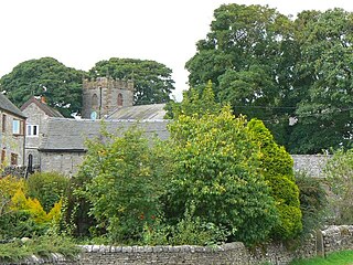
Grindon is a small village in the Staffordshire Peak District of England.

The Teifi Valley Railway is a 2 ft narrow gauge railway occupying a section of the former standard gauge Great Western Railway line between Llandysul and Newcastle Emlyn. After the closure of the former line by British Rail in 1973, a preservation group built and periodically extended a narrow-gauge railway along the route, westwards from Henllan, eventually operating a 3 kilometres (1.9 mi) long line as a tourist attraction.

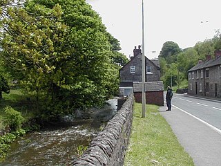
Hulme End is a small hamlet in Staffordshire, England. It is located in the Peak District National Park about 10 miles north of Ashbourne. A natural gateway to the Manifold valley, the settlement is located beside the river Manifold where it crosses the road from Hartington to Warslow.
Wetton is a village in the Peak District National Park, North Staffordshire, at the top of the east side of the Manifold Valley. The population recorded in the 2001 Census was 157. At the time of the 2011 Census the population was recorded under Ilam. This article describes the location, some of the main features of the village, and a number of places of historical or general interest in or near the village. These include Long Low, Wetton, a prehistoric burial site unique to England.
Waterhouses railway station was a railway station that served the village of Waterhouses, Staffordshire. It was opened jointly by the North Staffordshire Railway (NSR) and the Leek and Manifold Valley Light Railway (L&MVLR) in 1905 and closed in 1943.
The Waterhouses branch line was a railway built by the North Staffordshire Railway to link the small villages east of Leek, Staffordshire with Leek, the biggest market town in the area. The railway opened in 1905 but closed to passengers in 1935. Freight continued on the line though until 1988, when the line was mothballed as the traffic from the quarries at Caldon Low ceased.

Hulme End railway station is a disused railway station in Staffordshire, England.
Ecton railway station was a station on the Leek and Manifold Light Railway. It served the hamlet of Ecton, Staffordshire. Today, the site is now part of the Manifold Way between Hulme End and Waterhouses.

Swainsley Tunnel is a tunnel on the route of the former Leek and Manifold Light Railway, which connected the market town of Leek with Hulme End, via Waterhouses, in Staffordshire, England. The tunnel is located between Ecton and Butterton.