
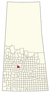
Beatty is a village in the Canadian province of Saskatchewan within the Rural Municipality of Flett's Springs No. 429 and Census Division No. 15. The village is located approximately 13 km (8 mi) northwest of the City of Melfort. It is at the junction of Highway 3 and Highway 368. In 1925, Beatty was a Canadian National Railways (CNR) rail station on the Swan River - Prince Albert branch line. The area surrounding Beatty is predominantly farmland and the main source of employment is agriculture.

The Rural Municipality of Arm River No. 252 is a rural municipality (RM) in the Canadian province of Saskatchewan within Census Division No. 11 and SARM Division No. 5. It is located along Highway 11 between Saskatoon and Regina.
The Rural Municipality of Vanscoy No. 345 is a rural municipality (RM) in the Canadian province of Saskatchewan within Census Division No. 12 and SARM Division No. 5. Located in the central portion of the province, it is southwest of the City of Saskatoon.

The Rural Municipality of Eye Hill No. 382 is a rural municipality (RM) in the Canadian province of Saskatchewan within Census Division No. 13 and SARM Division No. 6. It is located in the west-central portion of the province adjacent to the Alberta boundary.

The Rural Municipality of Milton No. 292 is a rural municipality (RM) in the Canadian province of Saskatchewan within Census Division No. 13 and SARM Division No. 6. Located in the west-central portion of the province, it is adjacent to the Alberta boundary.
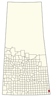
The Rural Municipality of Storthoaks No. 31 is a rural municipality (RM) in the Canadian province of Saskatchewan within Census Division No. 1 and SARM Division No. 1.
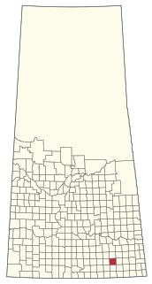
The Rural Municipality of Griffin No. 66 is a rural municipality (RM) in the Canadian province of Saskatchewan within Census Division No. 2 and SARM Division No. 1.

The Rural Municipality of Excelsior No. 166 is a rural municipality (RM) in the Canadian province of Saskatchewan within Census Division No. 7 and SARM Division No. 3.

The Rural Municipality of Rosedale No. 283 is a rural municipality (RM) in the Canadian province of Saskatchewan within Census Division No. 11 and SARM Division No. 5. It is located in the central portion of the province along Highway 11 between Saskatoon and Regina.

The Rural Municipality of Leroy No. 339 is a rural municipality (RM) in the Canadian province of Saskatchewan within Census Division No. 10 and SARM Division No. 5. It is located east of Saskatoon.
The Rural Municipality of Antler No. 61 is a rural municipality (RM) in the Canadian province of Saskatchewan within Census Division No. 1 and SARM Division No. 1.
The history of Saskatoon began with the first permanent non-indigenous settlement of Saskatoon, Saskatchewan, Canada, in 1883 when Toronto Methodists, wanting to escape the liquor trade in that city, decided to set up a "dry" community in the rapidly growing prairie region. As of 1882 this area was a part of the provisional district named Saskatchewan, North-West Territories (NWT). Their organization, the Temperance Colonization Society, first examined this area in 1882 and found that it would make an excellent location to found their community based on the ideals of the temperance movement. The settlers, led by John Neilson Lake, arrived on the site of what is now Saskatoon by traveling by railway from Ontario to Moose Jaw, Assiniboia, NWT, and then completing the final leg via horse-drawn cart. The plan for the Temperance Colony soon failed as the group was unable to obtain a large block of land within the community. Nonetheless, John Lake is commonly identified as the founder of Saskatoon; a public school, a park and two streets are named after him.
Highway 33 is a highway in the southern portion of the Canadian province of Saskatchewan connecting Regina to Stoughton; the highway is divided near Regina. Highway 33 is about 139 km (86 mi) long.
Highway 34 designates major roads intended for travel by the public between Highway 13 just to the west of Ogema to the US border. The highway used to connect to Montana Secondary Highway 511 at the Port of Big Beaver, however the port closed in 2011. Saskatchewan's main roadways are located in the central/southern geographical land area of rugged badlands, and rolling prairie and grass land in a western Canadian prairie province. This paved highway along with Red Coat Trail and Outlaw Tail, early Red river cart trails encompassed the Big Muddy Badlands.

Watson is a town of 777 residents in the rural municipality of Lakeside, in the Canadian province of Saskatchewan. Watson is located on the intersection of Highway 5 and Highway 6, the Canam Highway. Watson is approximately the same distance from Saskatoon which is to the west, and Regina to the south, which gives rise to its town motto, Industrial Crossroads of Saskatchewan.
Churchbridge is a town in the province of Saskatchewan, Canada, located at the junction of the Yellowhead Highway, and Highway 80. Churchbridge is a part of the rural municipality of Churchbridge 211, which is located within Saskatchewan Association of Rural Municipalities (SARM) Division No. 1 and census division Number 5.

St. Gregor is a village in the Canadian province of Saskatchewan within the Rural Municipality of St. Peter No. 369 and Census Division No. 15. It is approximately 20 km west of the Town of Watson on Highway 5.
St. Joseph's, Saskatchewan (Josephstal) was a colony which comprised the towns of Adanac, Biggar, Broadacres, Cactus Lake, Carmelheim, Cavell, Cosine, Denzil, Donegal, Evesham, Grosswerder, Handel, Kelfield, Kerrobert, Landis, Leipzig, Luseland, Macklin, Major, Onward, Pascal, Phippen, Primate, Revenue, Reward, Salvador, Scott, Tramping Lake, Unity, Wilkie, and Wolfe.

Oban is an unincorporated area administered by the rural municipality of Biggar No. 347, in the Canadian province of Saskatchewan. Oban is located on Saskatchewan Highway 14 in western Saskatchewan. The closest town is Biggar to the southeast. Biggar railway station is a divisional point for the Canadian National Railway (CNR). Oban had the last provincial interlocking tower at the Canadian National Railway and Canadian Pacific Railway level crossing, which was constructed in 1910 and closed in 1990.
