
Apache County is a county in the northeast corner of the U.S. state of Arizona. Shaped in a long rectangle running north to south, as of the 2020 census, its population was 66,021. The county seat is St. Johns.

Coconino County is a county in the North-Central part of the U.S. state of Arizona. Its population was 145,101 at the 2020 census. The county seat is Flagstaff. The county takes its name from Cohonino, a name applied to the Havasupai people. It is the second-largest county by area in the contiguous United States, behind San Bernardino County, California. It has 18,661 sq mi (48,300 km2), or 16.4% of Arizona's total area, and is larger than the nine smallest states in the U.S.

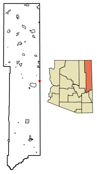
Navajo County is a county in the northern part of the U.S. state of Arizona. As of the 2020 census, its population was 106,717. The county seat is Holbrook.

Pima County is a county in the south central region of the U.S. state of Arizona. As of the 2020 census, the population was 1,043,433, making it Arizona's second-most populous county. The county seat is Tucson, where most of the population is centered. The county is named after the Pima Native Americans, also known as Tohono O'odham, who are indigenous to this area.

Buckeye is a city in Maricopa County, Arizona, United States. It is Arizona's second-largest city by area, and it is the westernmost suburb in the Phoenix Metropolitan Area. As of the 2020 census, the population was 91,502, up from 50,876 in 2010, and 6,537 in 2000. It was the fastest-growing city in the United States for 2017, 2018, and 2021.

Dilkon is a census-designated place (CDP) in Navajo County, Arizona, United States. The population was 1,184 at the 2010 census. The name of the town is said to be derived from the Navajo phrase "Smooth black rock" or "Bare surface.”

Greasewood is a census-designated place (CDP) in Navajo County, Arizona, United States. The population was 547 at the 2010 census.
Holbrook is a city in Navajo County, Arizona, United States. According to the 2010 census, the population of the city was 5,053. The city is the county seat of Navajo County.

Kayenta is a U.S. town which is part of the Navajo Nation and is in Navajo County, Arizona, United States. Established November 13, 1986, the Kayenta Township is unique in being the only "township" existing under the laws of the Navajo Nation.

Shonto is a census-designated place (CDP) in Navajo County, Arizona, United States, in the Navajo Nation. The population was 591 at the 2010 census.

Linden is an unincorporated community located in Navajo County, Arizona, United States, just west of the city of Show Low. It is situated atop the Mogollon Rim at an elevation of over 6,000 feet. The community was evacuated in June 2002 due to the Rodeo-Chediski fire, which eventually consumed part of Linden, destroying a number of homes.

Indian Wells is a census-designated place in Navajo County, Arizona, United States. Indian Wells Elementary School is located in the town, it serves 600 students. It is also the name of the local Navajo chapter of the Navajo Nation Council. Indian Wells is served by a post office with the ZIP code of 86031. The ZIP Code Tabulation Area for ZIP Code 86031 had a population of 1,856 at the 2010 census, with 255 in Indian Wells itself.

Sanders is a census-designated place (CDP) in Apache County, Arizona, United States. Sanders is located at the junction of U.S. Route 191 and Interstate 40. As of the 2020 census, it had a population of 575.

Woodruff is an unincorporated community in Navajo County, Arizona, United States. Woodruff is 10.5 miles (16.9 km) southeast of Holbrook. Woodruff has a post office with ZIP code 85942.
Lupton is an unincorporated community and census-designated place (CDP) in Apache County, Arizona, United States. Lupton is located along Interstate 40 at the New Mexico border, 21 miles (34 km) southwest of Gallup, New Mexico. Lupton has a post office with ZIP code 86508. As of the 2010 census, the Lupton CDP had a population of 25.
Holbrook High School is a high school in Holbrook, Arizona, United States. It is the only high school under the jurisdiction of the Holbrook Unified School District. Adjacent to the school is a Bureau of Indian Affairs-operated dormitory, the Tiisyatin Residential Hall, housing a maximum of 128 students.

Cornfields is a chapter of the Navajo Nation and a census-designated place (CDP) in Apache County, Arizona, United States. The population was 255 at the 2010 census.
Prewitt is an unincorporated community and census-designated place (CDP) in McKinley County, New Mexico, United States. It is located along Interstate 40, 20 miles (32 km) northwest of Grants. Prewitt has a post office with ZIP code 87045. As of the 2020 census, the population of Prewitt was 842.
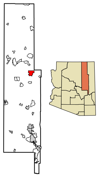
Whitecone is a census-designated place in Navajo County, in the U.S. state of Arizona. The population was 817 at the 2010 census.
Manuelito is an unincorporated community and census-designated place (CDP) on the Navajo Nation in McKinley County, New Mexico, United States. As of the 2020 census, it had a population of 68.


