
Davao del Norte is a province in the Philippines located in the Davao Region in Mindanao. Its capital and largest city is Tagum. The province also includes Samal Island to the south in the Davao Gulf.

Davao Region, formerly called Southern Mindanao, is an administrative region in the Philippines, designated as Region XI. It is situated at the southeastern portion of Mindanao and comprises five provinces: Davao de Oro, Davao del Norte, Davao del Sur, Davao Oriental, and Davao Occidental.

Davao Oriental is a province in the Philippines located in the Davao Region in Mindanao. Its capital is city of Mati, and it borders the province of Davao de Oro to the west, and Agusan del Sur and Surigao del Sur to the north. The province is the traditional homeland of the Mandaya and Kalagan/Kaagan.

Tagum, officially the City of Tagum, is a 1st class component city and capital of the Davao del Norte, Philippines. According to the 2020 census, it has a population of 296,202 people making it the most populous component city in Mindanao.

Laak, officially the Municipality of Laak, is a 1st class municipality in the province of Davao de Oro, Philippines. According to the 2020 census, it has a population of 79,744 people.

Mabini, officially the Municipality of Mabini, is a 2nd class municipality in the province of Davao de Oro, Philippines. According to the 2020 census, it had a population of 43,552.

The Pan-Philippine Highway, also known as the Maharlika Highway, is a network of roads, expressways, bridges, and ferry services that connect the islands of Luzon, Samar, Leyte, and Mindanao in the Philippines, serving as the country's principal transport backbone. Measuring 3,379.73 kilometers (2,100.07 mi) long excluding sea routes, it is the longest highway in the Philippines that forms the country's north–south backbone component of National Route 1 (N1) of the Philippine highway network. The entire highway is designated as Asian Highway 26 (AH26) of the Asian Highway Network.
The legislative districts of Davao del Norte are the representation of the province of Davao del Norte in the various national legislatures of the Philippines. The province is currently represented in the lower house of the Congress of the Philippines through its first and second congressional districts.
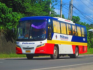
Philtranco Service Enterprises, Inc. is a bus company in the Philippines, servicing routes to Bicol, Eastern Visayas, Caraga, Davao Region, and Northern Mindanao. It is the oldest bus operator in the Philippines and in Asia. It is also the only bus carrier with a nationwide public transport franchise. Philtranco currently has more than 250 buses for its operations.
Metro Davao, officially called Metropolitan Davao, is a metropolitan area in the Mindanao island group, Philippines. It includes the cities of Davao City, Digos in Davao del Sur province; Tagum, Panabo and Samal in Davao del Norte province. The metropolitan area also encompasses the three municipalities of Carmen in Davao del Norte, Maco in Davao de Oro, and Santa Cruz in Davao del Sur. Metro Davao is one of three metropolitan areas in the Philippines.
Agusan is a Manobo language of northeastern Mindanao in the Philippines.
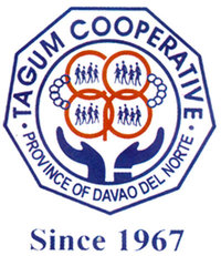
Tagum Cooperative is one of the largest cooperatives in Mindanao, Philippines as it is classified by the Cooperative Development Authority (CDA) of the Philippines as a large cooperative. It is composed of over 117, 000 members as of June 2015 coming from Tagum City, Davao del Norte and towns and cities throughout Region XI and in CARAGA region.
National Route 1 (N1) is a primary national route that forms part of the Philippine highway network, running from Luzon to Mindanao. Except for a 19-kilometer (12 mi) gap in Metro Manila and ferry connections, the highway is generally continuous. Most sections of N1 forms the Pan-Philippine Highway except for sections bypassed by expressways.

The Davao–Cotabato Road is a 205.7-kilometer (127.8 mi), two-to-four lane national primary road, connecting the provinces of Davao del Sur, Maguindanao, and Cotabato. It starts from Davao City to Sultan Kudarat, Maguindanao.

The Molave–Dipolog Road, also known as Malindang Mountain Road, is an 82-kilometer (51 mi), two-to-four lane, primary national road that connects the provinces of Zamboanga del Norte and Zamboanga del Sur. This road serves as the main highway when going to Dipolog from Pagadian.
The Cuevas–Bislig Road is a 46-kilometer (29 mi), two-lane national primary highway that connects the provinces of Agusan del Sur and Surigao del Sur. This highway also connects to the Maharlika Highway in Barangay Cuevas, Trento, Agusan del Sur. It lessens the travel time from the southern part of Agusan del Sur to Bislig City in Surigao del Sur.
National Route 10 (N10) is a 278-kilometer (173 mi) primary national route that forms part of the Philippine highway network and a spur of Asian Highway 26(AH26) of the Asian Highway Network. It connects the provinces of Misamis Oriental, Bukidnon and Davao del Sur.

The Butuan–Cagayan de Oro–Iligan Road, or Butuan–Cagayan de Oro–Iligan–Tukuran Road and also known as Lanao–Pagadian–Zamboanga City Road in the Zamboanga del Sur section, is a 416-kilometer (258 mi), two-to-six lane major thoroughfare, connecting the provinces of Agusan del Norte, Misamis Oriental, Lanao del Norte, and Zamboanga del Sur.
The Tagum City Flyover is an overpass along the Pan-Philippine Highway in Tagum, Davao del Norte. It carries traffic of Pan-Philippine Highway crossing its junction with Surigao–Davao Coastal Road and Tagum–Panabo Circumferential Road. It is the longest flyover in Mindanao with the length of 1.035 kilometers (0.643 mi).

