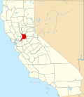
Timeline of Sacramento, California

Last updated

The following is a timeline of the history of the city of Sacramento, California, United States.

Contents

19th century

20th century

1937 - Sacramento Sheriff's Posse organized.

1942 - Sacramento Horsemen's Association organized.

21st century

See also

Related Research Articles

<span class="mw-page-title-main">Sacramento, California</span> Capital city of California, United States

Sacramento is the capital city of the U.S. state of California and the seat of Sacramento County. Located at the confluence of the Sacramento and American Rivers in Northern California's Sacramento Valley, Sacramento's 2020 population of 524,943 makes it the fourth-most populous city in Northern California, sixth-most populous city in the state, and the ninth-most populous state capital in the United States. Sacramento is the seat of the California Legislature and the Governor of California.

The history of Sacramento, California, began with its founding by Samuel Brannan and John Augustus Sutter, Jr. in 1848 around an embarcadero that his father, John Sutter, Sr. constructed at the confluence of the American and Sacramento Rivers a few years prior.

<span class="mw-page-title-main">Capitol Mall</span> Major street in Sacramento, California

The Capitol Mall or Capitol Mall Boulevard is a major street and landscaped parkway in the state capital city of Sacramento, California. Formerly known as M Street, it connects the city of West Sacramento in Yolo County to Downtown Sacramento. Capitol Mall begins at the eastern approach to the Tower Bridge, and runs east to Plaza de California and the California State Capitol.

<span class="mw-page-title-main">Congregation B'nai Israel (Sacramento, California)</span> Reform Jewish synagogue in Sacramento, California, US

Congregation B'nai Israel is a Reform Jewish congregation and synagogue, located at 3600 Riverside Boulevard, in Sacramento, California, in the United States. Founded in 1852 as an Orthodox community, the congregation is the oldest Jewish congregation in Sacramento. The congregation dates the California Gold Rush of 1849, when Jewish settlers gathered to observe the High Holy days. The congregation purchased its first building at 7th and L streets on September 2, 1852, making it the first synagogue west of the Mississippi River.

<span class="mw-page-title-main">Hardin Bigelow</span> American politician

Hardin Bigelow was the first elected mayor of the city of Sacramento, California, which was known then as "Sacramento City." Bigelow's efforts to construct Sacramento's first levees won him enough support to become mayor in Sacramento's first mayoral elections in February 1850. Bigelow served seven months, from April to November, before succumbing to cholera; while he was mayor, Sacramento averted disaster in a potentially devastating flood, but fell victim to a series of April fires, a riot, and a cholera epidemic.

<span class="mw-page-title-main">Sacramento Historic City Cemetery</span> Historic cemetery in California, United States

The Sacramento Historic City Cemetery, located at 1000 Broadway, at 10th Street, is the oldest existing cemetery in Sacramento, California. It was designed to resemble a Victorian garden and sections that are not located in level areas are surrounded by brick or concrete retaining walls to create level terraces. The cemetery grounds are noted for their roses which are said to be among the finest in California.

<span class="mw-page-title-main">Timeline of Cleveland</span>

This article is a timeline of the history of the city of Cleveland, Ohio, USA.

<span class="mw-page-title-main">Amos P. Catlin</span> American politician

Amos Parmalee Catlin was a California State Legislator and was instrumental in Sacramento becoming the capital of the State of California.

The following is a timeline of the history of the city of Hartford, Connecticut, USA.

The following is a timeline of the history of the city of Des Moines, Iowa, US.

The following is a timeline of the history of the city of Memphis, Tennessee, US.

The following is a timeline of the history of the city of San Francisco, California, United States.

The following is a timeline of the history of the city of Austin, Texas, USA.

The following is a timeline of the history of the city of Columbus, Ohio, United States.

The following is a timeline of the history of the U.S. city of Detroit, Michigan.

The following is a timeline of the history of Washington, D.C., the capital city of the United States.

The following is a timeline of the history of the city of Tallahassee, Florida, U.S.

Chevra Kaddisha Cemetery, later known as Home of Peace Cemetery, was the first Jewish cemetery in California founded on November 12, 1850, by the Sacramento City Hebrew Association, and was once located at 33rd at K Streets in the East Sacramento neighborhood of Sacramento, California. The cemetery closed around 1924, and is no longer standing. It is the location of a strip mall, there is no historical plaque.

New Helvetia Cemetery, initially named Sutter Fort Burying Ground, is a defunct cemetery founded in c. 1845 and closed in 1912, formerly located at the northeast corner of Alhambra Boulevard and J Street in the East Sacramento neighborhood of Sacramento, California. It was the first cemetery in the city of Sacramento.

The Home of Peace Cemetery is a Jewish cemetery founded in 1924, and located at 6200 Stockton Boulevard in Sacramento, California. This cemetery contains some of the earliest Jewish gravestones in the western United States, moved from Chevra Kaddisha Cemetery.

References

  1. 1 2 3 4 5 6 7 8 9 10 11 Britannica 1910.
  2. Jenner, Gail L. (2021-09-15). What Lies Beneath: California Pioneer Cemeteries and Graveyards. Rowman & Littlefield. p. 262. ISBN   978-1-4930-4896-0.
  3. Sacramento Archives and Museum Collection Center; Historic Old Sacramento Foundation (2006). Old Sacramento and Downtown. Arcadia. p. 7. ISBN   978-0-7385-3123-6.
  4. Charles E. Nagel (October 1957). "Sacramento Cholera Epidemic of 1850" (PDF). Golden Notes. 4 (1). Sacramento County Historical Society. Retrieved November 4, 2016.
  5. "Chevra Kaddisha (Home of Peace Cemetery) Historical Landmark". State of California, Office of Historic Preservation.
  6. "About Daily California Republican. (Sacramento, Calif.) 1850-1863". Chronicling America. Library of Congress . Retrieved November 4, 2016.
  7. 1 2 3 "California State Capitol History Part One". California State Capitol Museum. Retrieved November 4, 2016.
  8. Historical marker database accessed May 2023
  9. "Proceedings of the First State Convention of the Colored Citizens of the State of California". Sacramento: Democratic State Journal Print. 1855. Retrieved November 4, 2016 via Colored Conventions.
  10. 1 2 Junne, George H. (2000). Blacks in the American West and Beyond--America, Canada, and Mexico: A Selectively Annotated Bibliography. Greenwood Publishing Group. p. 259. ISBN   978-0-313-31208-3.
  11. G. Walter Reed (1923). History of Sacramento County, California. Los Angeles: Historic Record Company. p.  163. ISBN   978-5-88230-133-9.
  12. Herron, Paul E. (April 2022). ""This Crisis of Our History": The Colored Conventions Movement and the Temporal Construction of Southern Politics". Studies in American Political Development. 36 (1): 21–40. doi: 10.1017/S0898588X21000122 . ISSN   0898-588X. S2CID   246985506.
  13. American Library Annual, 1917–1918. New York: R.R. Bowker Co. 1918. p. 274. hdl:2027/mdp.39015013751220.
  14. "Pioneer cemetery once sat at site of East Sacramento's Sutter Middle School". Valley Community Newspapers. July 8, 2011. Retrieved 2023-01-08.
  15. Vernon N. Kisling, ed. (2000). Zoo and Aquarium History: Ancient Animal Collections To Zoological Gardens. CRC Press. p. 376. ISBN   978-1-4200-3924-5.
  16. "Guide to the Sacramento Business and Professional Women's Club Records". Collection Guide. Online Archive of California. California Digital Library . Retrieved November 4, 2016.
  17. Historical marker database accessed May 2023
  18. "Guide to the Sacramento Amateur Movie Makers Club Records". Collection Guide. Online Archive of California. California Digital Library. Retrieved November 4, 2016.
  19. "Sacramento Opera History". Sacramento Philharmonic & Opera. Retrieved November 4, 2016.
  20. Phaedra Hise (May 1, 1997). "Labor-Union Disharmony Silences Symphony". Inc. Retrieved November 4, 2016.
  21. Doris Weatherford (2012). Women in American Politics: History and Milestones. CQ Press. p. 244. ISBN   978-1-60871-007-2.
  22. "Guide to the Sacramento Peace Center records, 1960–1987". Collection Guide. Online Archive of California. California Digital Library. Retrieved November 4, 2016.
  23. Margaret Miller Rocq (1976). California Local History: A Bibliography and Union List of Library Holdings. Stanford University Press. ISBN   978-0-8047-0908-8.
  24. David Covin (2009). Black Politics After the Civil Rights Movement: Activity and Beliefs in Sacramento, 1970–2000. McFarland. p. 25. ISBN   978-0-7864-5298-9.
  25. 1 2 "Cases: United States". Global Nonviolent Action Database. Pennsylvania: Swarthmore College . Retrieved November 11, 2013.
  26. "About STJS". Sacramento Traditional Jazz Society. Retrieved November 4, 2016.
  27. John S. Davis (2012). Historical Dictionary of Jazz. Scarecrow Press. p. 319. ISBN   978-0-8108-7898-3.
  28. Julie Sontag; Julie Cross (April 16, 2013). "Climate Solutions Awards go to Corbett, Davis Flea". The Davis Enterprise. Retrieved November 4, 2016.
  29. Population of the 100 Largest Cities and Other Urban Places in the United States: 1790 to 1990, US Census Bureau, 1998
  30. "Have Modem Will Travel". Sacramento Bee. October 27, 1995.
  31. For Natomas Buzz, see Maura R. O'Connor (October 31, 2011). "The Natomas Buzz, Hyperlocal news for a Sacramento, Calif. community". CJR's Guide to News Startups. Columbia Journalism Review . For Sacramento Press, see Caitlin Kasunich (September 21, 2011). "The Sacramento Press, An ad network helps pay the bills for local news". CJR's Guide to News Startups. Columbia Journalism Review. Both retrieved November 4, 2016.

Bibliography

38°33′20″N121°28′08″W / 38.555556°N 121.468889°W / 38.555556; -121.468889