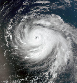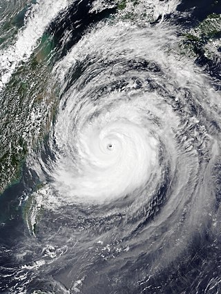
The 2018 Pacific typhoon season was at the time, the costliest Pacific typhoon season on record, until the record was beaten by the following year. The season was well above-average, producing twenty-nine storms, thirteen typhoons, seven super typhoons and six Category 5 tropical cyclones. The season ran throughout 2018, though most tropical cyclones typically develop between May and October. The season's first named storm, Bolaven, developed on January 3, while the season's last named storm, Man-yi, dissipated on November 28. The season's first typhoon, Jelawat, reached typhoon status on March 29, and became the first super typhoon of the year on the next day.

The 2019 Pacific typhoon season was the costliest Pacific typhoon season on record, just ahead of the previous year and 2023. The season featured fairly above-average tropical cyclone activity for the second consecutive year, producing 29 named storms, 17 typhoons, and five super typhoons. The season's first named storm, Pabuk, reached tropical storm status on January 1, becoming the earliest-forming tropical storm of the western Pacific Ocean on record, breaking the previous record that was held by Typhoon Alice in 1979. The season's first typhoon, Wutip, reached typhoon status on February 20. Wutip further intensified into a super typhoon on February 23, becoming the strongest February typhoon on record, and the strongest tropical cyclone recorded in February in the Northern Hemisphere. The season's last named storm, Phanfone, dissipated on December 29 after it made landfall in the Philippines.

Typhoon Bolaven, known in the Philippines as Typhoon Julian, was regarded as the most powerful storm to strike the Korean Peninsula in nearly a decade, with wind gusts measured up to 186 km/h (116 mph). Forming as a tropical depression on August 19, 2012, to the southwest of the Mariana Islands, Bolaven steadily intensified as it slowly moved west-northwestward in a region favoring tropical development. The system was soon upgraded to a tropical storm less than a day after formation and further to a typhoon by August 21. Strengthening became more gradual thereafter as Bolaven grew in size. On August 24, the system attained its peak intensity, with winds of 185 km/h (115 mph) and a barometric pressure of 910 mbar. Weakening only slightly, the storm passed directly over Okinawa on August 26 as it began accelerating toward the north. Steady weakening continued as Bolaven approached the Korean Peninsula and it eventually made landfall in North Korea late on August 28 before transitioning into an extratropical cyclone. The remnants rapidly tracked northeastward over the Russian Far East before turning eastward and were last noted on September 1 crossing the International Dateline.

Typhoon Soulik, known in the Philippines as Super Typhoon Huaning, was a powerful tropical cyclone that caused widespread damage in Taiwan and East China in July 2013. The storm originated from an upper-level cold-core low well to the northeast of Guam on July 6. Gaining tropical characteristics, the system soon developed a surface low and became a tropical depression early on July 7. Tracking generally westward, a motion it would retain for its entire existence, the depression underwent a period of rapid intensification starting on July 8 that culminated in Soulik attaining its peak strength early on July 10. At that time, the system had sustained winds estimated at 185 km/h (115 mph) and barometric pressure of 925 mbar. Thereafter, an eyewall replacement cycle and cooler waters weakened the system. Though it passed over the warm waters of the Kuroshio Current the following day, dry air soon impinged upon the typhoon. Soulik later made landfall late on July 12 in northern Taiwan before degrading to a tropical storm. Briefly emerging over the Taiwan Strait, the storm moved onshore for a second time in Fujian on July 13. The system was last noted as a tropical depression early on July 14.

Typhoon Neoguri, known in the Philippines as Typhoon Florita, was a large and powerful tropical cyclone which struck Japan in 2014. The eighth named storm and the second typhoon of the annual typhoon season, Neoguri developed into a tropical storm on July 3 and then a typhoon on July 4. It rapidly deepened on July 5, reaching peak intensity late on July 6. Neoguri began to decay on July 7 and passed through Okinawa on July 8 and then making landfall over Kyushu as a severe tropical storm late on July 9. After Neoguri passed through the southern coast of Honshū on July 10, it became extratropical on July 11.

Typhoon Vongfong, known in the Philippines as Super Typhoon Ompong, was the most intense tropical cyclone worldwide in 2014, and struck Japan as a large tropical system. It also indirectly affected the Philippines and Taiwan. Vongfong was the nineteenth named storm and the ninth typhoon of the 2014 Pacific typhoon season. Estimates assess damage from Vongfong to have been over US$160 million, mainly for striking mainland Japan. At least 9 people were killed along the path of the typhoon in those countries.

Typhoon Halola, known in the Philippines as Typhoon Goring, was a small but long-lived tropical cyclone in July 2015 that traveled 7,640 km (4,750 mi) across the Pacific Ocean. The fifth named storm of the 2015 Pacific hurricane season, Halola originated from a Western Pacific monsoon trough that had expanded into the Central Pacific by July 5. Over the next several days, the system waxed and waned due to changes in wind shear before organizing into a tropical depression on July 10 while well southwest of Hawaii. The depression strengthened into Tropical Storm Halola on the next day as it traveled westward. Halola crossed the International Date Line on July 13 and entered the Western Pacific, where it was immediately recognized as a severe tropical storm. The storm further strengthened into a typhoon over the next day before encountering strong wind shear on July 16, upon which it quickly weakened into a tropical depression as it passed south of Wake Island. However, the shear relaxed on July 19, allowing Halola to reintensify. On July 21, Halola regained typhoon status and later peaked with 10-minute sustained winds of 150 km/h (93 mph) and a minimum pressure of 955 hPa. From July 23 onward, increasing wind shear and dry air caused Halola to weaken slowly. The system fell below typhoon intensity on July 25 as it began to recurve northwards. Halola made landfall over Kyushu on July 26 as a tropical storm and dissipated in the Tsushima Strait shortly after.

Typhoon Dujuan, known in the Philippines as Super Typhoon Jenny, was the second most intense tropical cyclone of the Northwest Pacific Ocean in 2015 in terms of ten-minute maximum sustained winds, tied with Noul. The twenty-first named storm and the thirteenth typhoon of the 2015 Pacific typhoon season, Dujuan brought extremely powerful winds throughout the Yaeyama Islands and Taiwan in late September, causing 3 deaths in Taiwan. The typhoon also caused over ¥2.5 billion (US$392.9 million) damage in East China.

Typhoon Maria, known in the Philippines as Super Typhoon Gardo, was a powerful tropical cyclone that affected Guam, the Ryukyu Islands, Taiwan, and East China in early July 2018. Developing into the eighth named tropical storm of the 2018 Pacific typhoon season and passing the Mariana Islands on July 4, Maria strengthened into the fourth typhoon of the season and underwent rapid intensification the next day amid favorable environmental conditions. The typhoon reached its first peak intensity on July 6; subsequently, Maria weakened due to an eyewall replacement cycle, but it reintensified and reached a second, stronger peak intensity on July 9 with 10-minute sustained winds of 195 km/h (121 mph) and a minimum pressure of 915 hPa. Over the next three days, it started to gradually weaken due to another eyewall replacement cycle and decreasing sea surface temperatures. After crossing the Yaeyama Islands and passing north of Taiwan on July 10, Maria ultimately made landfall over Fujian, China, early on July 11, before dissipating the next day.

Typhoon Jongdari was a strong, long-lived and erratic tropical cyclone that impacted Japan and East China in late July and early August 2018. Formed as the twelfth named storm of the 2018 typhoon season near Okinotorishima on July 24, Jongdari gradually intensified and developed into the fourth typhoon of the year on July 26. Influenced by an upper-level low and a subtropical ridge, Jongdari executed a rare counter-clockwise southeast of Japan on the next day. At that time, it also reached peak intensity. The typhoon made landfall in Kii Peninsula, over Mie Prefecture of Japan locally early on July 29.

Tropical Storm Rumbia was a rather weak but very destructive tropical cyclone that caused widespread and disastrous flooding in East China in August 2018. The twenty-second officially recognized tropical cyclone of the 2018 Pacific typhoon season, Rumbia developed from an area of low pressure that developed southeast of the Ryukyu Islands on August 13. Favorable environmental conditions supported development of the low into a tropical depression by August 15. At 12:00 UTC that day, the depression strengthened into Tropical Storm Rumbia, which refers to the Sago palm. Initially moving northward, the cyclone turned westward in response to a building ridge to its northeast while slowly strengthening, reaching its peak intensity with maximum 10-minute sustained winds of 85 km/h (50 mph) on August 16. At 20:05 UTC that day, the storm made landfall in Shanghai at peak intensity, maintaining its strength as it moved inland due to ample environmental moisture. However, Rumbia began to weaken as it continued further inland, degenerating into a tropical depression on August 17 shortly before becoming extratropical over central China. The extratropical remnants of Rumbia accelerated northeastward into the Russian Far East, where they dissipated on August 23.

Typhoon Trami, known in the Philippines as Super Typhoon Paeng, was the second typhoon to affect Japan within a month. The twenty-fourth tropical storm and tenth typhoon of the annual typhoon season, Trami developed from a low-pressure area southeast of Guam on September 20. It intensified into a tropical storm on the next day and intensified into a typhoon on September 22. Trami steadily intensified and reached its peak intensity late on September 24. On the following day, Trami slowed and drifted northward. It began to weaken due to upwelling. Trami accelerated and turned northeastward on September 29, before it struck Japan on the next day, and became extratropical on October 1. The extratropical remnants persisted for days until dissipated completely on October 8.

Typhoon Lekima, known in the Philippines as Super Typhoon Hanna, was the third costliest typhoon in Chinese history. The ninth named storm of the 2019 Pacific typhoon season, Lekima originated from a tropical depression that formed east of the Philippines on 30 July. It gradually organized, became a tropical storm, and was named on 4 August. Lekima intensified under favorable environmental conditions and peaked as a Category 4–equivalent Super typhoon. However, an eyewall replacement cycle caused the typhoon to weaken before it made landfall in Zhejiang early on 10 August, as a Category 2–equivalent typhoon. Lekima weakened subsequently while moving across Eastern China, and made its second landfall in Shandong on 11 August.

Typhoon Maysak, known in the Philippines as Typhoon Julian, was a deadly, damaging and powerful tropical cyclone that struck the Ryukyu Islands and the Korean Peninsula in September 2020. The third typhoon of the 2020 Pacific typhoon season, Maysak formed from a tropical disturbance. The disturbance gradually organized, receiving the name Julian from PAGASA as it became a tropical depression. As the depression strengthened, the JMA subsequently named the system Maysak. Maysak rapidly intensified into a strong typhoon before weakening and making landfall in South Korea.

Typhoon Tapah, known in the Philippines as Typhoon Nimfa was a Category 1 equivalent typhoon that caused damages in Japan and South Korea. The seventeenth named storm and the seventh typhoon of the 2019 Pacific typhoon season, Tapah formed on September 17 from the remnants of Tropical Depression Marilyn.

Typhoon Prapiroon, known in the Philippines as Severe Tropical Storm Florita, was a Category 1 typhoon that worsened the floods in Japan and also caused impacts in neighboring South Korea. The storm formed from an area of low pressure near the Philippines and strengthened to a typhoon before entering the Sea of Japan. The seventh named storm and the first typhoon of the annual annual typhoon season. Prapiroon originated from a low-pressure area far off the coast of Northern Luzon on June 28. Tracking westwards, it rapidly upgraded into a tropical storm, receiving the name Prapiroon due to favorable conditions in the Philippine Sea on the next day.

Severe Tropical Storm Maliksi, known in the Philippines as Severe Tropical Storm Domeng, was a tropical cyclone in June 2018 that brought rainfall to the Philippines and Japan. It caused 2 deaths and prompted the PAGASA to declare the beginning of the rainy season in the Philippines. The fifth named storm and 4th tropical cyclone in the Philippine Area of Responsibility (PAR), it was first noted as an area of convection in the South of Palau on May 31.

Typhoon In-fa, known in the Philippines as Typhoon Fabian, was a very large and costly tropical cyclone that brought record amounts of rainfall to China in July 2021, becoming the second-wettest tropical cyclone ever recorded in the country. It was also the first storm to impact the city of Shanghai since Typhoon Mitag of 2019. The ninth depression, sixth tropical storm and third typhoon of the 2021 Pacific typhoon season, the system was first noted by the Joint Typhoon Warning Center as an area of low pressure, located east of the Philippines on July 14. Favorable conditions helped the storm to intensify, becoming a tropical depression, two days later and a tropical storm on July 17, being assigned the name In-fa by the Japan Meteorological Agency. Located in a weak steering environment, the system struggled to organize under dry air and moderate wind shear before organizing further. It continued to move mostly westward, strengthening into a typhoon and deepening quickly. The storm struggled to organize itself significantly due to continuous dry air intrusions and its frequent motion changes. On July 21, it reached its peak intensity according to the JTWC with winds of 175 km/h (110 mph); the JMA estimated a lower numbers of 150 km/h (90 mph) on the system. Nevertheless, the system reached its minimum barometric pressure of 950 hPa (28.05 inHg), three days later after passing through the Ryukyu's. As the system entered the East China Sea, marginal conditions started to take toll on the system, with In-fa weakening steadily and slowly, until it made its consecutive landfalls over Putuo District of Zhoushan and Pinghu on July 25 and 26, respectively, as a tropical storm. For the next couple of days, the storm slowly moved inland while gradually weakening, before turning northward on July 29. Later that day, In-fa weakened into a remnant low over northern China. The remnants continued their northward trek for another couple of days, before dissipating near North Korea on July 31.

Severe Tropical Storm Kompasu, known in the Philippines as Severe Tropical Storm Maring was a very large and deadly tropical cyclone that affected the Philippines, Taiwan, and southeast China. Part of the 2021 Pacific typhoon season, Kompasu originated from an area of low pressure east of the Philippines on 6 October 2021. The Japan Meteorological Agency (JMA) classified it as a tropical depression that day. A day later, the Philippine Atmospheric, Geophysical and Astronomical Services Administration (PAGASA) classified it as a tropical depression, naming it Maring. The cyclone was initially heavily disorganised, competing with another vortex, Tropical Depression Nando. Eventually, Maring became dominant, and the JMA reclassified it as a tropical storm, naming it Kompasu. Kompasu made landfall in Cagayan, Philippines, on 11 October 2021, and two days later, the storm made landfall in Hainan, China. The cyclone dissipated on 14 October 2021 while located over Vietnam.

Typhoon Hinnamnor, known in the Philippines as Super Typhoon Henry, was a very large and powerful tropical cyclone that impacted Japan, South Korea, Taiwan, the Philippines, and Russia. The eleventh named storm, fourth typhoon, and the 1st super typhoon of the 2022 Pacific typhoon season, Hinnamnor originated from a disturbed area of weather first noted on August 27 by the JTWC. This area soon formed into Tropical Storm Hinnamnor on the next day. The storm rapidly intensified and became a typhoon on the August 29. Overnight, Hinnamnor cleared a small eye along with a well-defined CDO, and intensified into a high-end Category 4-equivalent super typhoon.


