
Navajo County is a county in the northern part of the U.S. state of Arizona. As of the 2020 census, its population was 106,717. The county seat is Holbrook.

Houck is a census-designated place (CDP) in Apache County, Arizona, United States. The population was 1,024 at the 2010 census.

McNary is a census-designated place (CDP) in Apache and Navajo counties in the U.S. state of Arizona, on the Fort Apache Indian Reservation. The population was 528 at the 2010 census.

St. Michaels is a chapter of the Navajo Nation and a census-designated place (CDP) in Apache County, Arizona, United States. The Navajo Nation Government Campus is located within the chapter at Window Rock.
Canyon Day is a census-designated place (CDP) in Gila County, Arizona, United States, on the Fort Apache Indian Reservation. The population was 1,209 at the 2010 census.

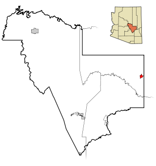
Cibecue is a census-designated place (CDP) in Navajo County, Arizona, United States, on the Fort Apache Indian Reservation. The population was 1,713 in the 2010 United States Census.

East Fork is a census-designated place (CDP) in Navajo County, Arizona, United States, on the Fort Apache Indian Reservation. The population was 699 at the 2010 census.

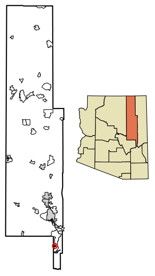
Whiteriver is a census-designated place (CDP) located on the Fort Apache Indian Reservation in Navajo County, Arizona, United States. The population was 4,104 at the 2010 census, making it the largest settlement on the Reservation.

Camp Verde is a town in Yavapai County, Arizona, United States. As of the 2010 census, the population of the town is 10,873.

The Fort Apache Indian Reservation is an Indian reservation in Arizona, United States, encompassing parts of Navajo, Gila, and Apache counties. It is home to the federally recognized White Mountain Apache Tribe of the Fort Apache Reservation, a Western Apache tribe. It has a land area of 1.6 million acres and a population of 12,429 people as of the 2000 census. The largest community is in Whiteriver.

Bylas is an unincorporated community and census-designated place in Graham County, Arizona, United States, located within the San Carlos Apache Indian Reservation. As of the 2010 census, its population was 1,962. The community has a medical clinic, a police substation, and a market. Bylas is an Apache settlement divided into two communities, one of the White Mountain Apache, the other of San Carlos and Southern Tonto Apache. It is named for Bylas a chief of the Eastern White Mountain Apache band.

Fort Apache is an unincorporated community in Navajo County, Arizona, United States. Today's settlement of Fort Apache incorporates elements of the original U.S. Cavalry post Fort Apache, and lies within the Fort Apache Indian Reservation, home of the White Mountain Apache Tribe, 2 miles (3.2 km) east of Canyon Day. Fort Apache has a post office with ZIP code 85926.

Carrizo is a census-designated place in Gila County, Arizona, United States, located on the Fort Apache Indian Reservation.

Cornfields is a chapter of the Navajo Nation and a census-designated place (CDP) in Apache County, Arizona, United States. The population was 255 at the 2010 census.
Del Muerto is a census-designated place (CDP) in Apache County, Arizona, United States. The population was 329 at the 2010 census.
Oak Springs is a census-designated place (CDP) in Apache County, Arizona, United States. The population was 63 at the 2010 census.

Cedar Creek is a census-designated place in Gila County, Arizona, United States, on the Fort Apache Indian Reservation. Cedar Creek is located along Arizona State Route 73. The population in 2010 was 318.
Hondah is a census-designated place (CDP) in Navajo County, Arizona, United States, on the Fort Apache Indian Reservation. The population was 812 at the 2010 census.
Rainbow City is a census-designated place in Navajo County, in the U.S. state of Arizona, on the Fort Apache Indian Reservation. The population was 968 at the 2010 census.

Seven Mile is a census-designated place in Navajo County, in the U.S. state of Arizona, on the Fort Apache Indian Reservation. The population was 707 at the 2010 census.


