Virginia Peak (Wyoming)

Last updated
Virginia Peak
Henderson overlook.jpg
Northeast aspect
Highest point
Elevation 10,141 ft (3,091 m) [1] [2]
Prominence 641 ft (195 m) [1]
Parent peak Man Peak (10,326 ft) [1]
Isolation 2.88 mi (4.63 km) [1]
Coordinates 42°56′05″N110°47′12″W / 42.9348578°N 110.7867454°W / 42.9348578; -110.7867454 [3]
Geography
USA Wyoming relief location map.svg
Red triangle with thick white border.svg
Virginia Peak
Location in Wyoming
Usa edcp relief location map.png
Red triangle with thick white border.svg
Virginia Peak
Virginia Peak (the United States)
CountryUnited States
State Wyoming
County Lincoln
Protected area Bridger–Teton National Forest
Parent range Rocky Mountains
Salt River Range
Topo map USGS Man Peak
Climbing
Easiest route class 1 hiking [1]

Virginia Peak is a 10,141-foot-elevation (3,091-meter) mountain summit in Lincoln County, Wyoming, United States. [3]

Contents

Description

Virginia Peak is set in the Salt River Range which is a subrange of the Rocky Mountains. [2] It is located 19 miles (31 km) south-southeast of Alpine, Wyoming, on land managed by Bridger–Teton National Forest. Precipitation runoff from the mountain drains into the Greys River and topographic relief is significant as the summit rises 3,700 feet (1,100 meters) above the river in two miles (3.2 km). The mountain's toponym has been officially adopted by the United States Board on Geographic Names. [3]

Climate

According to the Köppen climate classification system, Virginia Peak is located in an alpine subarctic climate zone with long, cold, snowy winters, and cool to warm summers. [4] Due to its altitude, it receives precipitation all year, as snow in winter and as thunderstorms in summer.

See also

Related Research Articles

<span class="mw-page-title-main">Sharkstooth Peak</span> Mountain in the state of Colorado

Sharkstooth Peak is a 12,468-foot-elevation (3,800-meter) mountain summit in Montezuma County, Colorado.

<span class="mw-page-title-main">Bannock Peak</span> Mountain in Wyoming, United States

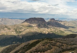
Bannock Peak is a 10,329-foot (3,148-metre) mountain summit in the southern section of the Gallatin Range in Yellowstone National Park, in the U.S. state of Wyoming. The peak ranks as the sixth-highest peak in the Gallatin Range. Precipitation runoff from the mountain drains west into headwaters of the Gallatin River and east into Panther Creek which is a tributary of the Gardner River. Topographic relief is significant as the summit rises nearly 2,000 feet above Panther Creek in one mile (1.6 km). This mountain's toponym was officially adopted in 1897 by the United States Board on Geographic Names.

<span class="mw-page-title-main">Tower Mountain (Colorado)</span> Mountain in Colorado, United States

Tower Mountain, elevation 13,558 ft (4,132 m), is a summit located northeast of Silverton, Colorado.

<span class="mw-page-title-main">Gilpin Peak</span> Mountain in the state of Colorado

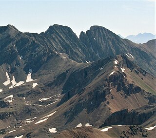
Gilpin Peak is a high mountain summit in the Sneffels Range of the Rocky Mountains of North America. The 13,700-foot (4,176 m) thirteener is located in the Mount Sneffels Wilderness of Uncompahgre National Forest, 3.5 miles (5.6 km) north-northeast of the Town of Telluride, Colorado, United States, on the drainage divide between Ouray County and San Miguel County. Gilpin Peak was named in honor of William Gilpin, the first Governor of the Territory of Colorado.

<span class="mw-page-title-main">Snowdon Peak</span> Mountain in Colorado, United States

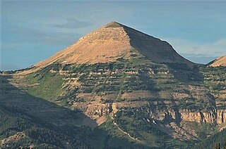
Snowdon Peak is a 13,077-foot-elevation (3,986-meter) mountain summit located in San Juan County, Colorado, United States. It is situated seven miles south of the community of Silverton, in the Weminuche Wilderness, on land managed by San Juan National Forest. It is part of the San Juan Mountains range which is a subset of the Rocky Mountains of North America, and is set nine miles west of the Continental Divide. Topographic relief is significant as the east aspect rises 4,300 feet above the Animas River in approximately 1.5 mile. Neighbors include Mount Garfield three miles to the east-southeast, and Twilight Peak, which is the nearest higher peak, 3.7 miles to the south-southwest. This mountain can be seen from U.S. Route 550. The mountain is named after Snowdon, the highest mountain in Wales.

<span class="mw-page-title-main">Ramshorn Peak</span> Mountain in Wyoming, United States

Ramshorn Peak is an 11,635-foot-elevation (3,546-meter) mountain summit located in Fremont County of Wyoming, United States.

<span class="mw-page-title-main">Silvertip Peak (Wyoming)</span> Mountain in the American state of Wyoming

Silvertip Peak is a 10,645-foot-elevation (3,245-meter) mountain summit located in Park County, Wyoming, United States.

<span class="mw-page-title-main">Babcock Peak</span> Mountain in the American state of Colorado

Babcock Peak is a 13,161-foot-elevation (4,011-meter) mountain summit in La Plata County, Colorado.

<span class="mw-page-title-main">Sunshine Mountain (Hinsdale County, Colorado)</span> Mountain in the American state of Colorado

Sunshine Mountain is a 13,329-foot-elevation (4,063-meter) summit in Hinsdale County, Colorado, United States.

<span class="mw-page-title-main">Whitecross Mountain</span> Mountain in the American state of Colorado

Whitecross Mountain is a 13,553-foot-elevation (4,131-meter) summit in Hinsdale County, Colorado, United States.

<span class="mw-page-title-main">Ladd Peak</span> Mountain in Wyoming, United States

Ladd Peak is a 12,967-foot-elevation (3,952-meter) mountain summit in Sublette County, Wyoming, United States.

<span class="mw-page-title-main">Darwin Peak</span> Mountain in Wyoming, United States

Darwin Peak is an 11,647-foot-elevation (3,550-meter) mountain summit in Teton County, Wyoming, United States.

<span class="mw-page-title-main">Hodges Peak</span> Mountain in Wyoming, United States

Hodges Peak is an 11,180-foot-elevation (3,408-meter) mountain summit in Sublette County, Wyoming, United States.

<span class="mw-page-title-main">Hobbs Peak (Wyoming)</span> Mountain in Wyoming, United States of America

Hobbs Peak is an 11,663-foot-elevation (3,555-meter) mountain summit in Fremont County, Wyoming, United States.

<span class="mw-page-title-main">Pinnacle Buttes</span> Mountain in Wyoming, United States

Pinnacle Buttes is an 11,516-foot-elevation (3,510-meter) mountain summit located in Fremont County, Wyoming, United States.

<span class="mw-page-title-main">Grandjean Peak</span> Mountain in Idaho, United States

Grandjean Peak is a 9,180-foot-elevation (2,798-meter) mountain summit in Boise County, Idaho, United States.

<span class="mw-page-title-main">Man Peak</span> Mountain in Wyoming, United States

Man Peak is a 10,326-foot-elevation (3,147-meter) mountain summit in Lincoln County, Wyoming, United States.

<span class="mw-page-title-main">Loaf Mountain</span> Mountain in Wyoming, United States

Loaf Mountain is a 11,722-foot-elevation (3,573-meter) summit in Johnson County, Wyoming, United States.

<span class="mw-page-title-main">Indian Peak (Wyoming)</span> Mountain in Wyoming, United States

Indian Peak is a 10,929-foot-elevation (3,331-meter) mountain summit in Park County, Wyoming, United States.

<span class="mw-page-title-main">Beaver Mountain (Wyoming)</span> Mountain in Wyoming, United States

Ramshorn Peak is a 9,851-foot-elevation (3,003-meter) summit in Teton County, Wyoming, United States.

References

  1. 1 2 3 4 5 "Virginia Peak - 10,141' WY". listsofjohn.com. Retrieved 2023-10-06.
  2. 1 2 "Virginia Peak, Wyoming". Peakbagger.com. Retrieved 2023-10-06.
  3. 1 2 3 "Virginia Peak". Geographic Names Information System . United States Geological Survey, United States Department of the Interior . Retrieved 2023-10-06.
  4. Peel, M. C.; Finlayson, B. L.; McMahon, T. A. (2007). "Updated world map of the Köppen−Geiger climate classification". Hydrol. Earth Syst. Sci. 11. ISSN   1027-5606.