Woopen Creek, Queensland

Last updated

Woopen Creek
Queensland
Woopen Creek Road, Woopen Creek, 2018.jpg
Woopen Creek Road, Woopen Creek, 2018
Australia Queensland location map.svg
Red pog.svg
Woopen Creek
Woopen Creek, Queensland
Coordinates 17°28′22″S145°52′33″E / 17.4727°S 145.8758°E / -17.4727; 145.8758 (Woopen Creek (centre of locality))
Population141 (2016 census) [1]
 • Density5.281/km2 (13.68/sq mi)
Postcode(s) 4871
Elevation10–404 m (33–1,325 ft)
Area26.7 km2 (10.3 sq mi)
Time zone AEST (UTC+10:00)
Location
LGA(s) Cairns Region
State electorate(s) Hill
Federal division(s) Kennedy
Suburbs around Woopen Creek:
Wooroonooran Bartle Frere Eubenangee
Waugh Pocket
Wooroonooran Woopen Creek Ngatjan
Wooroonooran Ngatjan Ngatjan

Woopen Creek is a rural locality in the Cairns Region, Queensland, Australia. [2] In the 2016 census, Woopen Creek had a population of 141 people. [1]

Contents

Geography

Russell River, boundary between Woopen Creek (foreground) and Bartle Frere (background), 2018 Russell River, boundary between Woopen Creek (foreground) and Bartle Frere (background), 2018 02.jpg
Russell River, boundary between Woopen Creek (foreground) and Bartle Frere (background), 2018
Banana farming along Woopen Creek Road, Woopen Creek, 2018 Banana farming along Woopen Creek Road, Woopen Creek, 2018.jpg
Banana farming along Woopen Creek Road, Woopen Creek, 2018

The Russell River forms the northern boundary of the locality while mountainous regions form its other boundaries. There are two flatter valleys formed by Woopen Creek in the southern part of locality and Vorris Creek in the northern part of the locality. Although the land is predominantly freehold, only the flatter valleys are developed for use for agriculture while the more mountainous areas remain undeveloped. The principal agricultural use is growing sugarcane and bananas. [3]

Although the Bruce Highway does not pass through the locality,

Mount Mirinjo ( 17°30′18″S145°51′50″E / 17.505°S 145.8638°E / -17.505; 145.8638 (Mount Mirinjo) ) in the Francis Range is in the southernmost part of locality, close to the boundary with Ngatjan. It is 404 metres (1,325 ft) above sea level compared with approximately 10 metres (33 ft) above sea level at the northernmost part of the locality. [4]

History

By 1940, residents of Woopen Creek had agitated for some years to have a school in their district. [5] In November 1941 tenders were called to erect the school. [6] However, the school was not built at this time, probably because the fear of a Japanese invasion in 1942 resulted in the closure of schools in coastal areas and reserving all construction materials exclusively for military purposes. [7] [8] In March 1951 residents made another attempt to establish a school at Woopen Creek. [9] [10] In 1951 the Queensland Government decided relocate the school building from Nerada State School (which closed in 1945) to establish Woopen Creek State School. [11] The school opened on 4 February 1952. It closed on 8 December 1967. [12]

In 2005 the Broken Nose Vanilla farm was established, an example of a wider trend of diversifying the agriculture of the Cairns region. [13] [14]

In the 2016 census, Woopen Creek had a population of 141 people. [1]

Education

There are no schools in Woopen Creek. The nearest primary schools are Bartle Frere State School in neighbouring Bartle Frere to the north and Mirriwinni State School in Mirriwinni to the north-east. The nearest secondary school is Babinda State School (Prep-12) in Babinda to the north-east. [3]

Related Research Articles

<span class="mw-page-title-main">Gordonvale, Queensland</span> Suburb of Cairns, Queensland, Australia

Gordonvale is a rural sugar-growing town and locality situated on the southern side of Cairns in the Cairns Region, Queensland, Australia. In the 2021 census, the locality of Gordonvale had a population of 6,944 people.

<span class="mw-page-title-main">Edmonton, Queensland</span> Suburb of Cairns, Queensland, Australia

Edmonton is a town and suburb in the Cairns Region, Queensland, Australia. In the 2016 census, Edmonton had a population of 10,753 people.

<span class="mw-page-title-main">Babinda</span> Suburb of Cairns, Queensland, Australia

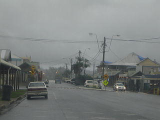
Babinda is a rural town and locality in the Cairns Region, Queensland, Australia. In the 2016 census, the locality of Babinda had a population of 1,253 people.

<span class="mw-page-title-main">Aloomba, Queensland</span> Town in Queensland, Australia

Aloomba is a town and a locality in the Cairns Region, Queensland, Australia. In the 2016 census, Aloomba had a population of 529 people.

<span class="mw-page-title-main">Millaa Millaa, Queensland</span> Town in Queensland, Australia

Millaa Millaa is a rural town and locality in the Tablelands Region, Queensland, Australia. In the 2016 census, the locality of Millaa Millaa had a population of 514 people.

<span class="mw-page-title-main">Holloways Beach, Queensland</span> Suburb of Cairns, Queensland, Australia

Holloways Beach is a residential coastal suburb of Cairns, Queensland, Australia. In the 2021 census, Holloways Beach had a population of 2,398 people. II is located about 10 kilometres north of the city of Cairns between the suburbs of Machans Beach and Yorkeys Knob.

<span class="mw-page-title-main">Lake Eacham, Queensland</span> Suburb of Tablelands Region, Queensland, Australia

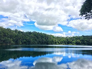
Lake Eacham is a rural locality in the Tablelands Region, Queensland, Australia. In the 2021 census, Lake Eacham had a population of 459 people.

<span class="mw-page-title-main">Mirriwinni, Queensland</span> Town in Queensland, Australia

Mirriwinni is a rural town and locality in the Cairns Region, Queensland, Australia. The spelling Miriwinni has also been used historically, but Mirriwinni is the official spelling from 8 October 2010. In the 2016 census, the locality of Mirriwinni had a population of 447 people.

<span class="mw-page-title-main">Bartle Frere, Queensland</span> Suburb of Cairns Region, Queensland, Australia

Bartle Frere is a rural locality in the Cairns Region, Queensland, Australia. In the 2021 census, Bartle Frere had a population of 169 people.

<span class="mw-page-title-main">Fishery Falls, Queensland</span> Suburb of Cairns Region, Queensland, Australia

Fishery Falls is a locality in the Cairns Region, Queensland, Australia. In the 2021 census, Fishery Falls had a population of 205 people.

<span class="mw-page-title-main">Eubenangee, Queensland</span> Suburb of Cairns Region, Queensland, Australia

Eubenangee is a coastal locality split between the Cairns Region and the Cassowary Coast Region, Queensland, Australia. In the 2016 census, the population of Eubenangee was 242 people.

Coorumba is a rural locality in the Cassowary Coast Region, Queensland, Australia. In the 2016 census, Coorumba had a population of 121 people.

<span class="mw-page-title-main">Peeramon</span> Town in Queensland, Australia

Peeramon is a rural town and locality in the Tablelands Region, Queensland, Australia. In the 2016 census, the locality of Peeramon had a population of 628 people.

<span class="mw-page-title-main">Wooroonooran, Queensland</span> Suburb of Cairns Region, Queensland, Australia

Wooroonooran is an undeveloped locality split among the Cairns Region, the Cassowary Coast Region and the Tablelands Region in Queensland, Australia. In the 2021 census, Wooroonooran had a population of 4 people.

<span class="mw-page-title-main">Waugh Pocket</span> Suburb of Cairns Region, Queensland, Australia

Waugh Pocket is a locality in the Cairns Region, Queensland, Australia. In the 2021 census, Waugh Pocket had a population of 46 people.

Moregatta is a rural locality in the Tablelands Region, Queensland, Australia. In the 2021 census, Moregatta had a population of 62 people.

Nerada is a rural locality in the Cassowary Coast Region, Queensland, Australia. In the 2021 census, Nerada had a population of 88 people.

<span class="mw-page-title-main">Middlebrook, Queensland</span> Suburb of Tablelands Region, Queensland, Australia

Middlebrook is a rural locality in the Tablelands Region, Queensland, Australia. In the 2021 census, Middlebrook had a population of 62 people.

<span class="mw-page-title-main">Babinda Boulders</span> Public recreation area within Wooroonooran National Park, Australia

Babinda Boulders, officially called the Boulders Scenic Reserve but known locally as Babinda Boulders or simply the Boulders, is a public recreation reserve alongside Babinda Creek, managed by the Cairns Regional Council and adjacent to the Wooroonooran National Park in far north Queensland, Australia.

References

  1. 1 2 3 Australian Bureau of Statistics (27 June 2017). "Woopen Creek (SSC)". 2016 Census QuickStats. Retrieved 20 October 2018. OOjs UI icon edit-ltr-progressive.svg
  2. "Woopen Creek – locality in Cairns Region (entry 48941)". Queensland Place Names. Queensland Government . Retrieved 18 September 2020.
  3. 1 2 "Queensland Globe". State of Queensland . Retrieved 1 October 2020.
  4. "Mount Mirinjo – mountain in Cairns Regional (entry 22263)". Queensland Place Names. Queensland Government . Retrieved 18 September 2020.
  5. "BARTLE FRERE NOTES". Cairns Post . No. 12, 030. Queensland, Australia. 9 September 1940. p. 8. Archived from the original on 1 October 2020. Retrieved 1 October 2020 via National Library of Australia.
  6. "Advertising". Cairns Post . No. 12, 405. Queensland, Australia. 24 November 1941. p. 1. Retrieved 1 October 2020 via National Library of Australia.
  7. "Children in wartime". Queensland WWII Historic Places. Queensland Government. 30 June 2014. Retrieved 1 October 2020.
  8. "Industry". Queensland WWII Historic Places. Queensland Government. 30 June 2014. Archived from the original on 1 October 2020. Retrieved 1 October 2020.
  9. "BABINDA NOTES". Cairns Post . No. 15, 289. Queensland, Australia. 9 March 1951. p. 7. Archived from the original on 1 October 2020. Retrieved 1 October 2020 via National Library of Australia.
  10. "CHLORINATION OF WATER SUPPLY AT GORDONVALE". Cairns Post . No. 15, 321. Queensland, Australia. 17 April 1951. p. 5. Archived from the original on 1 October 2020. Retrieved 1 October 2020 via National Library of Australia.
  11. "Removal of Nerada School". Cairns Post . No. 15, 500. Queensland, Australia. 12 November 1951. p. 5. Archived from the original on 1 October 2020. Retrieved 1 October 2020 via National Library of Australia.
  12. Queensland Family History Society (2010), Queensland schools past and present (Version 1.01 ed.), Queensland Family History Society, ISBN   978-1-921171-26-0
  13. Sherrington, Matt (20 November 2015). "Vanilla slice of life paying off". North Queensland Register. Retrieved 1 October 2020.
  14. "Cane growers diversify to survive". ABC News . 31 August 2007. Archived from the original on 1 October 2020. Retrieved 1 October 2020.

Further reading

Commons-logo.svg Media related to Woopen Creek, Queensland at Wikimedia Commons