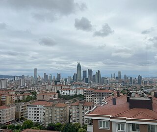
Ümraniye is a municipality and district of Istanbul Province, Turkey. Its area is 46 km2, and its population is 732,379 (2022). It was separated from Üsküdar in 1987. It is bordered by Çekmeköy to the northeast, Sancaktepe to the east, Ataşehir to the south, Üsküdar to the west and Beykoz to the northwest.
Kırıkkale Province is a province of Turkey. It is located on the crossroads of major highways east of Ankara leading east to the Black Sea region. Its area is 4,791 km2, and its population is 277,046 (2022). With its rapid population growth it has become an industrial center. The province was established in 1989 from part of Ankara Province. The provincial capital is Kırıkkale.

Bozdoğan is a municipality and district of Aydın Province, Turkey. Its area is 859 km2, and its population is 32,607 (2022). It is 76 km (47 mi) from the city of Aydın.

Alpu is a municipality and district of Eskişehir Province, Turkey. Its area is 1,028 km2, and its population is 9,966 (2022). The town lies at an elevation of 764 m (2,507 ft).

Beylikova, formerly Beylikahır, is a municipality and district of Eskişehir Province, Turkey. Its area is 715 km2, and its population is 5,781 (2022). The town lies at an elevation of 764 m (2,507 ft).

Günyüzü is a municipality and district of Eskişehir Province, Turkey. Its area is 828 km2, and its population is 5,155 (2022). Its elevation is 871 m (2,858 ft).

İnönü is a municipality and district of Eskişehir Province, Turkey. Its area is 345 km2, and its population is 6,173 (2022). Its elevation is 840 m (2,756 ft).

Han, formerly Hanköy and Hüsrevpaşa, is a municipality and district of Eskişehir Province, Turkey. Its area is 378 km2, and its population is 2,052 (2022). The town lies at an elevation of 1,220 m (4,003 ft).

Mahmudiye is a municipality and district of Eskişehir Province, Turkey. Its area is 659 km2, and its population is 7,575 (2022). The town lies at an elevation of 877 m (2,877 ft).

Mihalgazi is a municipality and district of Eskişehir Province, Turkey. Its area is 109 km2, and its population is 2,987 (2022). The town lies at an elevation of 210 m (689 ft), on the Sakarya River, 35 km north from Eskişehir city. The district borders İnhisar to the west, Yenipazar to the northwest, Sarıcakaya to the east and Tepebaşı to the south. There are hot springs in Sakarıılıca.

Mihalıççık, also Mihalıçcık, is a municipality and district of Eskişehir Province, Turkey. Its area is 1,809 km2, and its population is 7,659 (2022). The elevation is 1,305 m (4,281 ft).

Sarıcakaya is a municipality and district of Eskişehir Province, Turkey. Its area is 382 km2, and its population is 4,621 (2022). The town lies at an elevation of 252 m (827 ft). On August 15, 2023, there was a temperature of 49.5 °C (121.1 °F) recorded in Sarıcakaya, setting the record for the highest temperature ever recorded in Turkey.

Seyitgazi is a municipality and district of Eskişehir Province, Turkey. Its area is 1,578 km2, and its population is 12,587 (2022). The central town of Seyitgazi lies at a distance of 43 km (27 mi) towards the south from the province capital of Eskişehir. The town was known formerly as Nakoleia.

Sivrihisar is a municipality and district of Eskişehir Province, Turkey. Its area is 2,748 km2, and its population is 20,087 (2022). Its elevation is 1,070 m (3,510 ft).

Menderes is a municipality and district of İzmir Province, Turkey. Its area is 777 km2, and its population is 106,173 (2022).

Bozüyük is a city in Bilecik Province in the Marmara region of Turkey. It is the seat of Bozüyük District. Its population is 71,806 (2021), making it the second most populous municipality in the province after Bilecik. Bozüyük depends economically on Eskişehir. The town is 32 km away from Bilecik and 45 km away from Eskişehir. It consists of 10 quarters: Çarşı, Kasımpaşa, Tekke, Yeni, Yediler, 4 Eylül, Yeşilkent, Içköy, Akpınar and Yenidoğan.

Sultangazi is municipality and district of Istanbul Province, Turkey. Its area is 37 km2, and its population is 542,531 (2022). To the west are the neighbourhoods of Esenler and Başakşehir, Gaziosmanpaşa is to the south and Eyüpsultan is to the north and east. One border of the district is formed by the TEM highway.

Odunpazarı is a municipality and district of Eskişehir Province, Turkey. Its area is 1,120 km², and its population is 422,423 (2022), 47% of the provincial population. Odunpazarı District covers the southern part of Greater Eskişehir, including the historic center, and the adjacent countryside.

Tepebaşı is a municipality and district of Eskişehir Province, Turkey. Its area is 1,403 km2, and its population is 384,645 (2022), 42% of the provincial population. The Mayor of Tepebaşı is Ahmet Ataç.

Söğüt District is a district of Bilecik Province of Turkey. Its seat is the town Söğüt. Its area is 523 km2, and its population is 18,352 (2021). It is in the Marmara region in the north-west of the country, bordering Bilecik to the west, Gölpazarı to the north, İnhisar to the north-east, Tepebaşı (Eskişehir) to the south-east, and Bozüyük to the south-west.


