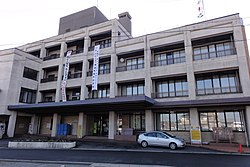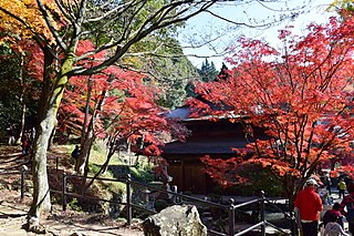
Seto is a city in Aichi Prefecture, Japan. As of 1 October 2019, the city had an estimated population of 127,659 in 56,573 households, and a population density of 1,146 persons per km2. The total area was 111.40 square kilometres (43.01 sq mi).

Kasugai is a city in Aichi Prefecture, Japan. As of 1 October 2019, the city had an estimated population of 306,764, and a population density of 3,306 persons per km2. The total area of the city is 92.78 square kilometres (35.82 sq mi). The city is sometimes called Owarikasugai to avoid confusion with other municipality of the same name, including Kasugai in Yamanashi Prefecture.

Inazawa is a city located in Aichi Prefecture, Japan. As of 1 October 2019, the city had an estimated population of 135,580 in 54,999 households, and a population density of 1,709 inhabitants per square kilometre (4,430/sq mi). The total area of the city was 79.35 km2 (30.64 sq mi).

Tōkai is a city located in Aichi Prefecture, Japan. As of 1 October 2019, the city had an estimated population of 113,698 in 51,035 households, and a population density of 2,618 persons per km2. The total area of the city was 43.43 square kilometres (16.77 sq mi).

Ōbu is a city located in Aichi Prefecture, Japan. As of 1 October 2019, the city had an estimated population of 92,179 in 39,382 households, and a population density of 2,739 persons per km2. The total area of the city is 33.66 square kilometres (13.00 sq mi). Ōbu has been a member of the World Health Organization’s Alliance for Healthy Cities (AFHC) since June 5, 2000.

Owariasahi is a city located in Aichi Prefecture, Japan. As of 1 October 2019, the city had an estimated population of 81,954 in 35,583 households, and a population density of 3,897 persons per km². The total area of the city is 21.03 square kilometres (8.12 sq mi).

Toyoake is a city located in Aichi Prefecture, Japan. As of 1 October 2019, the city had an estimated population of 69,525 in 30,185 households, and a population density of 2,994 persons per km2. The total area of the city is 23.22 square kilometres (8.97 sq mi).

Nisshin is a city in Aichi Prefecture, Japan. As of 1 October 2019, the city had an estimated population of 91,795 in 37,398 households, and a population density of 2,629 persons per km². The total area of the city was 34.91 square kilometres (13.48 sq mi).

Kanie is a town located in Ama District, Aichi Prefecture, Japan. As of 1 October 2019, the town had an estimated population of 37,082 in 16,647 households, and a population density of 3,344 persons per km2. The total area of the town was 11.09 square kilometres (4.28 sq mi).
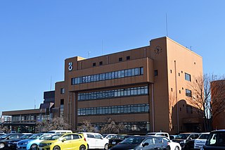
Tōgō is a town located in Aichi District, Aichi Prefecture, Japan. As of 1 October 2019, the town had an estimated population of 44,109 in 17,792 households, and a population density of 2,446 persons per km2. The total area of the town was 18.03 square kilometres (6.96 sq mi).

Nagakute is a city located in Aichi Prefecture, Japan. As of 1 October 2019, the city had an estimated population of 61,503 in 24,352 households, and a population density of 2,854 persons per km2. The total area of the city is 21.55 square kilometres (8.32 sq mi). Nagakute is a member of the World Health Organization’s Alliance for Healthy Cities (AFHC).

Toyoyama is a town located in Nishikasugai District, Aichi Prefecture, Japan. As of 1 October 2019, the town had an estimated population of 15,630 in 6,757 households, and a population density of 2,529 persons per km2. The total area of the town is 6.18 square kilometres (2.39 sq mi).

Tobishima is a village located in Ama District, Aichi Prefecture, in the Tōkai region of Japan. As of 1 October 2019, the town had an estimated population of 4,609 in 1765 households, and a population density of 206 persons per km². The total area of the village was 22.42 square kilometres (8.66 sq mi).
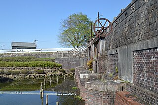
Yatomi is a city located in Aichi Prefecture, Japan. As of December 1, 2019, the city had an estimated population of 44,589 in 18,185 households and a population density of 910 persons per km2. The total area of the city is 49.0 square kilometres (18.9 sq mi). The between of the border, and neighboring town of Kanie.

Agui is a town located in Chita District, Aichi Prefecture, Japan. As of 1 October 2019, the town had an estimated population of 28,291 in 10,682 households, and a population density of 1,189 persons per km². The total area of the town was 23.80 square kilometres (9.19 sq mi).

Taketoyo is a town located in Chita District, Aichi Prefecture, Japan. As of 1 October 2019, the town had an estimated population of 43,147 in 18,392 households, and a population density of 1,636 persons per km2. The total area of the town was 26.38 square kilometres (10.19 sq mi).

Tōei is a town located in Kitashitara District, Aichi Prefecture, Japan. As of 1 October 2019, the town had an estimated population of 3,033 in 1438 households, and a population density of 24.6 persons per km2. The total area of the town was 123.38 square kilometres (47.64 sq mi).

Toyone is a village located in Kitashitara District, Aichi Prefecture, Japan. As of 1 October 2019, the village had an estimated population of 1,031 in 507 households, and a population density of 6.61 persons per km². The total area of the village was 155.88 square kilometres (60.19 sq mi).
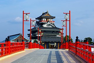
Kiyosu is a city in Aichi Prefecture, Japan. As of 1 October 2019, the city had an estimated population of 69,687 in 29,477 households, and a population density of 4,017 persons per km². The total area of the city is 17.35 square kilometres (6.70 sq mi).

Ama is a city located in Aichi Prefecture, Japan. As of 1 October 2019, the city had an estimated population of 87,651 in 36,997 households, and a population density of 3,188 persons per km². The total area of the city was 27.49 square kilometres (10.61 sq mi). Ama is a member of the World Health Organization’s Alliance for Healthy Cities (AFHC).
