
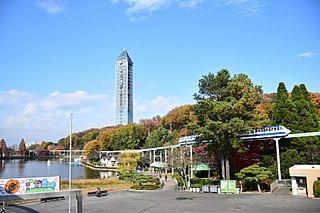
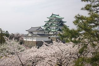
Nagoya is the largest city in the Chūbu region of Japan. It is the fourth-most populous city in Japan, with a population of 2.3 million in 2020, and the principal city of the Chūkyō metropolitan area, which is the third-most populous metropolitan area in Japan with a population of 10.11 million. Located on the Pacific coast in central Honshu, it is the capital and most populous city of Aichi Prefecture, with the Port of Nagoya being Japan's largest seaport.

Aichi is a rural district located just east of Nagoya in central western Aichi Prefecture, Japan.

Minato-ku is one of the 16 wards of the city of Nagoya in Aichi Prefecture, Japan. As of 1 October 2019, the ward had an estimated population of 143,913 and a population density of 3,153 persons per km². The total area was 45.64 km². It is geographically the largest of the wards of Nagoya in terms of land area.
Chikusa is one of the 16 wards of the city of Nagoya in Aichi Prefecture, Japan. As of 1 October 2019, the ward had an estimated population of 165,863 and a population density of 9,123 persons per km². The total area was 18.18 km².
Naka Ward is one of the 16 wards of the city of Nagoya in Aichi Prefecture, Japan. As of 1 October 2019, the ward has an estimated population of 90,918 and a population density of 9,693 persons per km2. The total area is 9.38 km2.

Atsuta is one of the 16 wards of the city of Nagoya in Aichi Prefecture, Japan. As of 1 October 2019, the ward had an estimated population of 66,318 and a population density of 8,088 persons per km2. The total area was 8.20 km2.

Midori-ku is one of the 16 wards of the city of Nagoya in Aichi Prefecture, Japan. As of 1 October 2019, the ward had an estimated population of 247,475 and a population density of 6,528 persons per km2. The total area was 37.91 km2. It is the largest of the wards of Nagoya in terms of population.

Higashi Ward is one of the 16 wards of the city of Nagoya in Aichi Prefecture, Japan. As of 1 October 2011, the ward had an estimated population of 82,939 and a population density of 10,757 persons per km2. The total area was 7.71 km2.

Kita Ward is one of the 16 wards of the city of Nagoya in Aichi Prefecture, Japan. As of 1 October 2019, the ward had an estimated population of 163,555 and a population density of 9,330 persons per km2. The total area was 17.53 km2.

Meitō-ku is one of the 16 wards of the city of Nagoya in Aichi Prefecture, Japan. As of 1 October 2019, the ward had an estimated population of 165,287 and a population density of 8,498 persons per km². The total area was 19.45 km².

Mizuho is one of the 16 wards of the city of Nagoya in Aichi Prefecture, Japan. As of 1 October 2019, the ward had an estimated population of 107,622 and a population density of 9,592 persons per km². The total area was 11.22 km².
Tenpaku is one of the 16 wards of the city of Nagoya in Aichi Prefecture, Japan. As of 1 October 2019, the ward had an estimated population of 164,522, and a population density of 7,624 persons per km². The total area was 21.58 square kilometres (8.33 sq mi).

Minami-ku is one of the 16 wards of the city of Nagoya in Aichi Prefecture, Japan. As of 1 October 2019, the ward had an estimated population of 136,015 and a population density of 7,368 persons per km2. The total area was 18.46 km2.

Moriyama is one of the wards of the city of Nagoya in Aichi Prefecture, Japan. As of 1 October 2019, the ward has an estimated population of 176,298 and a population density of 5,184 inhabitants per square kilometre (13,430/sq mi). The total area is 34.01 km2 (13.13 sq mi).

Chikusa Station is an interchange railway station in Higashi-ku and Chikusa-ku, Nagoya, Aichi Prefecture, Japan, operated by Central Japan Railway Company and the Transportation Bureau City of Nagoya.

Tsurumai Station is an interchange railway station in Naka-ku, Nagoya, Aichi Prefecture, Japan, operated by JR Central and the Nagoya City Transportation Bureau.

Yagoto Station is an underground metro station on the Nagoya Municipal Subway in Shōwa-ku, Nagoya, Aichi Prefecture, Japan, operated by the Transportation Bureau City of Nagoya. The station is located in part of the district of Yagoto.

Hisaya-ōdōri Station is an underground metro station located in Naka-ku, Nagoya, Aichi Prefecture, Japan operated by the Nagoya Municipal Subway. It is an interchange station between the Sakura-dōri Line and the Meijō Line and is located 3.3 rail kilometers from the terminus of the Sakura-dōri Line at Taiko-dori Station and 3.4 rail kilometers from the terminus of the Meijō Line at Kanayama Station.

Yagoto Nisseki Station is an underground metro station located in Shōwa-ku, Nagoya, Aichi Prefecture, Japan operated by the Nagoya Municipal Subway. It is located 16.2 rail kilometers from the terminus of the Meijō Line at Kanayama Station. This station serves Nagoya Daini Red Cross Hospital.

Sakurayama Station is an underground metro station located in Mizuho-ku, Nagoya, Aichi Prefecture, Japan operated by the Nagoya Municipal Subway’s Sakura-dōri Line. It is located 9.5 kilometers from the terminus of the Sakura-dōri Line at Taiko-dori Station.


