Minamichita

Last updated • 2 min readFrom Wikipedia, The Free Encyclopedia
Minamichita
南知多町
Minamichita town-office.jpg
Minamichita Town Hall
Flag of Minamichita Aichi.svg
Emblem of Minamichita, Aichi.svg
Minamichita in Aichi Prefecture Ja.svg
Location of Minamichita in Aichi Prefecture
Japan location map with side map of the Ryukyu Islands.svg
Red pog.svg
Minamichita
 
Coordinates: 34°42′54.5″N136°55′47.4″E / 34.715139°N 136.929833°E / 34.715139; 136.929833
Country Japan
Region Chūbu region
Tōkai region
Prefecture Aichi
District Chita
Area
  Total
38.37 km2 (14.81 sq mi)
Population
 (October 1, 2019)
  Total
17,393
  Density450/km2 (1,200/sq mi)
Time zone UTC+9 (Japan Standard Time)
Phone number0569-65-0711
AddressToyohama, Minamichita-chō, Chita-gun, Aichi-ken 470-3495
Climate Cfa
Website Official website
Symbols
Flower Narcissus
Tree Quercus phillyraeoides (species of Oak)

Minamichita (南知多町, Minamichita-chō) is a town in Chita District, Aichi Prefecture, Japan. As of 1 October 2019, the town had an estimated population of 17,393 in 7338 households, [1] and a population density of 453 persons per km2. The total area of the town was 38.37 square kilometres (14.81 sq mi).

Contents

Geography

Minamichita is located in the extreme southern tip of Chita Peninsula in southern Aichi Prefecture, including a number of islands in Mikawa Bay. The town is bordered by Mikawa Bay to the east, and Ise Bay to the west. Part of the town's area are within the borders of the Mikawa Wan Quasi-National Park.

Neighboring municipalities

Demographics

Per Japanese census data, [2] the population of Minamichita had been declining steadily over the past 70 years.

Historical population
YearPop.±%
1940 22,741    
1950 30,379+33.6%
1960 28,972−4.6%
1970 27,705−4.4%
1980 27,017−2.5%
1990 25,954−3.9%
2000 23,250−10.4%
2010 20,550−11.6%

Climate

The town has a climate characterized by hot and humid summers, and relatively mild winters (Köppen climate classification Cfa). The average annual temperature in Minamichita is 15.7 °C (60.3 °F). The average annual rainfall is 1,550.1 mm (61.03 in) with September as the wettest month. The temperatures are highest on average in August, at around 27.2 °C (81.0 °F), and lowest in January, at around 5.2 °C (41.4 °F). [3]

Climate data for Minamichita (1991−2020 normals, extremes 1979−present)
MonthJanFebMarAprMayJunJulAugSepOctNovDecYear
Record high °C (°F)17.0
(62.6)
21.0
(69.8)
24.4
(75.9)
28.9
(84.0)
32.7
(90.9)
34.8
(94.6)
37.6
(99.7)
38.3
(100.9)
36.1
(97.0)
30.4
(86.7)
25.6
(78.1)
23.1
(73.6)
38.3
(100.9)
Mean daily maximum °C (°F)9.1
(48.4)
10.0
(50.0)
13.5
(56.3)
18.8
(65.8)
23.2
(73.8)
26.1
(79.0)
30.0
(86.0)
31.7
(89.1)
28.0
(82.4)
22.6
(72.7)
16.9
(62.4)
11.6
(52.9)
20.1
(68.2)
Daily mean °C (°F)5.2
(41.4)
5.6
(42.1)
8.7
(47.7)
13.7
(56.7)
18.3
(64.9)
21.9
(71.4)
25.8
(78.4)
27.2
(81.0)
23.8
(74.8)
18.3
(64.9)
12.6
(54.7)
7.6
(45.7)
15.7
(60.3)
Mean daily minimum °C (°F)1.3
(34.3)
1.4
(34.5)
4.1
(39.4)
8.9
(48.0)
13.9
(57.0)
18.5
(65.3)
22.7
(72.9)
23.8
(74.8)
20.5
(68.9)
14.6
(58.3)
8.5
(47.3)
3.6
(38.5)
11.8
(53.3)
Record low °C (°F)−6.5
(20.3)
−7.3
(18.9)
−5.2
(22.6)
−2.7
(27.1)
2.9
(37.2)
9.0
(48.2)
14.6
(58.3)
14.1
(57.4)
8.8
(47.8)
2.7
(36.9)
−2.4
(27.7)
−6.0
(21.2)
−7.3
(18.9)
Average precipitation mm (inches)54.4
(2.14)
59.3
(2.33)
107.7
(4.24)
122.2
(4.81)
159.9
(6.30)
187.7
(7.39)
167.7
(6.60)
106.8
(4.20)
248.7
(9.79)
201.2
(7.92)
77.4
(3.05)
57.2
(2.25)
1,550.1
(61.03)
Average precipitation days (≥ 1.0 mm)5.46.19.29.510.112.310.97.310.510.06.65.9103.8
Mean monthly sunshine hours 181.5176.5199.8205.4206.8155.9193.9241.9174.5170.9167.4175.42,249.9
Source: Japan Meteorological Agency [4] [3]

History

The area of Minamichita was part of Owari Province and controlled by Owari Domain under the Edo period Tokugawa shogunate. It was a major port on the coastal trade route between Edo and Osawa. After the Meiji restoration, it was organized into villages within Chita District, Aichi with the establishment of the modern municipalities system.

The modern town of Minamichita was established on June 1, 1961, through the merger of the towns of Utsumi, Mihama, and Morozaki, and the villages of Shinojima and Himakajima, all within Chita District. During March 2006, discussions were held to merge Minamichita with the town of Mihama to the north to form the new city of “Minamicentrair” after the popular nickname for Chūbu Centrair International Airport, but the merger proposal was strongly opposed by the majority of the inhabitants of Minamichita, and the merger did not take place. [5]

Economy

Utsumi ware ceramic censer in the shape of a standing elephant, grey glaze, Yamadera kiln (1907-1914) Aichi Prefectural Ceramic Museum 2018 (049).jpg
Utsumi ware ceramic censer in the shape of a standing elephant, grey glaze, Yamadera kiln (1907-1914)

The primary sector dominates the economy of Minamichita, notably commercial fishing and agriculture. Secondary industries include food processing, and seasonal tourism to beach resorts.

The Yamadera kiln (山寺窯) was located in Utsumi, today part of Minamichita. The kiln was active in the years Meiji 40 (1907) - Taishō 3 (1914). It produced Utsumi ware (内海焼). [6] [7]

Education

Minamichita has six public elementary schools and five public junior high schools operated by the town government, and one high school operated by the Aichi Prefectural Board of Education.

Transportation

Railway

Meitetsu logomark 2.svg MeitetsuChita New Line

Highways

Seaports

Local attractions

Related Research Articles

<span class="mw-page-title-main">Okazaki, Aichi</span> Core city in Chūbu, Japan

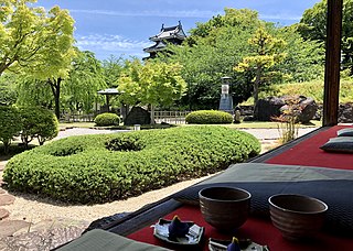
Okazaki is a city located in Aichi Prefecture, Japan. As of 1 October 2019, the city had an estimated population of 386,999 in 164,087 households, and a population density of 999 persons per km². The total area of the city was 387.20 km2 (149.50 sq mi).

<span class="mw-page-title-main">Handa, Aichi</span> City in Chūbu, Japan

Handa is a city located in Aichi Prefecture, Japan. As of 1 October 2019, the city had an estimated population of 118,259 in 51,846 households, and a population density of 2,494 persons per km2. The total area of the city was 47.42 square kilometres (18.31 sq mi).

<span class="mw-page-title-main">Toyota, Aichi</span> Core city in Chūbu, Japan

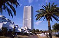
Toyota, formerly known as Koromo, is a city in Aichi Prefecture, Japan. As of 1 October 2019, the city had an estimated population of 426,162 and a population density of 464 people per km2. The total area was 918.32 square kilometres (354.57 sq mi). It is located about 50 minutes from Nagoya by way of the Meitetsu Toyota Line.

<span class="mw-page-title-main">Nishio</span> City in Chūbu, Japan

Nishio is a city located in Aichi Prefecture, in the Chūbu region of Japan. As of 1 October 2019, the city had an estimated population of 169,984 in 65,553 households, with a population density of 1,054 persons per km2. The total area of the city was 160.22 square kilometres (61.86 sq mi). It is a regional commercial and manufacturing center and the country's leading producer of powdered green tea.

<span class="mw-page-title-main">Gamagōri</span> City in Chūbu, Japan

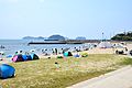
Gamagōri is a city in Aichi Prefecture, Japan. As of 1 October 2019, the city had an estimated population of 80,063 in 32,800 households, and a population density of 1,407 persons per km2. The total area of the city is 56.92 square kilometres (21.98 sq mi).

<span class="mw-page-title-main">Tokoname</span> City in Chūbu, Japan

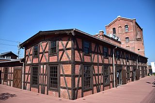
Tokoname is a city in Aichi Prefecture, Japan. As of 1 October 2019, the city had an estimated population of 57,872 in 24,872 households, and a population density of 1,035 persons per km2. The total area of the city is 55.90 square kilometres (21.58 sq mi).

<span class="mw-page-title-main">Shinshiro</span> City in Chūbu, Japan

Shinshiro is a city located in Aichi Prefecture, Japan. As of 1 October 2019, the city had an estimated population of 44,581 in 17,691 households, and a population density of 89.3 persons per km2. The total area of the city is 499.23 square kilometres (192.75 sq mi).

<span class="mw-page-title-main">Tōkai, Aichi</span> City in Chūbu, Japan

Tōkai is a city located in Aichi Prefecture, Japan. As of 1 October 2019, the city had an estimated population of 113,698 in 51,035 households, and a population density of 2,618 persons per km2. The total area of the city was 43.43 square kilometres (16.77 sq mi).

<span class="mw-page-title-main">Tahara, Aichi</span> City in Chūbu, Japan

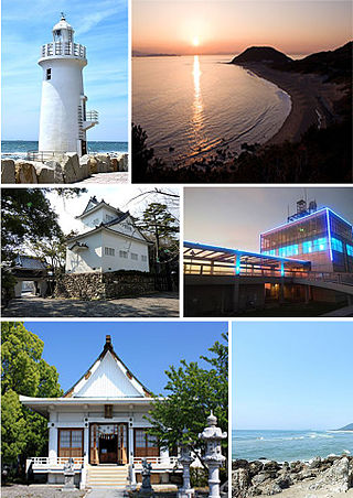
Tahara is a city in Aichi Prefecture, Japan. As of 1 October 2019, the city had an estimated population of 60,206 in 22,576 households, and a population density of 315 persons per km2. The total area of the city is 191.12 square kilometres (73.79 sq mi).

<span class="mw-page-title-main">Aichi Prefecture</span> Prefecture of Japan

Aichi Prefecture is a prefecture of Japan located in the Chūbu region of Honshū. Aichi Prefecture has a population of 7,552,873 and a geographic area of 5,172.92 square kilometres (1,997.28 sq mi) with a population density of 1,460 inhabitants per square kilometre (3,800/sq mi). Aichi Prefecture borders Mie Prefecture to the west, Gifu Prefecture and Nagano Prefecture to the north, and Shizuoka Prefecture to the east. Nagoya is the capital and largest city of the prefecture.

<span class="mw-page-title-main">Mihama, Aichi</span> Town in Japan

Mihama is a town located in Chita District, Aichi Prefecture, Japan. As of 1 October 2019, the town had an estimated population of 22,701 in 8852 households, and a population density of 491 persons per km². The total area of the town was 46.20 square kilometres (17.84 sq mi)

<span class="mw-page-title-main">Chita District</span>

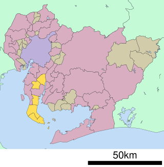
Chita is a district located in southwestern Aichi Prefecture, Japan, on Chita Peninsula.

<span class="mw-page-title-main">Mihama, Fukui</span> Town in Chūbu, Japan

Mihama is a town located in Fukui Prefecture, Japan. As of 1 May 2018, the city had an estimated population of 9,643 in 3175 households and the population density of 63 persons per km2. The total area of the town was 152.35 square kilometres (58.82 sq mi).

<span class="mw-page-title-main">Meitetsu</span> Japanese railway company

Nagoya Railroad Co., Ltd., often abbreviated to as Meitetsu (名鉄), is a private railway company operating around Aichi Prefecture and Gifu Prefecture of Japan. TYO: 9048

<span class="mw-page-title-main">Aga, Niigata</span> Town in Chūbu, Japan

Aga is a town in Niigata Prefecture, Japan. As of 30 November 2020, the town had an estimated population of 10,386 in 4490 households, and a population density of 11 persons per km2. The total area of the town is 952.89 square kilometres (367.91 sq mi).

<span class="mw-page-title-main">Chita Peninsula</span> Peninsula in Aichi Prefecture, Japan

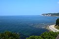
The Chita Peninsula is a peninsula to the south of Aichi Prefecture, central Honshū, Japan. It runs approximately north-south. To the west is Ise Bay, while to the east it encloses Mikawa Bay. It faces the Atsumi Peninsula southeast across Mikawa Bay. Chūbu Centrair International Airport is located off the west coast of the peninsula.

<span class="mw-page-title-main">Kōwa Station</span> Railway station in Mihama, Aichi Prefecture, Japan

Kōwa Station is a train station in the town of Mihama, Chita District, Aichi Prefecture, Japan, operated by Meitetsu.

<span class="mw-page-title-main">Utsumi Station</span> Railway station in Mihamachita, Aichi Prefecture, Japan

Utsumi Station is a train station in the town of Minamichita, Chita District, Aichi Prefecture, Japan, operated by Meitetsu.

<span class="mw-page-title-main">Himakajima</span>

Himakajima (日間賀島) is an inhabited island in Mikawa Bay in Aichi Prefecture, Japan off the coast of the Chita Peninsula, which is administered by the town of Minamichita, Aichi. All of the island is within the borders of the Mikawa-wan Quasi-National Park. It draws many tourists who come to eat the octopus and blowfish caught off the island and prepared there, to enjoy the onsen, to fish, or to spend time on the beach. Per the 2015 Japanese census, the island had a population of 1896 people in 607 households.

<span class="mw-page-title-main">Shinojima</span> Island in Japan

Shinojima (篠島) is an inhabited island in Mikawa Bay on the Pacific coast of Japan. The island is administered as part of the town of Minamichita in Aichi Prefecture, Japan. As of 2015, the island's population was 1,653 inhabitants in 622 households. All of the island is within the borders of the Mikawa-wan Quasi-National Park.

References

  1. Minamichita Town official statistics (in Japanese)
  2. Minamichita population statistics
  3. 1 2 気象庁 / 平年値(年・月ごとの値). JMA . Retrieved April 13, 2022.
  4. 観測史上1~10位の値(年間を通じての値). JMA . Retrieved April 13, 2022.
  5. "美浜町の概要". Mihama official home page (in Japanese). Retrieved 28 December 2015.
  6. "企画展「四代佐七と内海焼」 |TabiChita(タビチタ)|愛知県|知多半島観光圏協議会".
  7. "No. 1939 内田家企画展 「四代佐七と内海焼」 開催中 | 教育長の窓" [No. 1939 Uchida family special exhibition “Fourth generation Sashichi and Utsumi ware” now being held | Superintendent’s window]. minamichita.ed.jp. Archived from the original on 27 October 2020.