Nagoya is the largest city in the Chūbu region of Japan. It is the fourth-most populous city in Japan, with a population of 2.3 million in 2020, and the principal city of the Chūkyō metropolitan area, which is the third-most populous metropolitan area in Japan with a population of 10.11 million. Located on the Pacific coast in central Honshu, it is the capital and most populous city of Aichi Prefecture, with the Port of Nagoya being Japan's largest seaport.

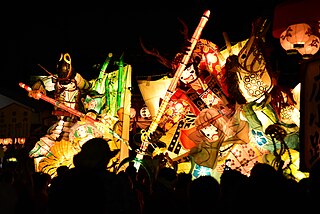
Ichinomiya is a city located in Aichi Prefecture, Japan. The city is sometimes called Owarichinomiya to avoid confusion with other municipalities of the same name, including Ichinomiya and Ichinomiya in Chiba Prefecture. As of 1 October 2019, the city had an estimated population of 379,654 in 161,434 households, and a population density of 3,336 persons per km2. The total area of the city was 113.82 square kilometres (43.95 sq mi).
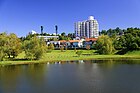
Seto is a city in Aichi Prefecture, Japan. As of 1 October 2019, the city had an estimated population of 127,659 in 56,573 households, and a population density of 1,146 persons per km2. The total area was 111.40 square kilometres (43.01 sq mi).
Kariya is a city in central Aichi Prefecture, Japan. As of 1 October 2019, the city had an estimated population of 153,162 in 66,751 households, and a population density of 3,040 persons per km2. The total area of the city is 50.39 square kilometres (19.46 sq mi).

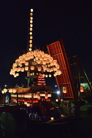
Inuyama is a city in Aichi Prefecture, Japan. As of 1 October 2019, the city had an estimated population of 73,420 in 31,276 households, and a population density of 980 persons per km2. The total area of the city is 74.90 square kilometres (28.92 sq mi). The name of the city literally translates to "Dog Mountain". The name appears in historical records from 1336 AD, but its origin is unknown.
Kōnan is a city located in Aichi Prefecture, Japan. As of 1 October 2019, the city had an estimated population of 97,903 in 41,363 households, and a population density of 3,242 inhabitants per square kilometre (8,400/sq mi). The total area of the city is 30.20 km2 (11.66 sq mi).

Inazawa is a city located in Aichi Prefecture, Japan. As of 1 October 2019, the city had an estimated population of 135,580 in 54,999 households, and a population density of 1,709 inhabitants per square kilometre (4,430/sq mi). The total area of the city was 79.35 km2 (30.64 sq mi).

Tōkai is a city located in Aichi Prefecture, Japan. As of 1 October 2019, the city had an estimated population of 113,698 in 51,035 households, and a population density of 2,618 persons per km2. The total area of the city was 43.43 square kilometres (16.77 sq mi).

Ōbu is a city located in Aichi Prefecture, Japan. As of 1 October 2019, the city had an estimated population of 92,179 in 39,382 households, and a population density of 2,739 persons per km2. The total area of the city is 33.66 square kilometres (13.00 sq mi). Ōbu has been a member of the World Health Organization’s Alliance for Healthy Cities (AFHC) since June 5, 2000.

Owariasahi is a city located in Aichi Prefecture, Japan. As of 1 October 2019, the city had an estimated population of 81,954 in 35,583 households, and a population density of 3,897 persons per km². The total area of the city is 21.03 square kilometres (8.12 sq mi).

Tsushima is a city located in Aichi Prefecture in the Chūbu region of Japan. As of October 1, 2019, the city had an estimated population of 61,647 in 26,559 households, and a population density of 2,457 persons per km². The total area of the city is 25.09 square kilometres (9.69 sq mi).
Kanie is a town located in Ama District, Aichi Prefecture, Japan. As of 1 October 2019, the town had an estimated population of 37,082 in 16,647 households, and a population density of 3,344 persons per km2. The total area of the town was 11.09 square kilometres (4.28 sq mi).

The Battle of Okehazama took place on 12 June 1560 in Owari Province, in today's Aichi Prefecture. In this battle, the heavily outnumbered Oda clan troops, commanded by Oda Nobunaga, defeated Imagawa Yoshimoto and established Oda as one of the front-running warlords in the Sengoku period.

Aichi Prefecture is a prefecture of Japan located in the Chūbu region of Honshū. Aichi Prefecture has a population of 7,552,873 and a geographic area of 5,172.92 square kilometres (1,997.28 sq mi) with a population density of 1,460 inhabitants per square kilometre (3,800/sq mi). Aichi Prefecture borders Mie Prefecture to the west, Gifu Prefecture and Nagano Prefecture to the north, and Shizuoka Prefecture to the east. Nagoya is the capital and largest city of the prefecture.
Tōgō is a town located in Aichi District, Aichi Prefecture, Japan. As of 1 October 2019, the town had an estimated population of 44,109 in 17,792 households, and a population density of 2,446 persons per km2. The total area of the town was 18.03 square kilometres (6.96 sq mi).
Yatomi is a city located in Aichi Prefecture, Japan. As of December 1, 2019, the city had an estimated population of 44,589 in 18,185 households and a population density of 910 persons per km2. The total area of the city is 49.0 square kilometres (18.9 sq mi). The between of the border, and neighboring town of Kanie.

Midori-ku is one of the 16 wards of the city of Nagoya in Aichi Prefecture, Japan. As of 1 October 2019, the ward had an estimated population of 247,475 and a population density of 6,528 persons per km2. The total area was 37.91 km2. It is the largest of the wards of Nagoya in terms of population.

Chūkyō, or the Chūkyō region, is a major metropolitan area in Japan that is centered on the city of Nagoya in Aichi Prefecture. The area makes up the most urbanized part of the Tōkai region. The population of 10,110,000 over an area of 7,072 square kilometers. Nevertheless, like most of Japan's major metro areas, the core of it lies on a fertile alluvial plain, in this case, the Nōbi Plain.

Komaki is a city located in Aichi Prefecture, Japan. As of 1 October 2019, the city had an estimated population of 148,872 in 68,174 households, and a population density of 2,370 inhabitants per square kilometre (6,100/sq mi). The total area of the city was 62.81 square kilometres (24.25 sq mi). Komaki is commonly associated with the former Komaki Airport, which is located on the border between Komaki and neighboring Kasugai.

Ama is a city located in Aichi Prefecture, Japan. As of 1 October 2019, the city had an estimated population of 87,651 in 36,997 households, and a population density of 3,188 persons per km². The total area of the city was 27.49 square kilometres (10.61 sq mi). Ama is a member of the World Health Organization’s Alliance for Healthy Cities (AFHC).