
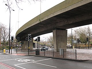
A roundabout is a type of circular intersection or junction in which road traffic is permitted to flow in one direction around a central island, and priority is typically given to traffic already in the junction.

The A41 in the UK is a trunk road between London and Birkenhead. Now, in parts, replaced by motorways, it passes through or near Watford, Kings Langley, Hemel Hempstead, Aylesbury, Bicester, Solihull, Birmingham, West Bromwich, Wolverhampton, Newport, Whitchurch, Chester and Ellesmere Port.

The A38, parts of which are known as Devon Expressway, Bristol Road and Gloucester Road, is a major A-class trunk road in England.

The A45 is a major road in England. It runs east from Birmingham past the National Exhibition Centre and the M42, then bypasses Coventry and Rugby, where it briefly merges with the M45 until it continues to Daventry. It then heads to Northampton and Wellingborough before running north of Rushden and Higham Ferrers and terminating at its junction with the A14 road in Thrapston.

The A500 is a major primary A road in Staffordshire and Cheshire, England. It is dual carriageway for most of its length and connects Nantwich, junctions 16 and 15 of the M6 motorway with the city of Stoke-on-Trent. It is known locally as the D-Road. In 2004 the road was stated as carrying 60,000 vehicles a day through Stoke.

The Big City Plan is a major development plan for the city centre of Birmingham, England.

The A4540 is a Ring Road in Birmingham, England, also known as the Middle Ring Road, or the Middleway. There are proposals to make it a red route. It runs around the centre of the city at a distance of approximately 1 mile (1.6 km). Birmingham City Centre is the area within this ring road. The ring road was planned and designed by Herbert Manzoni. It is now simply known as the Ring Road due to the removal of the old Inner Ring Road.

The A594 Central Ring is the name of Leicester's central distributor road network.

Queensway is the name of a number of roads in central Birmingham, especially those that formed the A4400 Inner Ring Road. The name most often refers to the Great Charles Street Queensway tunnel, part of the A38.

Masshouse is a development site in Birmingham, United Kingdom where 13 highrise blocks are being constructed for public services, commerce and residential purposes. When completed, the blocks will have a prominent position on the Eastside skyline.

Old Square is a public square and road junction in the Core area of Birmingham City Centre, England.
Bricklayers Arms is a road intersection between the A2 and the London Inner Ring Road in Walworth, south London, England. It is the junction of Tower Bridge Road, Old Kent Road, New Kent Road and Great Dover Street and comprises a four-way roundabout with flyover and bypass lane. Eastbound traffic from New Kent Road to Old Kent Road bypasses the roundabout using the flyover and westbound traffic from Old Kent Road to New Kent Road uses the bypass lane.
Birmingham city centre, also known as Central Birmingham and often known locally as town, is the central business district of Birmingham, England. Following the removal of the Inner Ring Road, the city centre is now defined as being the area within the Middle Ring Road. The city centre is undergoing massive redevelopment with the Big City Plan, which means there are now nine emerging districts and the city centre is approximately five times bigger.
Sir Herbert John Baptista Manzoni CBE MICE was a British civil engineer known for holding the position of City Engineer and Surveyor of Birmingham from 1935 until 1963. This position put him in charge of all municipal works and his influence on the city, especially following World War II, completely changed the image of Birmingham.

The Coventry ring road, also known by its road number, A4053, is a 3.62-kilometre (2.25 mi) ring road in Coventry, England, which forms a complete dual-carriageway loop around the city centre. The road's circuit encompasses the old and new Coventry Cathedrals, Coventry University, shopping areas including the Upper and Lower Precincts, West Orchards and Cathedral Lanes, the medieval Spon Street and the Coventry Skydome. With the exception of one at-grade roundabout, the ring road's nine junctions are entirely grade separated and closely spaced, with short weaving sections between them, giving it a reputation for being difficult to navigate. The junctions include connections with three other A roads: the A4114, linking Coventry to the A45, A46, M1 and M40, and also westbound towards Birmingham; and the A4600, which also connects with the A428, A444, M6 and M69; and the A429 to Kenilworth.

The A40 is a major trunk road connecting London to Fishguard, Wales. The A40 in London passes through seven London Boroughs: the City of London, Camden, Westminster, Kensington & Chelsea, Hammersmith & Fulham, Ealing and Hillingdon, to meet the M40 motorway junction 1 at Denham, Buckinghamshire.
Kilkenny Central Access Scheme (CAS), previously Kilkenny Inner Relief Road Scheme is a controversial new road, improvement of existing roads and junctions and a new concrete bridge over the River Nore later named St. Francis Bridge, with provisions for footpaths and cycle lanes throughout. CAS comprises 4.5 kilometers of single carriageway road that is 7.3 metres wide. The scheme proved to be controversial as the route of the completed road will bring heavy traffic through residential areas, also the route will bring heavy traffic through the centre of medieval Irishtown section of the city.

Paradise, formerly named Paradise Circus, is the name given to an area of approximately 7 hectares in Birmingham city centre between Chamberlain and Centenary Squares. The area has been part of the civic centre of Birmingham, England since the 19th century when it contained buildings such as the Town Hall, Mason Science College, Birmingham and Midland Institute buildings and Central Library. The site was redeveloped from 1960 to 1975 into the present Paradise Circus based within a roundabout on the Inner Ring Road system containing a new Central Library and School of Music. From 2015 Argent Group will redevelop the area into new mixed use buildings and public squares.

Ringway Centre or SBQ is a Grade B locally listed building located on Smallbrook Queensway in the city centre of Birmingham, England. The six storey, 230 metres (750 ft) long building was designed by architect, James Roberts as part of the Inner Ring Road scheme in the 1950s and is notable for its gentle sweeping curved elevation along Smallbrook Queensway. Completed in 1962 the building originally named the Ringway Centre was the first part of the Inner Ring Road scheme to be completed and the only part with street level shops and footways. The building currently provides office space on its upper floors and commercial space at street level.

Road building was central to planning policy for much of the 20th century in Bristol, England. The planned road network evolved over time but at its core was a network of concentric ring roads and high-capacity radial roads.
