
Ballymagorry or Ballymagory is a small village and townland in County Tyrone, Northern Ireland. It is west of Artigarvan and 5 kilometres (3.1 mi) north of Strabane. In the 2001 Census it had a population of 565. It lies within the Strabane District Council area and lies on the River Glenmornan.
Barmeen is a townland in County Antrim, Northern Ireland. It is located at the foot of Glendun, one of the nine Glens of Antrim, west of Cushendun and north of Knocknacarry. It is situated in the historic barony of Cary and the civil parish of Culfeightrin and covers 59 acres.
Groggan is a hamlet and townland near Randalstown in County Antrim, Northern Ireland. It is situated in the historic barony of Toome Upper and the civil parish of Drummaul and covers an area of 620 acres. It is within the Borough of Antrim.
Mullaghboy is a small village and townland on Islandmagee in County Antrim, Northern Ireland. It is situated in the civil parish of Islandmagee and the historic barony of Belfast Lower. It is within the Larne Borough Council area. It had a population of 364 people in the 2011 Census..
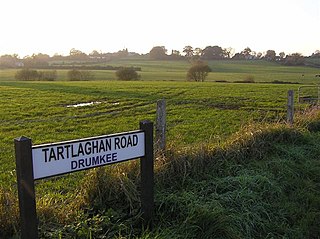
Drumkee is a townland in the southeast of County Tyrone, Northern Ireland. It is directly south of the area presently known as Coalisland and east, and slightly north, of Dungannon. It is situated in the historic barony of Dungannon Middle and the civil parish of Killyman and covers an area of 285 acres. The barony's tax records dated 1666 list two families living in Drumkee.
Ballymully Glebe is a townland in County Tyrone, Northern Ireland. It is situated in the historic barony of Dungannon Upper and the civil parish of Desertcreat and covers an area of 144 acres.
Acravally is a townland in County Antrim, Northern Ireland. It is situated in the historic barony of Cary and the civil parish of Culfeightrin and covers an area of 31 acres.

Aghaboy is a townland in County Antrim, Northern Ireland. It is situated in the historic barony of Toome Upper and the civil parish of Drummaul and covers an area of 286 acres

Aghaloughan is a townland in County Antrim, Northern Ireland. It is situated in the historic barony of Toome Upper and the civil parish of Drummaul and covers an area of 286 acres

Aghancrossy is a townland in County Antrim, Northern Ireland, near Dervock. It is situated in the historic barony of Dunluce Lower and the civil parish of Derrykeighan and covers an area of 55 acres

Aghanliss is a townland in County Antrim, Northern Ireland. It is situated in the historic barony of Massereene Upper and the civil parish of Ballinderry and covers an area of 341 acres
Altigarron is a townland in County Antrim, Northern Ireland. It is situated in the historic barony of Belfast Upper and the civil parish of Shankill and covers an area of 694 acres
Antynanum is a townland in County Antrim, Northern Ireland. It is situated in the historic barony of Antrim Lower and the civil parish of Racavan and covers an area of 450 acres.

Appletee is a townland in County Antrim, Northern Ireland. It is situated in the historic barony of Antrim Lower and the civil parish of Connor and covers an area of 226 acres.
Artibrannan is a townland in County Antrim, Northern Ireland, near Ballymena. It is situated in the historic barony of Toome Lower and the civil parishes of Ahoghill and Craigs and covers an area of 112 acres.

Aughalish is a townland in County Antrim, Northern Ireland. It is situated in the historic barony of Toome Upper and the civil parish of Drummaul and covers an area of 93 acres.

Ballaghbeddy is a townland of 164 acres in County Antrim, Northern Ireland, near Ballymoney. It is situated in the historic barony of Kilconway and the civil parish of Finvoy, on the eastern bank of the River Bann which forms the western boundary of the parish of Finvoy.

Ballinlea Upper is a townland in County Antrim, Northern Ireland, near to Straid. It is situated in the historic barony of Cary and the civil parish of Ballintoy and covers an area of 280 acres

Oughtboy is a townland in County Tyrone, Northern Ireland. It is situated in the barony of Strabane Upper and the civil parish of Bodoney Upper and covers an area of 964 acres.
Drummaul is a townland and civil parish in County Antrim, Northern Ireland. It is situated in the historic barony of Toome Upper and contains the town of Randalstown.


