Chesterfield Township | |
|---|---|
 | |
 Location of Illinois in the United States | |
| Coordinates: 39°13′N90°5′W / 39.217°N 90.083°W | |
| Country | United States |
| State | Illinois |
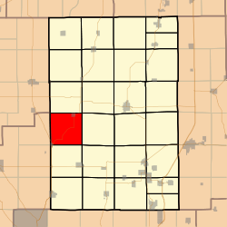
| County | Macoupin |
| Settled | November 1, 1870 |
| Area | |
• Total | 35.7 sq mi (92 km2) |
| • Land | 35.67 sq mi (92.4 km2) |
| • Water | 0.03 sq mi (0.078 km2) |
| Elevation | 571 ft (174 m) |
| Population (2020) | |
• Total | 744 |
| 823 | |
| • Density | 24/sq mi (9.3/km2) |
| Time zone | UTC-6 (CST) |
| • Summer (DST) | UTC-5 (CDT) |
| FIPS code | 17-117-13178 |
Chesterfield Township (T9N R9W) is located in Macoupin County, Illinois, United States. As of the 2010 census, its population was 855 and it contained 380 housing units. [2]
