Draper, Queensland

Last updated

Draper
Queensland
Broad Bridge 2023.jpg
Broad Bridge, 2023
Australia Queensland location map.svg
Red pog.svg
Draper
Draper, Queensland
Coordinates 27°21′29″S152°55′01″E / 27.3580°S 152.9169°E / -27.3580; 152.9169 (Draper (centre of locality))
Population676 (2016 census) [1]
 • Density71.2/km2 (184.3/sq mi)
Postcode(s) 4520
Area9.5 km2 (3.7 sq mi)
Time zone AEST (UTC+10:00)
Location
LGA(s) City of Moreton Bay
State electorate(s) Pine Rivers
Federal division(s) Dickson
Suburbs around Draper:
Closeburn Clear Mountain Eatons Hill
Yugar Draper Bunya
Samford Valley Samford Valley Ferny Hills

Draper is a rural residential locality in the City of Moreton Bay, Queensland, Australia. [2] In the 2016 census, Draper had a population of 676 people. [1]

Contents

Geography

Part of the southern boundary is marked by the South Pine River while the northern boundary follows Cedar Creek. [3]

Drapers Crossing is a ford ( 27°21′01″S152°55′07″E / 27.3502°S 152.9186°E / -27.3502; 152.9186 (Drapers Crossing) ) over the South Pine River. [4]

Eatons Crossing is a ford ( 27°20′41″S152°54′40″E / 27.3448°S 152.9112°E / -27.3448; 152.9112 (Eatons Crossing) ) over Cedar Creek. [5]

The land use is predominantly large-lot residential with some areas of farming, mostly grazing on native vegetation. [3]

History

The locality is named after settler Jacob Draper. He was born in Wiltshire, England in 1841. He immigrated to Moreton Bay in 1861. He died at Bunya in 1913. [2] Drapers Crossing is also named after him. [4]

In the 2011 census, Draper recorded a population of 653 people, 50.4% female and 49.6% male. [6] The median age of the Draper population was 39 years, 2 years above the national median of 37. 76.6% of people living in Draper were born in Australia. The other top responses for country of birth were England 5.2%, South Africa 3.4%, New Zealand 2.5%, Scotland 1.7%, Canada 1.2%. 93.1% of people spoke only English at home; the next most common languages were 1.2% Afrikaans, 0.5% Dutch, 0.5% German, 0.5% French, 0.5% Italian. [6]

In the 2016 census, Draper had a population of 676 people. [1]

Education

There are no schools in Draper. The nearest primary schools are Samford State School in Samford Village to the south-west, Eatons Hill State School in neighbouring Eatons Hill to the north-east, and Patrick Road State School in neighbouring Ferny Hills to the south-east. The nearest secondary schools are Ferny Grove State High School in Ferny Grove to the south and Albany Creek State High School in Albany Creek to the east. [3]

Amenities

There are a number of parks in Draper, including:

Related Research Articles

<span class="mw-page-title-main">Mount Glorious</span> Suburb of City of Moreton Bay, Queensland, Australia

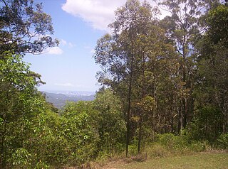
Mount Glorious is a rural locality in the City of Moreton Bay, Queensland, Australia. In the 2016 census, Mount Glorious had a population of 296 people.

<span class="mw-page-title-main">Warner, Queensland</span> Suburb of City of Moreton Bay, Queensland, Australia

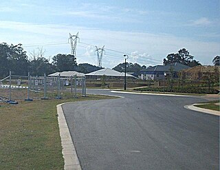
Warner is a suburb in the City of Moreton Bay, Queensland, Australia. In the 2016 census, Warner had a population of 11,411 people.

<span class="mw-page-title-main">Eatons Hill, Queensland</span> Suburb of City of Moreton Bay, Queensland, Australia

Eatons Hill is a suburb in the City of Moreton Bay, Queensland, Australia. In the 2016 census, Eatons Hill had a population of 7,973 people. Its postcode is 4037.

<span class="mw-page-title-main">Albany Creek</span> Suburb of Moreton Bay, Queensland, Australia

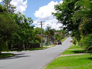
Albany Creek is a southern suburb in the City of Moreton Bay, Queensland, Australia. In the 2021 census, Albany Creek had a population of 16,385.

<span class="mw-page-title-main">Springfield, Queensland</span> Suburb of City of Ipswich, Queensland, Australia

Springfield is a suburb in the City of Ipswich, Queensland, Australia. In the 2021 census, Springfield had a population of 7,322 people.

<span class="mw-page-title-main">Dayboro, Queensland</span> Town in Queensland, Australia

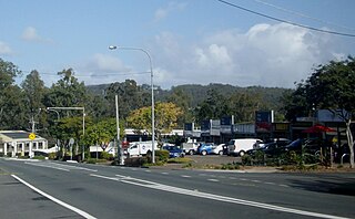
Dayboro is a rural town and locality in the City of Moreton Bay, Queensland, Australia. In the 2016 census, the locality of Dayboro had a population of 2,119 people.

<span class="mw-page-title-main">Ferny Grove, Queensland</span> Suburb of Brisbane, Queensland, Australia

Ferny Grove is an outer north-western suburb in the City of Brisbane, Queensland, Australia. In the 2016 census, Ferny Grove had a population of 5,725 people.

<span class="mw-page-title-main">Bray Park, Queensland</span> Suburb of Moreton Bay, Queensland, Australia

Bray Park is a suburb in the City of Moreton Bay, Queensland, Australia. In the 2016 census, Bray Park had a population of 10,246 people.

<span class="mw-page-title-main">Nudgee Beach, Queensland</span> Suburb of Brisbane, Queensland, Australia

Nudgee Beach is a suburb and beach in the City of Brisbane, Queensland, Australia. In the 2016 census, the suburb had a population of 263 people.

<span class="mw-page-title-main">Arana Hills, Queensland</span> Suburb of Moreton Bay, Queensland, Australia

Arana Hills is a suburb in Division 10 of the City of Moreton Bay, Queensland, Australia. In the 2016 census, Arana Hills had a population of 6,810 people.

Bunya is a suburb in the City of Moreton Bay, Queensland, Australia. In the 2016 census, Bunya had a population of 1,916 people.

<span class="mw-page-title-main">Ferny Hills, Queensland</span> Suburb of Moreton Bay, Queensland, Australia

Ferny Hills is a suburb in the City of Moreton Bay, Queensland, Australia. In the 2016 census, Ferny Hills had a population of 8,739 people.

<span class="mw-page-title-main">Camp Mountain, Queensland</span> Suburb of City of Moreton Bay, Queensland, Australia

Camp Mountain is a rural locality in the City of Moreton Bay, Queensland, Australia. In the 2016 census, Camp Mountain had a population of 1,416 people.

<span class="mw-page-title-main">Karrabin, Queensland</span> Suburb of Ipswich, Queensland, Australia

Karrabin is a rural locality in the City of Ipswich, Queensland, Australia. In the 2016 census, Karrabin had a population of 423 people.

<span class="mw-page-title-main">Samford Village, Queensland</span> Suburb of City of Moreton Bay, Queensland, Australia

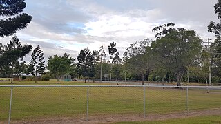
Samford Village is a rural locality in the City of Moreton Bay, Queensland, Australia. It is one of two localities in the town of Samford, the other being Samford Valley. The town's urban area occupies much of the land of the locality. In the 2016 census, Samford Village had a population of 796 people.

<span class="mw-page-title-main">Closeburn, Queensland</span> Suburb of City of Moreton Bay, Queensland, Australia

Closeburn is a rural locality in the City of Moreton Bay, Queensland, Australia. In the 2016 census, Closeburn had a population of 594 people.

<span class="mw-page-title-main">Forest Hill, Queensland</span> Town in Queensland, Australia

Forest Hill is a rural town and locality in the Lockyer Valley Region, Queensland, Australia. In the 2016 census, Forest Hill had a population of 968 people.

<span class="mw-page-title-main">Highvale, Queensland</span> Suburb of Moreton Bay City, Queensland, Australia

Highvale is a rural residential locality in the City of Moreton Bay, Queensland, Australia. In the 2016 census, Highvale had a population of 1,766 people.

<span class="mw-page-title-main">Rocksberg</span> Suburb of City of Moreton Bay, Queensland, Australia

Rocksberg is a rural locality in the City of Moreton Bay, Queensland, Australia. In the 2016 census, Rocksberg had a population of 300 people.

<span class="mw-page-title-main">Yugar, Queensland</span> Suburb of City of Moreton Bay, Queensland, Australia

Yugar is a rural locality in the City of Moreton Bay, Queensland, Australia. In the 2021 census, Yugar had a population of 406 people.

References

  1. 1 2 3 Australian Bureau of Statistics (27 June 2017). "Draper (SSC)". 2016 Census QuickStats. Retrieved 20 October 2018. OOjs UI icon edit-ltr-progressive.svg
  2. 1 2 "Draper – locality in Moreton Bay Region (entry 45431)". Queensland Place Names. Queensland Government . Retrieved 28 December 2020.
  3. 1 2 3 "Queensland Globe". State of Queensland . Retrieved 5 February 2021.
  4. 1 2 "Drapers Crossing – ford in Moreton Bay Regional (entry 10518)". Queensland Place Names. Queensland Government . Retrieved 28 December 2020.
  5. "Eatons Crossing – ford in Moreton Bay Regional (entry 11122)". Queensland Place Names. Queensland Government . Retrieved 28 December 2020.
  6. 1 2 Australian Bureau of Statistics (31 October 2012). "Draper (State Suburb)". 2011 Census QuickStats. OOjs UI icon edit-ltr-progressive.svg
  7. 1 2 3 4 5 6 "Land for public recreation - Queensland". Queensland Open Data. Queensland Government. 20 November 2020. Archived from the original on 22 November 2020. Retrieved 22 November 2020.