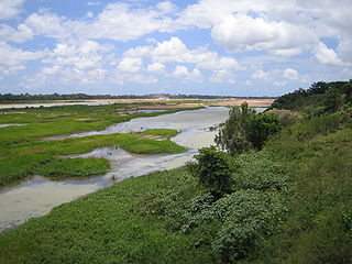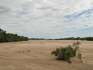
Endeavour River National Park is a national park in Queensland, Australia, gazetted to protect and preserve some of the natural and cultural resources in and around the mouth of the Endeavour River, immediately north of the small town of Cooktown. The park is located 1,561 kilometres (970 mi) northwest of Brisbane.

The Fitzroy River is a river in Central Queensland, Australia. Its catchment covers an area of 142,665 square kilometres (55,083 sq mi), making it the largest river catchment flowing to the eastern coast of Australia. It is also the largest river basin that discharges onto the Great Barrier Reef.

The Burdekin River is a river in North and Far North Queensland, Australia. The river rises on the northern slopes of Boulder Mountain at Valley of Lagoons, part of the western slope of the Seaview Range, and flows into the Coral Sea at Upstart Bay over 200 kilometres (124 mi) to the southeast of the source, with a catchment area of approximately 130,000 square kilometres (50,000 sq mi). The Burdekin River is Australia's largest river by (peak) discharge volume.

The Mitchell River is a river in Far North Queensland, Australia. The river rises on the Atherton Tableland about 50 kilometres (31 mi) northwest of Cairns and flows about 750 kilometres (470 mi) northwest across Cape York Peninsula from Mareeba to the Gulf of Carpentaria.

The Endeavour River, inclusive of the Endeavour River Right Branch, the Endeavour River South Branch, and the Endeavour River North Branch, is a river system located on Cape York Peninsula in Far North Queensland, Australia.

The Daintree River is a river that rises in the Daintree Rainforest near Cape Tribulation in Far North Queensland, Australia. The river is located about 100 kilometres (62 mi) northwest of Cairns in the UNESCO World Heritage–listed Wet Tropics of Queensland. The area is now primarily a tourist attraction.

The Palmer River is a river in Far North Queensland, Australia. The area surrounding the river was the site of a gold rush in the late 19th century which started in 1873.

The Ross River is a river in North Queensland, Australia. The 49-kilometre (30 mi) long river flows through the city of Townsville and empties into the Coral Sea. It is the major waterway flowing through Townsville and the city's main source of drinking water.

The Gilbert River is located in Far North Queensland, Australia. When combined with the Einasleigh River, the river system is the largest river system in northern Australia.

The Einasleigh River is a river in Far North Queensland, Australia. When combined with the Gilbert River, the river system is the largest river system in northern Australia.

The Normanby River, comprising the East Normanby River, the West Normanby River, the East Normanby River North Branch, the East Normanby River South Branch and the Granite Normanby River, is a river system in Far North Queensland, Australia.

The Caboolture River is a small river in South East Queensland, Australia.

The Bloomfield River is a river in the Wet Tropics of Far North Queensland, Australia, noted for its Bloomfield River cod fish species, found only in the river.

The Pimpama River is a perennial river in the South East region of Queensland, Australia. Its catchment lies within the Gold Coast local government area and covers an area of 171 square kilometres (66 sq mi).

The Annan River is a river in the Wet Tropics of Far North Queensland, Australia.

The Bohle River is a river in North Queensland, Australia.

The Russell River is a river in Far North Queensland, Australia. The 59-kilometre (37 mi)-long river flows towards the Coral Sea and is located approximately 60 kilometres (37 mi) south of Cairns.
The Burrum River is a river in the Wide Bay-Burnett region of Queensland, Australia.

The Mossman River is a river in lower Cape York Peninsula, Queensland, Australia.
The Olive River is a river in the Cape York Peninsula of Far North Queensland, Australia.


