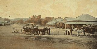
The Warrego Highway is located in southern Queensland, Australia. It connects coastal centres to the south western areas of the state, and is approximately 715 km in length. It takes its name from the Warrego River, which is the endpoint of the highway. The entire highway is part of the National Highway system linking Darwin and Brisbane: formerly National Highway 54, Queensland began to convert to the alphanumeric system much of Australia had adopted in the early-2000s and this road is now designated as National Highway A2.

Helidon is a rural town and locality in the Lockyer Valley Region, Queensland, Australia. In the 2021 census, the locality of Helidon had a population of 1,130 people.

Withcott is a rural town and locality in the Lockyer Valley Region, Queensland, Australia. In the 2021 census, the locality of Withcott had a population of 2,067 people.

Ballard is a rural locality in the Lockyer Valley Region, Queensland, Australia. In the 2021 census, Ballard had a population of 167 people.

Redwood is a rural locality on the outskirts of Toowoomba in the Toowoomba Region, Queensland, Australia. In the 2021 census, Redwood had a population of 159 people.
Flagstone Creek is a rural locality in the Lockyer Valley Region, Queensland, Australia. In the 2021 census, Flagstone Creek had a population of 256 people.

Mount Whitestone is a rural locality in the Lockyer Valley Region, Queensland, Australia. In the 2021 census, Mount Whitestone had a population of 129 people.

Fordsdale is a rural locality in the Lockyer Valley Region, Queensland, Australia. In the 2021 census, Fordsdale had a population of 50 people.

West Haldon is a locality split between Toowoomba Region and Lockyer Valley Region in Queensland, Australia. In the 2021 census, West Haldon had a population of 63 people.

Postmans Ridge is a rural locality in the Lockyer Valley Region, Queensland, Australia. In the 2021 census, Postmans Ridge had a population of 352 people.

Caffey is a rural locality in the Lockyer Valley Region, Queensland, Australia. In the 2021 census, Caffey had a population of 45 people.
Carpendale is a rural locality in the Lockyer Valley Region, Queensland, Australia. In the 2021 census, Carpendale had a population of 110 people.
Derrymore is a rural locality in the Lockyer Valley Region, Queensland, Australia. In the 2021 census, Derrymore had a population of 85 people.
Iredale is a rural locality in the Lockyer Valley Region, Queensland, Australia. In the 2021 census, Iredale had a population of 177 people.
Upper Lockyer is a rural locality in the Lockyer Valley Region, Queensland, Australia. In the 2021 census, Upper Lockyer had a population of 542 people.

Mount Berryman is a rural locality in the Lockyer Valley Region, Queensland, Australia. In the 2021 census, Mount Berryman had a population of 96 people.
Rockmount is a rural locality in the Lockyer Valley Region, Queensland, Australia. In the 2021 census, Rockmount had a population of 82 people.
Seventeen Mile is a rural locality in the Lockyer Valley Region, Queensland, Australia. In the 2021 census, Seventeen Mile had a population of 22 people.
Silver Ridge is a rural locality in the Lockyer Valley Region, Queensland, Australia.

The Toowoomba Connection Road is a 27.3 km (17.0 mi) former section of the Warrego Highway that passes through the city of Toowoomba in Queensland, Australia. With the opening of the Toowoomba Bypass in 2019 the Warrego Highway was redirected to it, and the bypassed section of the highway was renamed Toowoomba Connection Road and assigned the route number A21.


