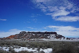
Aponi-vi is a populated place situated in Navajo County, Arizona. It has an estimated elevation of 1,122 feet (342 m) above sea level.

Aripine is a populated place situated in Navajo County, Arizona. Originally named Joppa, it was begun as a Mormon settlement in 1883. The name is derived as a combination of the first three letters of Arizona, and the flora of local forests. It has an estimated elevation of 6,427 feet (1,959 m) above sea level.

Arntz is a populated place situated in Navajo County, Arizona. It has an estimated elevation of 5,144 feet (1,568 m) above sea level.

Baby Rocks is a populated place situated in Navajo County, Arizona, and appears on the Baby Rocks U.S. Geological Survey Map. It has an estimated elevation of 5,236 feet (1,596 m) above sea level.

Bidahochi is a populated place situated in Navajo County, Arizona. It has an estimated elevation of 5,758 feet (1,755 m) above sea level. The nearby Bidahochi Formation was named for Bidahochi, AZ.

Burton is a populated place situated in Navajo County, Arizona. It has an estimated elevation of 6,109 feet (1,862 m) above sea level.

Castle Butte is a populated place situated in Navajo County, Arizona. It has an estimated elevation of 5,807 feet (1,770 m) above sea level.

Cedar Springs is a populated place situated in Navajo County, Arizona. It has an estimated elevation of 6,279 feet (1,914 m) above sea level.

Chakpahu is a populated place situated in Navajo County, Arizona. It has an estimated elevation of 6,375 feet (1,943 m) above sea level.

Cibecue Creek is a populated place situated in Navajo County, Arizona. It has an estimated elevation of 5,154 feet (1,571 m) above sea level.

Goodwater is a populated place situated in Navajo County, Arizona. It has an estimated elevation of 5,262 feet (1,604 m) above sea level.

Grasshopper is a populated place situated in Navajo County, Arizona. It has an estimated elevation of 5,922 feet (1,805 m) above sea level.

Hano is a populated place situated in the First Mesa CDP in Navajo County, Arizona on the Hopi Reservation.

Headquarters is a populated place situated in Navajo County, Arizona. It has an estimated elevation of 5,459 feet (1,664 m) above sea level.

Hidden Springs Mission is a populated place situated in Coconino County, Arizona, located on U.S. 89 about 75 miles north of Flagstaff, Arizona. It has an estimated elevation of 4,819 feet (1,469 m) above sea level. The San Juan Paiute Indian Community is located there.

Huk Ovi is a populated place situated in Navajo County, Arizona. It has an estimated elevation of 6,361 feet (1,939 m) above sea level.

Indian Pine is a populated place situated in Navajo County, Arizona. It has an estimated elevation of 7,175 feet (2,187 m) above sea level.

Manila is a populated place situated in Navajo County, Arizona. It got its name during the Spanish–American War, being named after the Philippines capital, and has an estimated elevation of 4,954 feet (1,510 m) above sea level.

Mumurva, also known as Monusva Spring Well or Mumurs-va, is a populated place situated in Navajo County, Arizona. Mumurva became the official name as a result of a Board on Geographic Names decision in 1995. It has an estimated elevation of 5,971 feet (1,820 m) above sea level.

Navajo is a populated place situated in Apache County, Arizona. It has an estimated elevation of 5,676 feet (1,730 m) above sea level.


