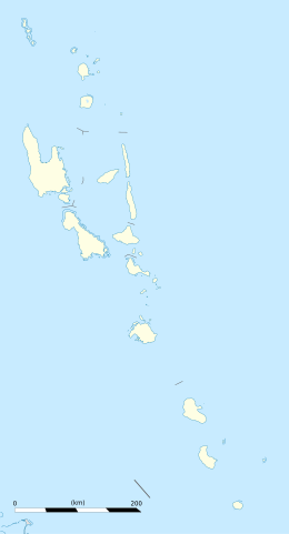
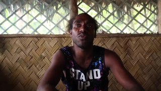
Torba is the northernmost and least populous province of Vanuatu. It consists of the Banks Islands and the Torres Islands.
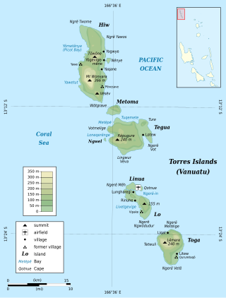
The Torres Islands are an island chain in the Torba Province of the country of Vanuatu, the country’s northernmost island group. The chain of islands that make up this micro-archipelago straddles the broader cultural boundary between Island Melanesia and several Polynesian outliers located in the neighbouring Solomon Islands. To the island chain’s north is Temotu Province of the Solomon Islands, to its south is Espiritu Santo, and to its southeast are the Banks Islands. To the west, beneath the ocean surface, is the deep Torres Trench, which is the subduction zone between the Australian Plate and Pacific Plate.
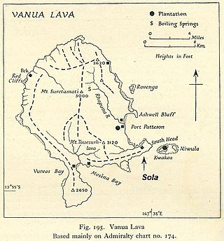
Vanua Lava is the second largest of the Banks Islands in Torba Province, Vanuatu, after slightly larger Gaua.
Mwotlap is an Oceanic language spoken by about 2,100 people in Vanuatu. The majority of speakers are found on the island of Motalava in the Banks Islands, with smaller communities in the islands of Ra and Vanua Lava, as well as migrant groups in the two main cities of the country, Santo and Port Vila.
Tegua is an island in Vanuatu's Torres Islands chain, located in Torba Province.

Ureparapara is the third largest island in the Banks group of northern Vanuatu, after Gaua and Vanua Lava.
Lakon is an Oceanic language, spoken on the west coast of Gaua island in Vanuatu.
Merelava is an island in the Banks Islands of the Torba Province of northern Vanuatu.
Koro is an Oceanic language spoken on Gaua island in Vanuatu. Its 280 speakers live in the village of Koro, on the south coast of Gaua.
Lo-Toga is an Oceanic language spoken by about 580 people on the islands of Lo and Toga, in the Torres group of northern Vanuatu. The language has sometimes been called Loh [sic] or Toga, after either of its two dialects.
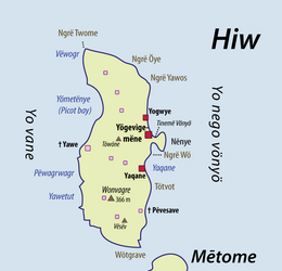
Hiw is an Oceanic language spoken on the island of Hiw, in the Torres Islands of Vanuatu. With about 280 speakers, Hiw is considered endangered.
Dorig(formerly called Wetamut) is a threatened Oceanic language spoken on Gaua island in Vanuatu.

Lemerig is an Oceanic language spoken on Vanua Lava, in Vanuatu.
Nume is an Oceanic language spoken on Gaua island in Vanuatu. Its 700 speakers live on the northeast coast of Gaua.
Olrat was an Oceanic language of Gaua island, in northern Vanuatu. It became extinct in 2009, with the death of its last speaker Maten Womal.
Mwesen is an Oceanic language spoken in the southeastern area of Vanua Lava Island, in the Banks Islands of northern Vanuatu, by about 10 speakers.
Löyöp is an Oceanic language spoken by about 240 people, on the east coast of Ureparapara Island in the Banks Islands of Vanuatu. It is distinct from Lehali, the language spoken on the west coast of the same island.
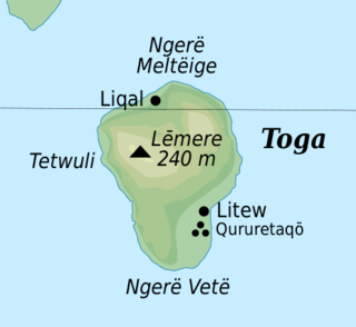
Toga is an island in the Torres group, within the Torba Province of Vanuatu.
The Torres–Banks languages form a linkage of Southern Oceanic languages spoken in the Torres Islands and Banks Islands of northern Vanuatu.
Proto-Torres-Banks is the reconstructed ancestor of the seventeen languages of the Torres and Banks Islands of Vanuatu. Like all indigenous languages of Vanuatu, it belongs to the Oceanic branch of the Austronesian languages.