Malampa is one of the six provinces of Vanuatu, located in the center of the country. It consists of three main islands: Malakula, Ambrym and Paama, and takes its name from the first syllable of their names. It includes a number of other islands – the small islands of Uripiv, Norsup, Rano, Wala, Atchin and Vao off the coast of Malakula, and the volcanic island of Lopevi. Also included are the Maskelynes Islands and some more small islands along the south coast of Malakula.
Northeast Malakula, or Uripiv-Wala-Rano-Atchin, is a dialect chain spoken on the islands of Uripiv, Wala, Rano, and Atchin and on the mainland opposite to these islands. Uripiv-Wala-Rano-Atchin is spoken today by about 9,000 people. Literacy rate of its speakers in their own language is 10–30%.

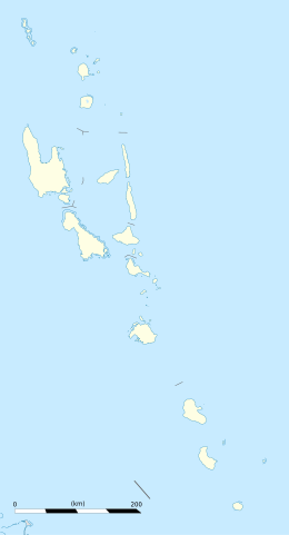
Malakula Island, also spelled Malekula, is the second-largest island in the nation of Vanuatu, formerly the New Hebrides, in Melanesia, a region of the Pacific Ocean.
The Central Vanuatu languages form a linkage of Southern Oceanic languages spoken in central Vanuatu.

The Southern Oceanic languages are a linkage of Oceanic languages spoken in Vanuatu and New Caledonia. It was proposed by John Lynch in 1995 and supported by later studies. It appears to be a linkage rather than a language family with a clearly defined internal nested structure.

The Republic of Vanuatu has the world's highest linguistic density per capita. Despite being a country with a population of less than 300,000, Vanuatu is home to 138 indigenous Oceanic languages.
John Willoughby Layard was an English anthropologist and psychologist.
Malua Bay is an Oceanic language spoken in northwest Malekula, Vanuatu. It has two main dialects: one spoken in Malua Bay and the other spoken in Espiegles Bay.

Mataso is an island in the Shefa of Vanuatu in the Pacific Ocean. The island is a part of Shepherd Islands archipelago.
Atchin is an islet off the north-eastern coast of Malakula in Vanuatu. The 1999 census showed a population of 761, which had decreased to 738 by 2009. According to the 2015 census, the population had further decreased to 724, residing in 158 households.
Uri is a small island located near Malakula, in the Malampa Province of Vanuatu in the Pacific Ocean.
Mavia is an inhabited island in Sanma Province of Vanuatu in the Pacific Ocean. The island lies off the eastern coast of Espiritu Santo. The estimated terrain elevation above the sea level is some 63 metres.

Ifira is an offshore island of Efate, located in Shefa Province of Vanuatu in the Pacific Ocean.
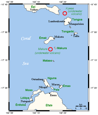
Tongoa is an inhabited island in Shefa Province of Vanuatu in the Pacific Ocean.
Tongariki Island is an inhabited island in Shefa Province of Vanuatu in the Pacific Ocean. The island is a part of Shepherd Islands archipelago.

Lamen is an inhabited island in Shefa Province of Vanuatu in the Pacific Ocean. The island is a part of Shepherd Islands archipelago.
The Malakula languages are a group of Central Vanuatu languages spoken on Malakula Island in central Vanuatu. Unlike some earlier classifications, linguist and Oceanic languages specialist John Lynch (2016) considered the Malakula languages to form a coherent group.
Rutan is a Malakula language of Vanuatu.
Najit is a Malakula language of Vanuatu, spoken by less than 5 speakers.