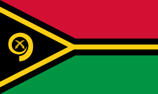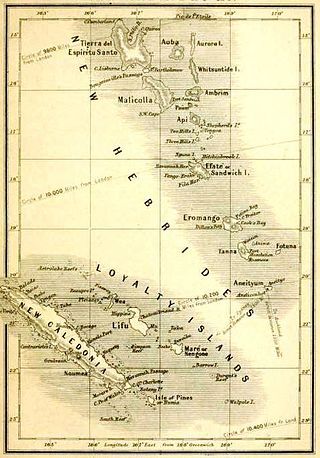
Vanuatu, officially the Republic of Vanuatu, is an island country in Melanesia, located in the South Pacific Ocean. The archipelago, which is of volcanic origin, is 1,750 km (1,090 mi) east of northern Australia, 540 km (340 mi) northeast of New Caledonia, east of New Guinea, southeast of Solomon Islands, and west of Fiji.

The history of Vanuatu spans over 3,200 years.

Air Vanuatu is an airline with its head office in the Air Vanuatu House, Port Vila, Vanuatu. It is Vanuatu's national flag carrier, operating to Australia, New Zealand, New Caledonia and points in the South Pacific. Its main base is Bauerfield International Airport, Port Vila.

Espiritu Santo is the largest island in the nation of Vanuatu, with an area of 3,955.5 km2 (1,527.2 sq mi) and a population of around 40,000 according to the 2009 census.

Luganville is the second largest city in Vanuatu after the capital Port Vila; it is located on the island of Espiritu Santo and has a population of 18,062 as of the 2020 census. Those on Vanuatu's northern islands who regard Luganville as their big city, particularly indigenous populations, call it Santo; rural residents of Espiritu Santo call it Kanal. Luganville served as a major base of operations for American troops during World War II.

Malakula Island, also spelled Malekula, is the second-largest island in the nation of Vanuatu, formerly the New Hebrides, in Melanesia, a region of the Pacific Ocean.

Maewo is an island in Vanuatu in Penama province, 105 km to the east of Espiritu Santo.

Paama is a small island in Malampa Province, Vanuatu.

The Southern Oceanic languages are a linkage of Oceanic languages spoken in Vanuatu and New Caledonia. It was proposed by John Lynch in 1995 and supported by later studies. It appears to be a linkage rather than a language family with a clearly defined internal nested structure.

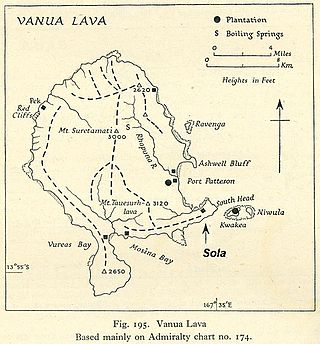
Vanua Lava is the second largest of the Banks Islands in Torba Province, Vanuatu, after slightly larger Gaua.

Aore Island is an island in Sanma Province, Vanuatu. It is located opposite Luganville on Espiritu Santo and has an area of 58 square kilometres (22 sq mi). The estimated terrain elevation above sea level is some 89 metres (292 ft).
Araki is a small rocky island with an area of 2.5 km², located 3 miles off the southern shores of Espiritu Santo, which is the largest island in the nation of Vanuatu.
The North Vanuatu languages form a linkage of Southern Oceanic languages spoken in northern Vanuatu.
Ratua, situated in the Vanuatu archipelago, is a 146-acre (59 ha) island located south of Espiritu Santo, between Aore and Malo islands.

The Coconut War was a brief clash between Papua New Guinean soldiers and rebels in Espiritu Santo shortly before and after the independence of the Republic of Vanuatu was declared on 30 July 1980.
Pseudunela espiritusanta is a species of sea slug, an acochlidian, a shell-less marine gastropod mollusk in the family Pseudunelidae.

Talua Theological Training Institute, formerly known as Talua Ministry Training Centre, is a Bible College in Vanuatu, run by the Presbyterian Church of Vanuatu. It is located near Luganville on the island of Espiritu Santo.
Elephant Island is an uninhabited island in Sanma Province of Vanuatu in the Pacific Ocean. Another island off the coast of Antarctica in the outer reaches of the South Shetland Islands, in the Southern Ocean, shares the same name.
Dany Island is a tropical island in the Sanma Province of Vanuatu in the Pacific Ocean.The island is privately owned and run as a tourist resort for snorkeling, scuba diving, beach bar and grill, surfing, and deep-sea fishing.
The Espiritu Santo languages are a group of North Vanuatu languages spoken on Espiritu Santo Island in northern Vanuatu. Tryon (2010) considers the Espiritu Santo languages to be a coherent group.


