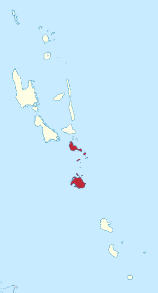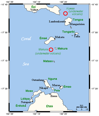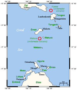
Shefa is one of the six provinces of Vanuatu, located in the center of the country and including the islands of Epi and Efate and the Shepherd Islands. The province's name is derived from the initial letters of SHepherd and EFAte. It has a population of 78,723 people and an area of 1,455 km2. Its capital is Port Vila, which is also the capital of the nation.

Epi is an island in Shefa Province, Vanuatu, at the north end of the Shepherd Islands.

The Shepherd Islands are a group of islands lying between the larger islands of Epi and Éfaté, in the Shefa province of Vanuatu. The aggregate land area is 88 square kilometres. They were named by Captain Cook after Anthony Shepherd, a British astronomer and friend of Cook.

Rah or Ra is a small coral islet of 0.5 km2 (0.19 sq mi), located in the Banks group of northern Vanuatu. The same name also refers to the single village which is situated within this islet.

Mataso is an island in the Shefa of Vanuatu in the Pacific Ocean. The island is a part of Shepherd Islands archipelago.
Malokilikili Island is an inhabited island in Sanma Province of Vanuatu in the Pacific Ocean. Malokilikili lies off the eastern coast of Malo Island.

Mavea, or locally Mav̈ea, is an inhabited island in Sanma Province of Vanuatu in the Pacific Ocean. The island lies off the eastern coast of Espiritu Santo. The estimated terrain elevation above the sea level is some 63 metres.
Uripiv Island is a small inhabited island in Malampa Province of Vanuatu in the Pacific Ocean. Uripiv lies off the north coast of Malekula Island. The estimated terrain elevation above the sea level is some 8 meters.

Ifira is an offshore island of Efate, located in Shefa Province of Vanuatu in the Pacific Ocean.

Emao is a small inhabited island in Shefa Province of Vanuatu in the Pacific Ocean. It was also previously known as Montague Island.

Makura, locally known as Makira, is a small inhabited island in Shefa Province of Vanuatu in the Pacific Ocean. Makura is a part of the Shepherds Islands archipelago.

Tongoa Island is an inhabited island in Shefa Province of Vanuatu in the Pacific Ocean.
Buninga Island is an inhabited island in Shefa Province of Vanuatu in the Pacific Ocean. The island is a part of Shepherd Islands archipelago.

Lamen Island is an inhabited island in Shefa Province of Vanuatu in the Pacific Ocean. The island is a part of Shepherd Islands archipelago.
Falea is a small uninhabited island in the Pacific Ocean, a part of the Shepherd Islands archipelago in the Shefa Province of Vanuatu.
Lataro is an uninhabited island in Sanma Province of Vanuatu in the Pacific Ocean.
Malotina is a small uninhabited island in Sanma Province of Vanuatu in the Pacific Ocean.
Malvapevu is a small uninhabited island in Sanma Province of Vanuatu in the Pacific Ocean.
Malparavu is a small uninhabited island in Sanma Province of Vanuatu in the Pacific Ocean.
Maltinerava is a small uninhabited island in Sanma Province of Vanuatu in the Pacific Ocean.


