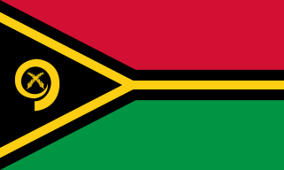
Vanuatu, officially the Republic of Vanuatu, is an island country located in the South Pacific Ocean. The archipelago, which is of volcanic origin, is 1,750 km (1,090 mi) east of northern Australia, 540 km (340 mi) northeast of New Caledonia, east of New Guinea, southeast of Solomon Islands, and west of Fiji.
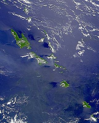
Vanuatu is a nation and group of islands in the South Pacific Ocean. It is composed of over 80 islands with 2,528 kilometres (1,571 mi) of coastline and a total surface area of 12,189 square kilometres (4,706 sq mi). It's a small country with a total size of 12,189 km2 (4,706 sq mi). Due to the spread out islands it has the 39th largest Exclusive Economic Zone of 663,251 km2 (256,083 sq mi).

Port Vila, or simply Vila, is the capital and largest city of Vanuatu. It is located on the island of Efate.
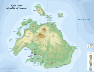
Efate is an island in the Pacific Ocean which is part of the Shefa Province in Vanuatu. It is also known as Île Vate.
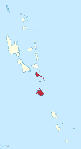
Shefa is one of the six provinces of Vanuatu, located in the center of the country and including the islands of Epi and Efate and the Shepherd Islands. The province's name is derived from the initial letters of SHepherd and EFAte. It has a population of 78,723 people and an area of 1,455 km2. Its capital is Port Vila, which is also the capital of the nation.
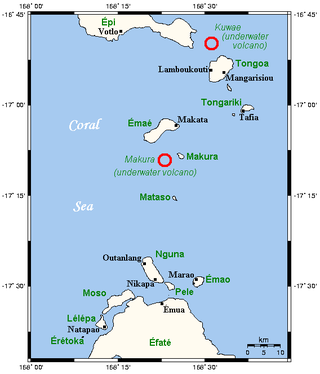
The Shepherd Islands are a group of islands lying between the larger islands of Epi and Éfaté, in the Shefa province of Vanuatu. The aggregate land area is 88 square kilometres. They were named by Captain Cook after Anthony Shepherd, a British astronomer and friend of Cook.

Iririki is a privately leased island, located in Mele Bay, near Port Vila, the Capital of Vanuatu. The island is owned and operated by Australian businessmen Shane Pettiona, Darren Pettiona and Peter Stockley.

Rah or Ra is a small coral islet of 0.5 km2 (0.19 sq mi), located in the Banks group of northern Vanuatu. The same name also refers to the single village which is situated within this islet. There are massive rocks on the island.
Mele-Fila (Ifira-Mele) is a Polynesian language spoken in Mele and Ifira on the island of Efate in Vanuatu. In spite of their differences, Mele and Fila are two dialects of the same language and are mutually intelligible. French and English are also fairly common among the residents of Efate.

Mataso is an island in the Shefa of Vanuatu in the Pacific Ocean. The island is a part of Shepherd Islands archipelago.
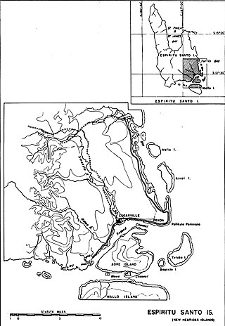
Mavea, or locally Mav̈ea, is an inhabited island in Sanma Province of Vanuatu in the Pacific Ocean. The island lies off the eastern coast of Espiritu Santo. The estimated terrain elevation above the sea level is some 63 metres.
Uripiv Island is a small inhabited island in Malampa Province of Vanuatu in the Pacific Ocean. Uripiv lies off the north coast of Malekula Island. The estimated terrain elevation above the sea level is some 8 meters.

Emao is a small inhabited island in Shefa Province of Vanuatu in the Pacific Ocean. It was also previously known as Montague Island.

Makura, locally known as Makira, is a small inhabited island in Shefa Province of Vanuatu in the Pacific Ocean. Makura is a part of the Shepherds Islands archipelago.
Tongoa Island is an inhabited island in Shefa Province of Vanuatu in the Pacific Ocean.
Buninga Island is an inhabited island in Shefa Province of Vanuatu in the Pacific Ocean. The island is a part of Shepherd Islands archipelago.
Tongariki Island is an inhabited island in Shefa Province of Vanuatu in the Pacific Ocean. The island is a part of Shepherd Islands archipelago.

Lamen Island is an inhabited island in Shefa Province of Vanuatu in the Pacific Ocean. The island is a part of Shepherd Islands archipelago.

The 2002 Port Vila earthquake occurred in the early dawn of January 3, 2002, 04:22 a.m. local time (UTC+11) northwest of Port Vila, the capital of Vanuatu. It had a magnitude of 7.2 and a maximum intensity of X (Extreme) west of the island on the Modified Mercalli intensity scale. There are no exact estimates on the number of injured individuals, but the majority of accounts say there were "several" amounts of injured civilians. the event also caused a minor tsunami of about 0.4−0.8 m just 11 minutes after the quake.

